Crowley, Malheur County, Oregon facts for kids
Quick facts for kids
Crowley, Oregon
|
|
|---|---|
| Country | United States |
| State | Oregon |
| County | Malheur |
| Elevation | 4,078 ft (1,243 m) |
| Time zone | UTC−07:00 (Mountain) |
| • Summer (DST) | UTC−06:00 (Mountain) |
| Area code(s) | 541 |
| GNIS feature ID | 1119587 |
| Coordinates and elevation from Geographic Names Information System | |
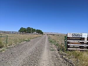
Crowley is a small, unincorporated community located in Malheur County, Oregon, in the United States. An unincorporated community means it's a place with a shared identity but without its own local government. It's like a neighborhood that's part of a larger county.
Crowley is found along Crowley Road, which is north of Oregon Route 78. It's about 50 miles (80 km) east of a town called Crane. You can also find Crowley Ranch and the Crowley Ranch Airstrip nearby.
The Story Behind the Name
The area around Crowley has a cool history! Crowley Creek, a local waterway, got its name from a person named Green Berry Crowley. He moved to this area with his son, James, in 1874. They built their home right by the creek.
Early Challenges
Life in the early days could be tough. In 1878, the Crowley family's home was unfortunately burned down during a conflict known as the Bannock War. Luckily, the family was able to escape and stay safe.
Crowley's Post Office
For a while, Crowley had its own post office. This was a big deal because it helped people send and receive mail, connecting them to the outside world.
- The Crowley post office officially opened in 1911.
- It served the community for many years.
- The post office eventually closed its doors in 1935.
It's interesting to note that there was another post office named Crowley in Polk County before this one.
 | Dorothy Vaughan |
 | Charles Henry Turner |
 | Hildrus Poindexter |
 | Henry Cecil McBay |


