Culbertson Tract land claim facts for kids

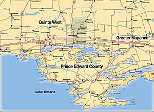
The Culbertson Tract Land Claim is about a piece of land in Ontario, Canada. It is located in Hastings County. This claim was first made in 1995 by the Mohawks of the Bay of Quinte First Nation. They are also known as the Tyendinaga Mohawks.
The claim covers about 923 acres of land. This land is around the Tyendinaga Mohawk Territory and most of the town of Deseronto. The Mohawks say they lost over 800 acres of this land between 1820 and 1843. This happened when more settlers moved into the area, even though the land was part of the Simcoe Treaty.
In 2003, the Canadian government department that deals with Indigenous affairs said they would only offer money for the land claim. They did not want to give the land back. But in 2013, this decision was challenged. A judge, Mr. Justice Rennie, said that the government's own rules actually allow for land to be returned, not just money. He said the Minister might have misunderstood the rules.
Because new buildings and roads have been built on the land, there have been some disagreements during the talks. But getting the land back is still the main goal. As of 2014, the Culbertson Tract Land Claim was still being discussed. On October 18, 2021, the Tyendinaga Mohawk Territory announced that their community had voted to accept a partial agreement for the land claim.
Contents
What is the Background of the Claim?
The History of the Land
The Haudenosaunee Confederacy is a group of Indigenous nations. It was formed a long time ago, in the early 1500s. It includes the Seneca, Onondaga, Oneida, Cayuga, and Mohawk nations. Later, in 1722, the Tuscarora nation joined them.
During the American Revolutionary War, this Confederacy stayed neutral. This means they did not pick a side. Around this time, a British leader named John Graves Simcoe signed a document called the Simcoe Deed, also known as Treaty 3 1/2. This treaty promised land in the Bay of Quinte area to the people of the Six Nations Confederacy. However, after the treaty was signed, many non-Indigenous settlers moved onto this land. This meant that much of the land promised in the Simcoe Treaty was taken over by others.
How Land Claims Work Legally
It has been a difficult journey for Indigenous communities to get their traditional lands back in Canada. The legal right for Indigenous groups to claim their heritage land was established in 1973. This happened because of a Supreme Court case called Calder et al. v. Attorney-General of British Columbia. This court decision gave Indigenous communities in Canada the legal right to claim land.
After this, the Canadian government created an official way for land claims to be handled. This process involves talks between the Indigenous community making the claim and the Department of Indigenous and Northern Affairs Canada. This process usually has four steps:
- Submitting the claim
- Assessing the claim
- Negotiating a solution
- Reaching a settlement and putting it into action
What is the Impact of the Claim?
Some people who study these issues believe that the long time it takes to settle land claims shows old ways of thinking about Indigenous people. The Culbertson Tract Land Claim has taken over twenty years. This long process is seen by some as an example of how colonial attitudes still affect Indigenous communities.
Protests and Awareness
The Mohawks of the Bay of Quinte have one of the largest First Nations territories in Ontario. They have protested in the past to bring attention to their land claim and to support other Indigenous communities.
Highway 401 Blockade - June 2007
On June 29, 2007, Mohawk protestors blocked a part of Ontario Highway 401. The blockade was about 30 kilometers long. They did this to show that the highway was built on their traditional land. This protest lasted only one day. It was meant to bring attention to the Culbertson land claim.
Gravel Quarry Occupation - March 2007
In March 2007, a group of Mohawk protestors gathered at a gravel quarry. This quarry is located in the Culbertson tract area. This protest group was not officially supported by the community council. They were protesting because the quarry was still making money from land that was part of the land claim negotiations. This protest also lasted only one day, and the gravel quarry is still being used today.
See also
 | Percy Lavon Julian |
 | Katherine Johnson |
 | George Washington Carver |
 | Annie Easley |


