Cumbemayo facts for kids

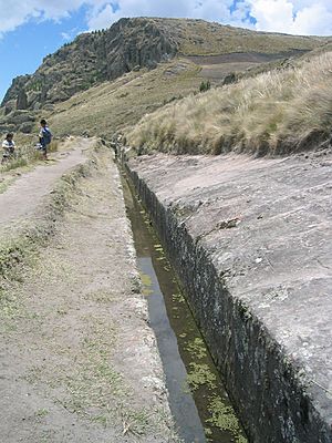
Partial view of aqueduct at Cumbemayo.
|
|
| Alternative name | Cumbe Mayo |
|---|---|
| Location | Cajamarca Province, Cajamarca |
| Coordinates | 07°11′23″S 78°34′26″W / 7.18972°S 78.57389°W |
| Type | Aqueduct, Temple, Petroglyphs |
| History | |
| Builder | Cajamarca culture |
| Founded | 1500 BCE |
| Site notes | |
| Archaeologists | Julio C. Tello |
Cumbemayo, also called Cumbe Mayo, is an amazing ancient place in Peru. It's about 20 kilometers (12 miles) southwest of the city of Cajamarca. This site sits high up in the mountains, at about 3,500 meters (over 11,000 feet) above sea level.
Cumbemayo was built around 1500 BCE. It features ancient water channels called aqueducts. You can also find cool grottos (small caves) and petroglyphs, which are carvings on rocks. All these wonders are found among unique rock formations.
History of Cumbemayo
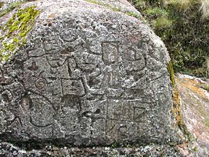
The aqueduct and the rock carvings at Cumbemayo are very old. Experts believe they were built between 1500 and 1000 BCE. Some of the petroglyphs look similar to those made by the ancient Chavín culture. This suggests a connection or shared style between these early peoples.
The Ancient Aqueduct
One of the most impressive parts of Cumbemayo is its aqueduct. The name "Cumbemayo" means "Narrow River" in the local Cajamarca Quechua language. This aqueduct is a long canal, about 9 kilometers (5.6 miles) in length. It was carefully carved into volcanic rock.
The purpose of this canal was to move water from the hills. It directed the water to farming fields and a large storage area. This storage area was likely at the bottom of Santa Apolonia Hill.
As you walk towards the aqueduct, you can see stone stairways. There's also a carved stone that might have been used as a special altar. Another interesting spot is the Sanctuary. This is a huge cliff that looks like a giant human head. Its "mouth" is a grotto where fascinating rock carvings have been found. These carvings are still a mystery, as their meaning is not yet fully understood.
The aqueduct winds its way down the hills towards Cajamarca. It stretches out for about 8 kilometers (5 miles). These canals were very important for bringing water from high places to the valleys below. This was especially helpful when water was scarce. Many petroglyphs are found near the aqueduct and in nearby caves. These symbols give us clues about the people who built these amazing water systems.
Los Frailones: The Stone Forest
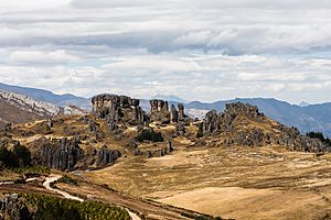
"Los Frailones" means "The Friars" in Spanish. These are huge volcanic rock pillars. Some of them stand as tall as 18 meters (60 feet)! These stone formations suddenly appear in the landscape. They look very different from the flat, grassy plains around Cajamarca. Wind and rain have slowly shaped these pillars over thousands of years.
Many of these pillars have taken on unique shapes. Some look like hands, and others resemble animals. This allows your imagination to wander in the beautiful Peruvian setting. Their impressive and rare shapes make some people think they see monks in a procession. This is why they are called frailones.
See also
 In Spanish: Los Frailones-Cumbemayo para niños
- Agricultural history of Peru
 | Victor J. Glover |
 | Yvonne Cagle |
 | Jeanette Epps |
 | Bernard A. Harris Jr. |


