
Currawong Bush Park facts for kids
Quick facts for kids Currawong Bush Park |
|
|---|---|

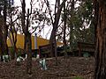
Millers Pond in Currawong Bush Park
|
|
| Type | Public Park |
| Location | Melbourne |
| Area | 59 hectares |
| Operated by | City of Manningham |
| Visitors | 750 per month approx. |
| Status | Open |
| Paths | Unsealed bush paths |
| Terrain | Remnant Riparian Bushland |
| Water | Mullum Mullum Creek, Millers Pond, Billy Baxter Wetlands, Go-Betweens Gully, Amersham Gully |
| Vegetation | Australian Native |
| Connecting transport | Car, Bus |
| Landmarks | Mullum Mullum Creek, Scar Trees |
| Facilities | Toilets, Barbecues, Picnic areas, Conference room, Education centre, Wildlife sanctuary |
Currawong Bush Park is a special natural park in the eastern suburbs of Melbourne, Australia. It sits right next to the Mullum Mullum Creek. This park is super important because it has 59 hectares (that's about 145 acres!) of original bushland. It's also home to many old Aboriginal sites.
The park is a popular spot for school groups and people who love to walk in nature. It used to have a special area for kangaroos, but that part is now closed. One of the biggest challenges for the park is dealing with animals and plants that don't belong there, like foxes and rabbits.
Contents
Park History
Ancient History: Aboriginal People
Long ago, the Wurundjeri people lived in this area. They were part of the Kulin nation, which included many tribes around Melbourne. The Wurundjeri were from the Woiworung tribe.
In 1991, experts found signs that the Wurundjeri people were here. They found four scarred trees. These are trees where bark or wood was carefully removed. Aboriginal people used this material to make tools like shields or canoes. A stone tool was also found near the Mullum Mullum Creek.
Recent History: The Park's Beginnings
The main building in the park, which now holds the office and a conference room, has an interesting story. It was built in 1959 by Robin and Bunty Elder. It's a great example of design by a famous architect named Geoffrey Trewenack.
Around 1969, the property became a public park. For a while, the park had a full-time ranger who helped look after it. Now, the park is managed in a different way.
Park Geography
Currawong Bush Park covers 59 hectares of land. It stretches from the Mullum Mullum Creek up the hillside. Two small valleys, called Go-betweens Gully and Amersham Gully, flow into the creek. The Mullum Mullum Creek Linear Park is on the other side of the creek.
Waterways in the Park
- Mullum Mullum Creek
- Go-Betweens Gully
- Amersham Gully
Park Ponds and Wetlands
- Millers Pond – This pond was built a long time ago.
- Billy Baxter Wetlands – These are newly built wetlands that help clean the water and support wildlife.
- Penny's Pond
Park Nature and Wildlife

Currawong Bush Park is a special place because it shows what the local nature was like before European settlers arrived. You can find many native Australian plants and animals here. This includes different types of eucalypt trees, like the Manna Gum. You might also spot kangaroos, especially the Eastern Grey kangaroo.
Challenges for Nature
The park is surrounded by homes. This means some problems come from outside the park.
- Introduced Animals: Animals like rabbits, foxes, stray dogs, and cats cause trouble. Rabbits dig holes, and foxes hunt native animals. Stray cats hunt birds and possums.
- Weeds: Weeds from nearby gardens can spread into the park through the waterways.
- Human Impact: Motorbikes and bicycles can disturb plants and animals if they go off the main paths. Light and noise from nearby roads and sports fields can also make it harder for wildlife to live in certain parts of the park.
Park Rules
To keep the park safe and healthy, there are some important rules:
- No Dogs: Dogs are not allowed anywhere in the park, even on a leash.
- Vehicles: Motorised vehicles like motorbikes and scooters can only be on the main roads and in carparks.
- Bikes: Cyclists can ride on fire access tracks. But they must get off their bikes when they go onto smaller walking paths.
- Fire Safety: The park is very prone to bushfires. Fires should only be made at the campfire site near the Education Centre. There are electric barbecues for cooking.
- No Camping: Camping is not allowed in the park.
Images for kids
-
Regenerative planting near the education centre and camping site

