Cuylerville, New York facts for kids
Quick facts for kids
Cuylerville, New York
|
|
|---|---|

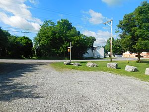
The hamlet of Cuylerville as seen from the site of the former Pennsylvania Railroad station
|
|
| Country | United States |
| State | New York |
| County | Livingston County |
| Town | Leicester |
| Area | |
| • Total | 0.42 sq mi (1.09 km2) |
| • Land | 0.42 sq mi (1.09 km2) |
| • Water | 0.00 sq mi (0.00 km2) |
| Elevation | 571 ft (174 m) |
| Population
(2020)
|
|
| • Total | 268 |
| • Density | 636.58/sq mi (245.54/km2) |
| Time zone | UTC-5 (Eastern (EST)) |
| • Summer (DST) | UTC-4 (EDT) |
| ZIP code |
14481
|
| Area code | 585 |
| FIPS code | 36-19510 |
| GNIS feature ID | 947974 |
Cuylerville is a small community called a hamlet in Livingston County, New York, United States. It is part of the Town of Leicester. In 2020, about 268 people lived there. Cuylerville is also known as a census-designated place, which means it's an area the government counts for population surveys.
Contents
History of Cuylerville
Early Beginnings and Native American History
Cuylerville was named after W. T. Cuyler, who was one of the first people to settle there. This area is very old and has an important history. It is built on the land where a large Seneca village once stood. The Seneca are one of the Native American groups known as the Iroquois. Their village here was called Little Beard's Town.
The Sullivan Campaign and Local Figures
Sadly, Little Beard's Town was destroyed during the Sullivan Campaign. This was a military operation in 1779 during the American Revolutionary War. It aimed to weaken the Iroquois Confederacy, who were allied with the British. A famous person named Mary Jemison, often called "the White Woman of the Genesee," lived in this area. She was an American pioneer who was captured by the Seneca people as a child and chose to live with them for the rest of her life.
Historic Buildings and Parks
Cuylerville has some interesting historic spots. The National Hotel is a building that was added to the National Register of Historic Places in 2004. This means it's recognized as an important historical site. Close to Cuylerville, you can also find the Boyd & Parker Park and Groveland Ambuscade. This park was added to the National Register of Historic Places in 2009 and marks another important historical event in the area.
Geography of Cuylerville
Location and Roads
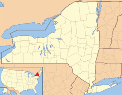
Cuylerville is located in the western part of Livingston County. It's in the eastern section of the town of Leicester. Two main roads, U.S. Route 20A and New York State Route 39, go through the community. They are known together as Cuylerville Road. If you travel west on these roads, you'll reach Leicester village in about 1.5 miles. If you go east, you'll get to Geneseo, which is the main town for Livingston County, about 3.5 miles away.
Land Area and River Valley
According to the U.S. Census Bureau, the area of Cuylerville that is counted for population (the CDP) covers about 1.09 square kilometers (or 0.42 square miles). All of this area is land. The hamlet of Cuylerville is located right at the western edge of the valley of the Genesee River. A valley is a low area of land between hills or mountains, often with a river flowing through it.
Population and People
Understanding Demographics
Demographics is the study of populations. It helps us understand how many people live in a place, how old they are, and other interesting facts about them.
Population Numbers
| Historical population | |||
|---|---|---|---|
| Census | Pop. | %± | |
| 2020 | 268 | — | |
| U.S. Decennial Census | |||
The population of Cuylerville was 297 people at the 2010 census. By the 2020 United States Census, the population had changed to 268 people. This information comes from the U.S. Decennial Census, which counts the population every ten years.
See also
 In Spanish: Cuylerville para niños
 | May Edward Chinn |
 | Rebecca Cole |
 | Alexa Canady |
 | Dorothy Lavinia Brown |


