Leicester, New York facts for kids
Quick facts for kids
Leicester, New York
|
|
|---|---|
| Country | United States |
| State | New York |
| County | Livingston |
| Government | |
| • Type | Town Council |
| Area | |
| • Total | 33.93 sq mi (87.89 km2) |
| • Land | 33.93 sq mi (87.88 km2) |
| • Water | 0.00 sq mi (0.01 km2) |
| Population
(2010)
|
|
| • Total | 2,200 |
| • Estimate
(2016)
|
2,139 |
| • Density | 63.04/sq mi (24.34/km2) |
| Time zone | UTC-5 (Eastern (EST)) |
| • Summer (DST) | UTC-4 (EDT) |
| ZIP code |
14481
|
| Area code(s) | 585 |
| FIPS code | 36-051-41883 |
Leicester is a town in Livingston County, New York, in the United States. In 2010, about 2,200 people lived there. The town was named after Leicester Phelps, who was one of the first people to live there.
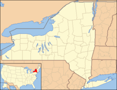
Leicester is located on the western edge of Livingston County. The smaller village of Leicester is right in the middle of the town. Leicester is also west of another village called Geneseo.
Contents
A Look at Leicester's History
Before European settlers arrived, the area was a major home for the Seneca people. They had three important villages here: Little Beard's Town, Big Tree, and Squakie Hill. In 1779, these villages were targeted during the Sullivan Expedition. This was an effort to stop raids on American communities.
The first settlers came to the area around 1789. The town of Leicester was officially formed in 1802. Its name was first spelled "Lester" or "Leister," but it was changed to the current spelling in 1805. Over time, parts of Leicester were used to create new towns. These included Mount Morris in 1813 and York in 1819.
A special building called the Coverdale Cobblestone House was added to the National Register of Historic Places in 2005. This means it is an important historical site.
Where is Leicester Located?
Leicester covers a total area of about 33.93 square miles (87.89 square kilometers). Only a tiny part of this area is water. The Genesee River forms the eastern border of the town. The western border of Leicester touches Wyoming County.
Two main roads, U.S. 20A and New York State Route 39, run together across the town from east to west. Another important road, New York State Route 36, runs north to south. It crosses US-20A and NY-39 in the village of Leicester.
Neighboring Towns and Areas
Leicester shares its borders with several other towns:
- To the north: York
- To the east: Geneseo
- To the south: Mount Morris
- To the west: Castile, Perry, and Covington
People Living in Leicester
The population of Leicester was 2,200 people in 2010. This number changes over time. For example, in 2000, there were 2,287 people living in the town.
Most people in Leicester are White (97.86%). There are also smaller groups of African American, Native American, and Asian people. About 1% of the population is Hispanic or Latino.
In 2000, there were 849 households in Leicester. A household is a group of people living together. About 35% of these households had children under 18. Most households (60.3%) were married couples living together.
The average age of people in Leicester in 2000 was 37 years old. About 26.3% of the population was under 18.
Education in Leicester
Students who live in the town of Leicester usually go to York Central School. However, if students live closer to the borders of Leicester, they might attend schools in nearby towns. These include schools in Geneseo, Perry, and Mount Morris.
Famous Person from Leicester
- George W. Patterson was a US congressman who came from Leicester.
Communities and Places in Leicester
- Beards Creek – This is a small stream that flows into the Genesee River. It was named after a Native American leader called "Little Beard."
- Big Tree – This was once a Native American community and later a special area (reservation) partly located in the town.
- Cuylerville – A small community located northeast of Leicester village. You can find it along Routes 20A and NY-39.
- Gibonville – This was a community that used to exist in the southwest part of the town.
- Leicester – This is the main village located right in the center of the town. It's where US-20A and NY-36 meet.
- Letchworth State Park – A large state park that touches the southern border of the town.
- Little Beard's Town – This was a Native American community that used to be near where Cuylerville is today.
- Pine Tavern Corners or Pine Tavern – A small community southwest of Leicester village, also on Routes 20A and 39.
- Squakie Hill – This was another Native American community and later a reservation. It was located near the Genesee River, west of NY-36.
- Teed Corners – A small community near the northern border of the town, located on NY-36.
See also
 In Spanish: Leicester (Nueva York) para niños
 | Stephanie Wilson |
 | Charles Bolden |
 | Ronald McNair |
 | Frederick D. Gregory |


