
Geneseo, New York facts for kids
Quick facts for kids
Geneseo, New York
|
||
|---|---|---|

The Bear Fountain sits in the center of Geneseo village's Main Street. In this picture, it is decorated with flags for Memorial Day.
|
||
|
||

Geneseo, New York
Location in New York

Geneseo, New York
Location in the United States
|
||
| Country | ||
| State | ||
| County | Livingston | |
| Town established | 1789 | |
| Government | ||
| • Type | Town Board | |
| Area | ||
| • Total | 45.14 sq mi (116.92 km2) | |
| • Land | 43.94 sq mi (113.82 km2) | |
| • Water | 1.20 sq mi (3.10 km2) | |
| Elevation | 909 ft (277 m) | |
| Population
(2010)
|
||
| • Total | 10,483 | |
| • Estimate
(2016)
|
10,726 | |
| • Density | 244.08/sq mi (94.24/km2) | |
| Time zone | UTC-5 (Eastern (EST)) | |
| • Summer (DST) | UTC-4 (EDT) | |
| ZIP code |
14454
|
|
| Area code(s) | 585 | |
| FIPS code | 36-051-28629 | |
| GNIS feature ID | 0978991 | |

Geneseo is a town in Livingston County, New York. It is located in the Finger Lakes region of the state. Geneseo is at the southern end of the Rochester Metropolitan Area. In 2010, about 10,483 people lived in the town.
The name "Geneseo" comes from an English version of an Iroquois word. The original word, Gen-nis-he-yo, means "beautiful valley." The village of Geneseo is found inside the western part of the town. Today, the town and village are best known as the home of the State University of New York at Geneseo.
Contents
History of Geneseo
Early Days and the Iroquois
Near Geneseo was the largest village of the Seneca. This village, called Chenussio, was an important center of power for the Iroquois Confederacy. It was also known as the Confederacy's "bread basket." This means it had many orchards, vineyards, and fields of corn and vegetables.
During the American Revolution, the Seneca people joined the British and their allies against the American colonists. These groups launched attacks from the west, which was a big threat to the Americans. To stop these attacks, General Washington sent the Sullivan Expedition. This army had a "scorched earth" policy, meaning they destroyed everything that could help the Iroquois.
As Sullivan's army got closer to Geneseo, the Senecas moved back. However, a group of Seneca warriors captured some of Sullivan's scouts. They took them to Geneseo and killed them. When Sullivan's troops found the bodies, they became very angry. They destroyed everything that could help the Iroquois. About 5,000 Seneca people then fled to Fort Niagara, which was held by the British. They spent a very cold winter there with little food or supplies.
After the Revolution
The town of Geneseo was created in 1789. This was even before Livingston County was officially formed. Colonists began to settle in Geneseo soon after James and William Wadsworth arrived in 1790. These brothers came from Connecticut to the Genesee Valley. They were sent by their uncle to manage and sell land he had bought. The Wadsworth brothers also took part in the Treaty of Big Tree talks in 1797. This treaty was signed between Robert Morris and the Seneca people in Geneseo.
Geneseo, along with nearby Mount Morris, was part of "The Morris Reserve." This was land that Robert Morris kept when he sold much of western New York to the Holland Land Company.
Geneseo was the birthplace of Eliza Emily Chappell Porter in 1807. She was a nurse, teacher, and helped people escape slavery during the American Civil War. Ferdinand Ward, who was known for tricking people, was also born in Geneseo in 1851.
The village of Geneseo became the main town for Livingston County in 1821. It officially became a village in 1832. The State Normal School, which is now SUNY Geneseo, opened in 1871. In 1991, a part of the village was named a National Historic Landmark by the United States Department of the Interior.
Geneseo Today


The Genesee River valley is wide and good for farming. It has some of the best farmland in New York. However, it used to flood often. Geneseo had many bad floods until the United States Army Corps of Engineers built the Mount Morris Dam in the 1950s. Now, farming is a big part of Geneseo's economy. Many people also live in Geneseo and travel to Rochester for work. The village of Geneseo is managed by a mayor and four trustees.
The town of Geneseo has three main areas. The village has a small-town feel. Much of Route 20A has many stores and businesses. The rest of the town is mostly farmland. One challenge for the community is "urban sprawl." This means that big stores are building on Route 20A. Some people like the convenience of these stores, while others worry about the town becoming too much like a suburb.
The Geneseo Airport (D52) is a small airport west of the village. It is on the Wadsworth farm and opened in 1969. About 20 planes use it each day. Since 1980, it has been home to groups that restore and fly old military planes. This includes the 1941 Historical Aircraft Group Museum. An airshow is held there every year in July.
The Association for the Preservation of Geneseo (APOG) is a group that works to protect and improve historic places in Geneseo. They also teach people about the town's history and buildings.
Two historic places, Sweet Briar and the Wadsworth Fort Site, are listed on the National Register of Historic Places.
Education in Geneseo
The Geneseo Central School District serves Geneseo and Groveland. It includes Geneseo Central School, which has about 75 students graduate each year.
The school's mascot is the Blue Devils. Their colors are blue and white, with gray as an accent color. In the past, red and black were also used.
In 1933, the school moved into its own building on School Street. A new part was added in 1963. In 1974, the school moved to its current location on Avon Road.
SUNY Geneseo is located inside the village of Geneseo. About 5,000 college students attend this university.
Geography and Climate
Geneseo's Location
The town of Geneseo covers about 45.2 square miles (117.1 km²). Most of this area, about 44.0 square miles (113.9 km²), is land. The rest, about 1.2 square miles (3.2 km²), is water.
The Genesee River forms the western border of the town. Conesus Lake forms the eastern border. Major roads like Interstate 390 and U.S. Route 20A go through the town. Other state routes like 39, 63, and 256 also pass through Geneseo.
Weather in Geneseo
Geneseo has a mild climate. Summers usually have temperatures between 60 and 80 degrees Fahrenheit (16 to 27 degrees Celsius). Winters typically average between 15 and 35 degrees Fahrenheit (-9 to 2 degrees Celsius).
| Climate data for Geneseo, New York | |||||||||||||
|---|---|---|---|---|---|---|---|---|---|---|---|---|---|
| Month | Jan | Feb | Mar | Apr | May | Jun | Jul | Aug | Sep | Oct | Nov | Dec | Year |
| Record high °F (°C) | 67 (19) |
72 (22) |
84 (29) |
91 (33) |
92 (33) |
95 (35) |
99 (37) |
97 (36) |
94 (34) |
83 (28) |
77 (25) |
71 (22) |
99 (37) |
| Mean daily maximum °F (°C) | 32 (0) |
34 (1) |
42 (6) |
55 (13) |
68 (20) |
77 (25) |
81 (27) |
79 (26) |
71 (22) |
60 (16) |
48 (9) |
37 (3) |
57 (14) |
| Daily mean °F (°C) | 24 (−4) |
26 (−3) |
34 (1) |
46 (8) |
58 (14) |
66 (19) |
71 (22) |
69 (21) |
62 (17) |
51 (11) |
40 (4) |
30 (−1) |
48 (9) |
| Mean daily minimum °F (°C) | 16 (−9) |
16 (−9) |
24 (−4) |
34 (1) |
45 (7) |
55 (13) |
59 (15) |
57 (14) |
50 (10) |
39 (4) |
32 (0) |
22 (−6) |
37 (3) |
| Record low °F (°C) | −24 (−31) |
−13 (−25) |
−9 (−23) |
11 (−12) |
29 (−2) |
35 (2) |
45 (7) |
37 (3) |
28 (−2) |
21 (−6) |
11 (−12) |
−7 (−22) |
−24 (−31) |
| Average precipitation inches (mm) | 1.57 (40) |
1.42 (36) |
2.20 (56) |
2.48 (63) |
3.00 (76) |
3.75 (95) |
3.78 (96) |
3.18 (81) |
3.20 (81) |
2.56 (65) |
2.45 (62) |
1.93 (49) |
31.52 (801) |
| Source: The Weather Channel | |||||||||||||
Communities in Geneseo
The town of Geneseo includes several small communities, called hamlets. These are located on the western shore of Conesus Lake. If you travel from north to south along NY 256 (West Lake Road), you will find:
- Cottonwood Cove
- Eagle Point
- Long Point
- Long Point Cove
- Sacketts Harbor
- Sleggs Landing
- Wadsworth Cove
Population of Geneseo
| Historical population | |||
|---|---|---|---|
| Census | Pop. | %± | |
| 1820 | 1,598 | — | |
| 1830 | 2,675 | 67.4% | |
| 1840 | 2,892 | 8.1% | |
| 1850 | 2,958 | 2.3% | |
| 1860 | 3,002 | 1.5% | |
| 1870 | 3,032 | 1.0% | |
| 1880 | 3,340 | 10.2% | |
| 1890 | 3,534 | 5.8% | |
| 1900 | 3,613 | 2.2% | |
| 1910 | 3,188 | −11.8% | |
| 1920 | 3,007 | −5.7% | |
| 1930 | 3,135 | 4.3% | |
| 1940 | 3,133 | −0.1% | |
| 1950 | 3,782 | 20.7% | |
| 1960 | 4,337 | 14.7% | |
| 1970 | 7,278 | 67.8% | |
| 1980 | 8,673 | 19.2% | |
| 1990 | 9,178 | 5.8% | |
| 2000 | 9,654 | 5.2% | |
| 2010 | 10,483 | 8.6% | |
| 2016 (est.) | 10,726 | 2.3% | |
| U.S. Decennial Census | |||

In 2000, there were 9,654 people living in Geneseo. There were 2,523 households and 1,303 families. The population density was about 219.6 people per square mile (84.8 people per square kilometer).
About 93.91% of the people were White. Other groups included African American (1.48%), Native American (0.11%), and Asian (2.61%). About 2.19% of the population was Hispanic or Latino.
The average age of people in Geneseo was 22 years old. This is because many college students live in the town. For every 100 females, there were about 72.3 males.
Images for kids
-
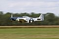
A P-51 Mustang at the 2007 Geneseo Airshow.
-
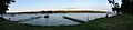
Part of the east side of Conesus Lake as seen from Geneseo's Long Point Park.

See also
 In Spanish: Geneseo (Nueva York) para niños
