Cymyran Strait facts for kids
Quick facts for kids Cymyran Strait |
|
|---|---|
|
|
|
| Location | Irish Sea |
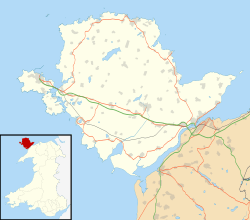
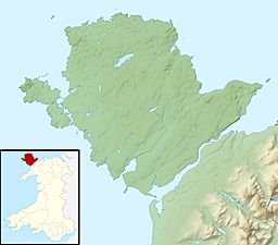
| Coordinates | 53°17′01″N 4°35′16″W / 53.2835°N 4.5879°W |
| Type | Strait |
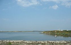
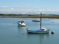
The Cymyran Strait is a narrow stretch of water that connects two larger bodies of water. It runs between the islands of Anglesey (Ynys Môn) and Holy Island (Ynys Cybi) in Wales.
This strait stretches from Beddmanarch Bay in the north down to Cymyran Bay in the south. At both ends, it opens up into the Irish Sea.
Contents
Crossing the Strait: Bridges and Roads
For a long time, crossing the Cymyran Strait was difficult. People had to use boats or find other ways around. Over the years, several important structures have been built to cross this water.
The First Bridge
The very first permanent link across the strait was the Four Mile Bridge. This bridge was built by 1530, making it possible to cross the water without a boat.
Modern Crossings
Later, more modern ways to cross the strait were built. These helped people and goods travel faster and easier.
- In 1823, the A5 London to Holyhead Road was built. It crossed the strait at a place called Stanley Embankment. This road was very important for connecting London to Holyhead.
- In 1848, the North Wales Coast Line railway also used the same Stanley Embankment. This allowed trains to travel between the islands.
- Much later, in 2001, the A55 expressway was built. This is a modern, fast road that also crosses the strait.
The Inland Sea
A special part of the Cymyran Strait is often called the Inland Sea (Y Lasinwen). This area is located between the Stanley Embankment and the Four Mile Bridge. It's almost like a lagoon, which is a shallow body of water separated from the main sea by a narrow strip of land.
Nearby Communities
The only settlement right on the shores of the Cymyran Strait is the village of Four Mile Bridge. However, several other towns and villages are quite close by. These include the town of Holyhead and the villages of Valley and Trearddur.
 | James B. Knighten |
 | Azellia White |
 | Willa Brown |


