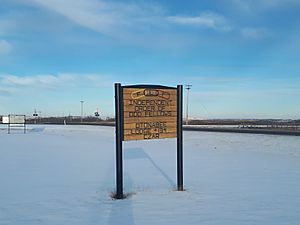
Czar, Alberta facts for kids
Quick facts for kids
Czar
|
|
|---|---|
|
Village
|
|
| Village of Czar | |

Czar, Alberta
|
|
| Motto(s):
Where the Cowboys Reign
|
|
| Country | Canada |
| Province | Alberta |
| Region | Central Alberta |
| Census division | 7 |
| Municipal district | Municipal District of Provost No. 52 |
| Incorporated | |
| • Village | November 12, 1917 |
| Area
(2021)
|
|
| • Land | 1.12 km2 (0.43 sq mi) |
| Elevation | 685 m (2,247 ft) |
| Population
(2021)
|
|
| • Total | 248 |
| • Density | 221.2/km2 (573/sq mi) |
| Time zone | UTC−7 (MST) |
| • Summer (DST) | UTC−6 (MDT) |
| Area code(s) | 780 587 |
| Highways | Highway 41 Highway 13 |
| Waterway | Shorncliffe Lake |
Czar is a small village located in the middle of Alberta, Canada. It's about 70 kilometers (43 miles) west of the Saskatchewan border. You can find Czar where two main roads, Highway 13 and Buffalo Trail, meet. It's also near the Canadian Pacific Kansas City railway tracks.
Contents
About Czar Village
Czar is a friendly community in central Alberta. It is known for its quiet, rural setting. The village was officially recognized on November 12, 1917.
Location and Travel
Czar is easy to reach by car. It sits right where Highway 13 and Highway 41 cross. These highways connect Czar to other towns and cities. The village is also close to the Canadian Pacific Kansas City railway.
Local Government
The village of Czar is run by the Czar Village Council. The head of the council is the Mayor, currently Angela Large. The council makes decisions to help the village grow and serve its residents.
People Living in Czar
Every few years, Statistics Canada counts how many people live in different places. This is called a census.
Population in 2021
In 2021, the Village of Czar had 248 people living there. These people lived in 86 homes. This number was an increase from 2016.
Population in 2016
Back in 2016, Czar had 202 people. They lived in 85 homes. This was also an increase from the 2011 count.
Village Size
Czar covers a land area of about 1.12 square kilometers (0.43 square miles). This means there are about 221 people per square kilometer.
 | John T. Biggers |
 | Thomas Blackshear |
 | Mark Bradford |
 | Beverly Buchanan |


