D'Estrees Bay facts for kids
Quick facts for kids D'Estrees Bay |
|
|---|---|
 |
|
| Location | Kangaroo Island, South Australia |
| Coordinates | 35°55′00″S 137°39′02″E / 35.91656209°S 137.65046840°E |
| Type | Bay |
| Basin countries | Australia |
| Max. length | 14 km (8.7 mi) |
| Max. depth | 27 m (89 ft) |
| Settlements | Haines D'Estrees Bay |
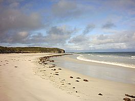
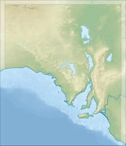
D'Estrees Bay is a beautiful bay located on the southern coast of Kangaroo Island in South Australia. It's about 39 kilometers (24 miles) south of Kingscote, which is the main town on the island. This bay is a popular spot for both locals and visitors.
Contents
Discovering D'Estrees Bay
How the Bay Got Its Name
D'Estrees Bay was named in 1803 by two French explorers, Peron and Freycinet. They were part of the Baudin expedition to Australia. They named the bay after Victor-Marie d'Estrées, who was a famous French military leader.
What Does the Bay Look Like?
The bay stretches for about 14 kilometers (9 miles). It goes from Point Tinline in the southwest to Point Reynolds in the northeast. Most of the bay has lovely sandy beaches that are easy to get to. It's a great place for a walk or to enjoy the ocean views.
Visiting D'Estrees Bay
On the western side of the bay, there is a small community. You'll find houses and places for people to stay during holidays. Some people even live there all year round. It's a quiet area, perfect for relaxing by the sea.
Nature and Conservation
A part of the land at the southwest end of D'Estrees Bay is protected. It is part of the Cape Gantheaume Conservation Park. This park helps to protect the natural environment and wildlife in the area. It's a great place to see native plants and animals.
Shipwreck Story
The Osmanli Shipwreck
D'Estrees Bay has a bit of history, including a shipwreck! On November 25, 1853, a ship called the Osmanli was sailing from Melbourne to Adelaide. It hit a hidden reef in D'Estrees Bay and sank. Luckily, all sixty people on board were able to get safely to shore using the ship's boats.
 | Audre Lorde |
 | John Berry Meachum |
 | Ferdinand Lee Barnett |


