Daisy Hill, Indiana facts for kids
Quick facts for kids
Daisy Hill, Indiana
|
|
|---|---|

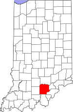
Washington County's location in Indiana
|
|
| Country | United States |
| State | Indiana |
| County | Washington |
| Township | Polk |
| Elevation | 791 ft (241 m) |
| Time zone | UTC-5 (Eastern (EST)) |
| • Summer (DST) | UTC-4 (EDT) |
| ZIP code |
47165
|
| Area code(s) | 812, 930 |
| GNIS feature ID | 452098 |
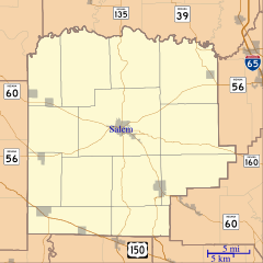
Daisy Hill is a small place in Indiana, United States. It is known as an unincorporated community. This means it is a group of homes and buildings that is not officially a town or city. It does not have its own local government. Daisy Hill is located within Polk Township in Washington County.
Where is Daisy Hill?
Daisy Hill is in the state of Indiana. You can find it using its geographic coordinates. These are like an address for a spot on Earth. Daisy Hill is located at 38 degrees, 30 minutes, 24 seconds North latitude and 85 degrees, 56 minutes, 21 seconds West longitude. This spot is about 791 feet (241 meters) above sea level.
A Look Back: The Story of Daisy Hill
People say that Daisy Hill got its name a long time ago. It is believed that the name came from a cemetery that was located near the community.
In 1974, a very powerful tornado hit Daisy Hill. This tornado was part of a huge event called the 1974 Super Outbreak. The Super Outbreak was one of the largest tornado outbreaks ever recorded. The tornado that struck Daisy Hill was extremely strong. It was rated as an F5 tornado on the Fujita scale. This means it was one of the most intense tornadoes possible. It caused a lot of damage, completely flattening farms in the Daisy Hill area.
 | Percy Lavon Julian |
 | Katherine Johnson |
 | George Washington Carver |
 | Annie Easley |


