1974 Super Outbreak facts for kids
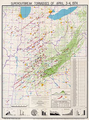
Paths of the 148 tornadoes
generated in United States during the 1974 Super Outbreak. One tornado was deconfirmed and determined to be a microburst. |
|
| Meteorological history | |
|---|---|
| Duration | April 3–4, 1974 |
| Tornado outbreak | |
| Tornadoes | 148 |
| Maximum rating | F5 tornado |
| Overall effects | |
| Fatalities | 319 fatalities |
| Damage | $5.26 billion (2023 USD) |
| Areas affected | Midwestern and Southern United States, Ontario, Canada |
|
Part of the tornado outbreaks of 1974 |
|
The 1974 Super Outbreak was a massive and powerful series of tornadoes that hit the central and eastern United States, plus parts of Canada, on April 3 and 4, 1974. It was the second-largest tornado outbreak ever recorded in a single 24-hour period. It was also the most violent, with 30 very strong tornadoes (rated F4 or F5 on the Fujita scale).
In total, 148 tornadoes were confirmed across 13 U.S. states and the Canadian province of Ontario. These states included Illinois, Indiana, Michigan, Ohio, Kentucky, Tennessee, Alabama, Mississippi, Georgia, North Carolina, Virginia, West Virginia, and New York. The outbreak caused about $5.26 billion in damage (when adjusted for inflation to 2023). At one point, 15 tornadoes were happening at the same time!
The 1974 Super Outbreak was the first time in history that more than 100 tornadoes occurred in less than 24 hours. A tornado expert named Thomas P. Grazulis created a way to rank tornado outbreaks, called the Outbreak Intensity Score (OIS). The 1974 Super Outbreak received a score of 446, making it the most violent tornado outbreak ever recorded.
Contents
- How the Storms Formed
- Tornadoes Confirmed
- Depauw–Daisy Hill, Indiana Tornado
- Xenia, Ohio Tornado
- Monticello Tornado Family
- Hanover/Madison, Indiana Tornado
- Brandenburg, Kentucky Tornado
- Cincinnati/Sayler Park, Ohio Tornado
- Louisville, Kentucky Tornado
- Tanner, Alabama (1st tornado)
- Jasper/Cullman, Alabama Tornado
- Tanner, Alabama (2nd tornado)
- Guin, Alabama Tornado
- Huntsville, Alabama Tornado
- Aftermath and Recovery
- See also
How the Storms Formed
| State/Province | Deaths |
|---|---|
| Alabama | 77 |
| Georgia | 16 |
| Illinois | 5 |
| Indiana | 47 |
| Kentucky | 71 |
| Michigan | 2 |
| North Carolina | 6 |
| Ohio | 38 |
| Ontario | 9 |
| Tennessee | 45 |
| Virginia | 1 |
| West Virginia | 1 |
| Total | 319 |
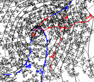
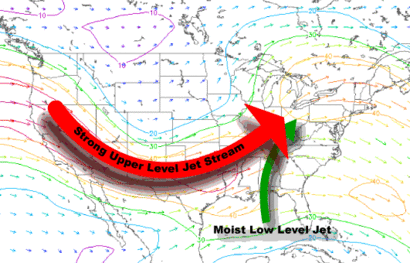
A strong low-pressure system formed on April 1, 1974. As it moved, it pulled in a lot of moist air. This made the storm much stronger. Weather experts at National Weather Service knew a severe weather outbreak was coming. But they didn't expect it to be this huge.
Before the main outbreak, some strong tornadoes had already hit parts of the Ohio Valley on April 1 and 2. On April 3, severe weather warnings were issued. In some northern areas, snow was falling. But in the central states, the air was getting very unstable. This meant it was perfect for powerful thunderstorms to form.
As the day went on, the air became even more unstable. Strong winds high in the atmosphere helped lift the warm, moist air. This created huge thunderstorms. These storms moved very fast, sometimes up to 60 miles per hour. They started to produce tornadoes.
The storms split into different groups. Some of the most powerful storms, called supercells, began to form. These supercells are known for creating strong and long-lasting tornadoes. The first F5 tornado of the day hit near Depauw, Indiana. Many of these supercells produced multiple strong or violent tornadoes. This included three F5 tornadoes in Depauw, Indiana; Xenia, Ohio; and Brandenburg, Kentucky.
Later in the day, more storms formed. These also produced powerful tornadoes. Some tornadoes traveled for very long distances. For example, one tornado in Indiana traveled about 121 miles. As the storms moved east, they hit warmer, moister air. This made the tornadoes even stronger and last longer.
In the evening, new storms developed further south in Alabama and Tennessee. These storms also created very strong, long-tracked tornadoes. Some of the most powerful tornadoes of the entire outbreak happened here. This included two F5 tornadoes that hit Tanner, Alabama, and an extremely strong F5 that destroyed Guin, Alabama. The tornado activity continued into the early morning of April 4.
Tornadoes Confirmed
| FU | F0 | F1 | F2 | F3 | F4 | F5 | Total |
|---|---|---|---|---|---|---|---|
| 0 | 12 | 38 | 34 | 34* | 23 | 7 | 148 |
- Note: An F3 tornado was confirmed in Ontario.
This tornado outbreak had the most violent tornadoes (F4 and F5) ever seen in a single event. There were seven F5 tornadoes and 23 F4 tornadoes. More than 100 tornadoes came from 33 "tornado families." A tornado family is when one thunderstorm creates several tornadoes one after another.
The first F5 tornado of the day hit Depauw, Indiana, at 3:20 p.m. EDT. It killed 6 people and injured 86 others. It traveled 65 miles, leveling homes in Depauw and Daisy Hill.
Seven F5 tornadoes were confirmed. One was in Indiana, one in Ohio, one in Kentucky, and three in Alabama. The last F5 crossed parts of Indiana, Ohio, and Kentucky. In Brandenburg, Kentucky, 31 people died. In Guin, Alabama, 28 people died. An F3 tornado also hit Windsor, Ontario, Canada, killing nine people.
At the peak of the outbreak, an amazing 16 tornadoes were on the ground at the same time. At one point, forecasters in Indiana were so overwhelmed that they issued a tornado warning for the entire state. This was the first and only time in U.S. history that a whole state was under a tornado warning.
The tornado activity lasted for 18 hours. It finally ended in Caldwell County, North Carolina, around 7:00 a.m. on April 4. In total, 319 people were killed by the 148 tornadoes. Also, 5,484 people were injured.
The 1974 Super Outbreak happened at the end of a very strong La Niña event. La Niña is a weather pattern that affects global weather. Even though two of the biggest tornado outbreaks happened during La Niña, scientists are still studying if there's a clear link between La Niña and tornado activity.
Depauw–Daisy Hill, Indiana Tornado
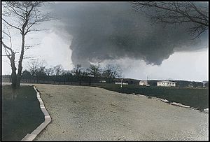
The tornado near Depauw, Indiana.
|
|
| Meteorological history | |
|---|---|
| Duration | 69 minutes |
| Formed | April 3, 3:20 p.m. CDT (UTC-5:00) |
| Dissipated | April 3, 4:29 p.m. CDT (UTC-5:00) |
| F5 tornado | |
| on the Fujita scale | |
| Overall effects | |
| Casualties | 6 fatalities, 86 injuries |
The Depauw-Daisy Hill tornado was the first F5 tornado of the outbreak. It touched down at 3:20 p.m. local time. It traveled about 65 miles through rural areas of southern Indiana. Near Depauw, many farms were completely leveled. Areas near Palmyra and Borden were also badly hit.
Morgan Elementary School was directly hit. Four classrooms were destroyed, but luckily, all the children and teachers were safe. In the Daisy Hill community, homes were completely swept away. The tornado was very wide, sometimes up to 1,760 yards (about a mile). Six people were killed and 86 were injured. One person died when a school bus flew into a ditch where she was hiding.
Xenia, Ohio Tornado
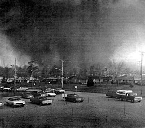
The Xenia tornado tearing through the southeast Pinecrest Garden district.
|
|
| Meteorological history | |
|---|---|
| Duration | 39 minutes |
| Formed | April 3, 4:33 p.m. EDT (UTC−04:00) |
| Dissipated | April 3, 5:12 p.m. EDT (UTC−04:00) |
| F5 tornado | |
| on the Fujita scale | |
| Highest winds | 250 to 305 mph (402 to 491 km/h) |
| Overall effects | |
| Casualties | 36 fatalities, 1,150 injuries |
| Damage | $100 million (1974 USD) |
The tornado that hit Xenia, Ohio, was the deadliest single tornado of the 1974 Super Outbreak. It killed 32 people and destroyed a large part of the town. The tornado started southwest of Xenia and grew very large and powerful as it moved northeast.
It slammed into Xenia, flattening neighborhoods like Windsor Park and Arrowhead. Entire rows of brick homes were swept away. When it reached downtown Xenia, it destroyed apartment buildings, homes, businesses, churches, and schools, including Xenia High School. Students at the school hid in a hallway just before the tornado dropped a school bus onto the stage where they had been practicing.
The tornado also lifted and blew over several railroad cars. Many businesses in downtown Xenia were destroyed. It then damaged Wilberforce University and Central State University. The tornado weakened and disappeared after traveling about 30 miles.
In Xenia, 32 people died, and about 1,150 were injured. About 1,400 buildings, which was half of the town, were heavily damaged or destroyed. The damage was estimated at $100 million (about $471.7 million in 2013).
Monticello Tornado Family
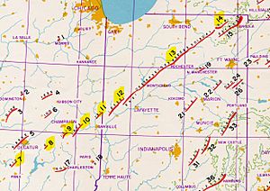
A portion of Fujita's track analysis focused on the northern portion of the outbreak. The Monticello family consists of tornadoes labeled 7 to 14
|
|
| Meteorological history | |
|---|---|
| Duration | 2:47 p.m. – 6:59 p.m. April 3 (UTC−05:00) 4 hours, 12 minutes |
| Tornado family | |
| Tornadoes | 8 confirmed, 2 suspected |
| Maximum rating | F4 tornado |
| Overall effects | |
| Casualties | 20 fatalities, 379 injuries |
| Areas affected | Illinois, Indiana |
| FU | F0 | F1 | F2 | F3 | F4 | F5 | Total |
|---|---|---|---|---|---|---|---|
| 0 | 1 | 2 | 1 | 3 | 1 | 0 | 8 |
This was the longest-lasting group of tornadoes in the outbreak. It tracked from central Illinois across northern Indiana for over 4 hours. Eight tornadoes touched down. This included the longest-tracked single tornado of the outbreak, the 121-mile F4 Monticello tornado.
Otterbein–Monticello–Wolcottville, Indiana Tornado
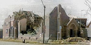
A view of the destroyed Presbyterian Church in Monticello.
|
|
| Meteorological history | |
|---|---|
| Duration | 2 hours |
| Formed | April 3, 4:47 p.m. CDT (UTC−05:00) |
| Dissipated | April 3, 6:47 p.m. CDT (UTC−05:00) |
| F4 tornado | |
| on the Fujita scale | |
| Overall effects | |
| Casualties | 18 fatalities, 362 injuries |
| Damage | $250 million |
This F4 tornado was half a mile wide. It created the longest damage path of the 1974 Super Outbreak, nearly crossing the entire state of Indiana. It traveled about 121 miles. The hardest hit area was Monticello. Much of the town was destroyed, including the courthouse, churches, businesses, and homes.
After hitting Monticello, the tornado became even stronger. It completely leveled several farms. It then tore through the west side of Rochester, destroying businesses and homes. The tornado continued northeast, hitting towns like Talma, Atwood, and Leesburg. It also crossed lakes, destroying lakeside homes and an airport.
In total, 18 people were killed by this storm. Five people died when their mini-bus fell 50 feet into the Tippecanoe River. The tornado showed that a long-held myth was wrong: it descended a 60-foot hill near the Tippecanoe River, proving tornadoes can follow terrain into valleys.
Hanover/Madison, Indiana Tornado
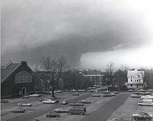
The tornado approaching the city of Madison.
|
|
| F4 tornado | |
|---|---|
| on the Fujita scale | |
| Overall effects | |
| Casualties | 11 fatalities, 300 injuries |
Soon after the Depauw tornado, the Hanover/Madison F4 tornado formed. It traveled through Jefferson County, destroying many buildings in Hanover and Madison. Eleven people were killed and 300 were injured.
About 90% of Hanover was destroyed or badly damaged. This included the Hanover College campus. Although no one at the college was killed, 32 of its 33 buildings were damaged. Hundreds of trees were knocked down, blocking all roads. In Madison, where seven people died, about 300 homes were destroyed.
Brandenburg, Kentucky Tornado
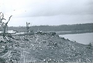
Remains of a house that was completely swept away in Brandenburg, with heavily debarked trees and shrubbery in the foreground.
|
|
| Meteorological history | |
|---|---|
| Duration | 52 minutes |
| Formed | April 3, 3:25 p.m. CDT (UTC-5:00) |
| Dissipated | April 3, 4:17 p.m. CDT (UTC-5:00) |
| F5 tornado | |
| on the Fujita scale | |
| Overall effects | |
| Casualties | 31 fatalities, 257 injuries |
| Damage | $2.5 million |
The Brandenburg tornado caused F5 damage and killed 31 people. It touched down around 3:25 p.m. CDT and traveled 32 miles. It quickly became violent as it moved into Meade County, sweeping away many homes. Cars were thrown hundreds of yards and twisted around trees.
The tornado then tore directly through Brandenburg with F5 power. Many well-built homes were completely leveled and swept away. The downtown area was also destroyed. Trees were stripped of their bark, and cars were crushed. Some checks from near Brandenburg were later found in Ohio. The tornado then crossed into Indiana before disappearing.
The Brandenburg tornado is the only tornado to have officially caused documented F5 damage in Kentucky.
Cincinnati/Sayler Park, Ohio Tornado
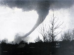
The Cincinnati/Sayler Park tornado; photo taken near Bridgetown.
|
|
| Meteorological history | |
|---|---|
| Duration | 23 minutes |
| Formed | April 3, 4:30 p.m. CDT (UTC-5:00) |
| Dissipated | April 3, 4:53 p.m. CDT (UTC-5:00) |
| F5 tornado | |
| on the Fujita scale | |
| Overall effects | |
| Casualties | 3 fatalities, 219 injuries |
The Sayler Park tornado was seen live on TV by thousands of people, as WCPO aired special news coverage. It was unusual because its path crossed parts of three states. It started in southeastern Indiana, then traveled through Boone County, Kentucky, causing F4 damage.
It then crossed the Ohio River into Ohio. Here, it reached F5 strength as it hit Sayler Park. The tornado lifted a large floating restaurant and threw a house into the river. In Sayler Park, many homes were swept away, leaving only bare foundations. A pickup truck was carried half a block over five homes before crashing.
The tornado weakened but continued through several Cincinnati neighborhoods, destroying many homes. It killed 3 people and injured 210. It was the most photographed tornado of the outbreak.
Louisville, Kentucky Tornado
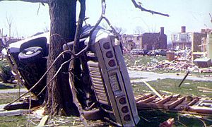
Major damage in the Northfield neighborhood of Louisville, including a vehicle partially wrapped around a tree.
|
|
| Meteorological history | |
|---|---|
| Duration | 20 minutes |
| Formed | April 3, 4:37 p.m. CDT (UTC-5:00) |
| Dissipated | April 3, 4:57 p.m. CDT (UTC-5:00) |
| F4 tornado | |
| on the Fujita scale | |
| Overall effects | |
| Casualties | 3 fatalities, 207 injuries |
About an hour after the Brandenburg tornado, the same supercell created an F4 tornado that hit Louisville. It touched down near Standiford Field Airport. It destroyed horse barns and part of Freedom Hall at the Kentucky Fair and Exposition Center. It then crossed I-65, scattering cars.
The tornado continued northeast, destroying Audubon Elementary School. It affected many neighborhoods, destroying hundreds of homes and damaging thousands more. Cherokee Park, a large historic park, had thousands of mature trees destroyed.
Three people were killed, and 207 were injured. A helicopter traffic reporter, Dick Gilbert, followed the tornado and gave live descriptions of the damage. Radio station WHAS-AM stayed on air, providing vital information to the city, as power was out for many.
Tanner, Alabama (1st tornado)
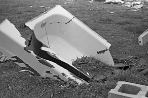
A bathtub deeply embedded into the ground in Harvest, Alabama.
|
|
| Meteorological history | |
|---|---|
| Duration | 90 minutes |
| Formed | April 3, 6:15 p.m. CDT (UTC-5:00) |
| Dissipated | April 3, 7:45 p.m. CDT (UTC-5:00) |
| F5 tornado | |
| on the Fujita scale | |
| Overall effects | |
| Casualties | 28 fatalities, 267 injuries |
The small town of Tanner was hit by two F5 tornadoes just 30 minutes apart. The first tornado formed at 6:30 p.m. CDT and lasted over 90 minutes, killing 28 people. It rapidly intensified, sweeping away homes and throwing cars. A family of six was killed.
Near Moulton, many homes were swept away. A water pump was lifted completely out of a wellhouse. The tornado crossed the Tennessee River as a large waterspout, flattening trees. It then slammed into Tanner, where many homes were swept away, cars were tossed, and trees were stripped. Lawson's Trailer Park was badly damaged.
The tornado continued into Madison County, hitting Capshaw and Harvest. Many homes were completely swept away. A bathtub from one house was found deeply stuck in the ground. The tornado was 500 yards wide at its peak.
Jasper/Cullman, Alabama Tornado
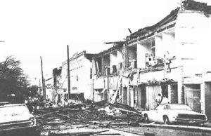
Heavy damage to buildings in downtown Jasper.
|
|
| Meteorological history | |
|---|---|
| Duration | 105 minutes |
| Formed | April 3, 6:35 p.m. CDT (UTC-5:00) |
| Dissipated | April 3, 8:20 p.m. CDT (UTC-5:00) |
| F4 tornado | |
| on the Fujita scale | |
| Overall effects | |
| Casualties | 3 fatalities, 178 injuries |
Another violent tornado touched down in Pickens County and headed northeast for nearly 2 hours. It caused major damage to downtown Jasper. The F4 storm also caused damage in Cullman.
Two people were killed near the Walker County line when a church was destroyed. The tornado tore directly through downtown Jasper at 6:57 p.m., causing severe damage and injuring at least 100 people. Many buildings and stores were damaged or destroyed. The Walker County courthouse was badly hit, and a new fire station was completely leveled.
The tornado then crossed Lewis Smith Lake and moved across the south side of Cullman. Homes and shopping centers were damaged or destroyed, resulting in one death and 36 injuries. In total, the storm killed three people and injured 150. Five hundred buildings were destroyed, and nearly 400 others were severely damaged.
Tanner, Alabama (2nd tornado)
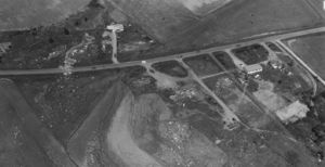
Homes swept away and scattered across fields near Hazel Green, Alabama, as a result of the second F5 tornado to impact the area.
|
|
| Meteorological history | |
|---|---|
| Duration | 90 minutes |
| Formed | April 3, 7:35 p.m. CDT (UTC-5:00) |
| Dissipated | April 3, 9:05 p.m. CDT) (UTC-5:00) |
| F5 tornado | |
| on the Fujita scale | |
| Overall effects | |
| Casualties | 16 fatalities, 190 injuries |
While rescue efforts were happening, another violent tornado struck the same area. This second tornado formed at 7:35 p.m. CDT and traveled 83 miles, very close to the path of the first storm. Sixteen people were killed by this tornado.
Tanner was hit again, and many structures left standing after the first tornado were destroyed. A man injured in the first tornado was taken to a church for shelter, but the church collapsed in the second tornado, killing him.
The tornado continued into Madison County, devastating Capshaw and Harvest again. Many homes were completely swept away. It then swept away more homes in the Hazel Green area. The tornado crossed into Tennessee, causing major damage and 6 deaths. Two people died when a church was destroyed during a service.
The two Tanner tornadoes together killed over 45 people and injured over 400. Over 1,000 houses, 200 mobile homes, and many other buildings and cars were destroyed or badly damaged. Both Tanner tornadoes are officially rated F5.
Guin, Alabama Tornado
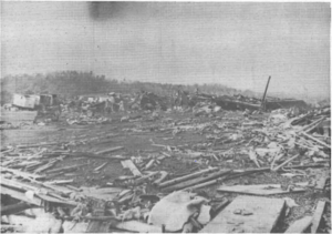
Remains of the Guin Mobile Home Plant, which was completely flattened.
|
|
| Meteorological history | |
|---|---|
| Duration | 100 minutes |
| Formed | April 3, 8:50 p.m. CDT (UTC-5:00) |
| Dissipated | April 3, 10:30 p.m. CDT (UTC-5:00) |
| F5 tornado | |
| on the Fujita scale | |
| Overall effects | |
| Casualties | 28 fatalities, 272 injuries |
The fast-moving tornado that destroyed Guin was the longest-lasting F5 tornado in the outbreak. It is considered one of the most violent ever recorded. The Guin Tornado traveled over 79.5 miles. It formed around 8:50 p.m. CDT near the Mississippi-Alabama border.
It became extremely violent as it entered Guin, causing F5 damage in many areas. It completely destroyed the Guin Mobile Home Plant, leaving nothing but twisted metal. The town's downtown area was also heavily damaged, with many businesses and churches destroyed. Trees were stripped of bark, and cars were thrown and mangled.
Residential areas in Guin were completely devastated. Many homes were swept away, leaving only bare ground. A damage surveyor noted that in one area, "It was just like the ground had been swept clean." Twenty-three people were killed in Guin.
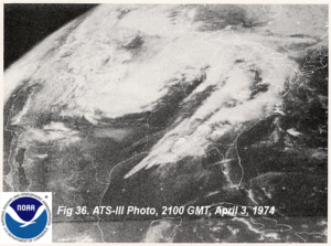
The tornado continued past Guin, hitting Twin and Delmar, killing 5 more people. It then grew up to a mile wide as it tore through the William B. Bankhead National Forest, flattening a huge area of trees. The tornado path was so wide it could be seen from satellite. It finally disappeared after destroying 546 buildings.
Huntsville, Alabama Tornado
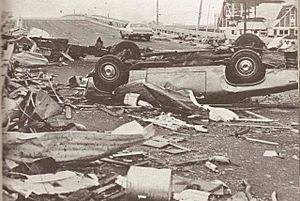
Damage at the intersection of Drake Avenue and Memorial Parkway in Huntsville.
|
|
| Meteorological history | |
|---|---|
| Duration | 51 minutes |
| Formed | April 3, 10:24 p.m. CDT (UTC-5:00) |
| Dissipated | April 3, 11:15 p.m. CDT (UTC-5:00) |
| F3 tornado | |
| on the Fujita scale | |
| Overall effects | |
| Casualties | 2 fatalities, 7 injuries |
Huntsville was hit by a strong F3 tornado shortly before 11:00 p.m. EDT. This tornado caused heavy damage in the southern part of the city, damaging or destroying nearly 1,000 buildings.
It first hit the Redstone Arsenal, damaging many buildings. Thanks to an early warning, there were only three minor injuries there. Many homes were badly damaged or destroyed in residential areas. A school was also destroyed. The Glenn'll trailer park was completely destroyed. The tornado even went over Monte Sano Mountain, which is 1,640 feet high, tearing apart more homes.
Strange electrical flashes and glowing lights were reported in the sky as the tornado passed through Huntsville. These were likely "power flashes" caused by damaged electrical equipment.
Aftermath and Recovery
On April 5, Georgia Governor Jimmy Carter declared 13 counties disaster areas. He asked President Nixon for federal aid, as damage was over $15.5 million. Help centers were opened, and the National Guard provided vehicles for search and rescue.
West Virginia Governor Moore also declared 14 counties disaster areas. President Nixon approved federal aid for some counties. The total damage from tornadoes and thunderstorms in West Virginia was over $3.6 million. The Red Cross helped victims with supplies and medical bills.
On April 10, the Disaster Relief Act of 1974 was quickly passed by the United States Senate. This law was a direct response to the huge damage from the tornado outbreak. Its main goal was to change how disasters are handled at a federal level and make it easier to get federal aid. This act led to the creation of a disaster coordinating agency. President Nixon signed it into law on May 22.
See also
- List of tornadoes and tornado outbreaks
- List of North American tornadoes and tornado outbreaks
- List of Canadian tornadoes and tornado outbreaks
- List of tornadoes striking downtown areas of large cities
- List of F5 and EF5 tornadoes
- Tornado outbreak of December 10–11, 2021 - One of the deadliest tornado outbreaks in Kentucky's history.
- 2011 Super Outbreak – A very similar, but larger and deadlier outbreak that occurred in April 2011.
 | George Robert Carruthers |
 | Patricia Bath |
 | Jan Ernst Matzeliger |
 | Alexander Miles |


