Meade County, Kentucky facts for kids
Quick facts for kids
Meade County
|
|||
|---|---|---|---|

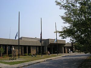
Meade County courthouse in Brandenburg
|
|||
|
|||

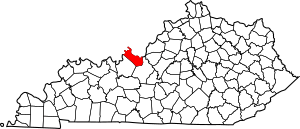
Location within the U.S. state of Kentucky
|
|||
 Kentucky's location within the U.S. |
|||
| Country | |||
| State | |||
| Founded | 1823 | ||
| Named for | James Meade | ||
| Seat | Brandenburg | ||
| Largest city | Brandenburg | ||
| Area | |||
| • Total | 325 sq mi (840 km2) | ||
| • Land | 305 sq mi (790 km2) | ||
| • Water | 19 sq mi (50 km2) 5.9% | ||
| Population
(2020)
|
|||
| • Total | 30,003 | ||
| • Estimate
(2023)
|
30,131 |
||
| • Density | 92.32/sq mi (35.64/km2) | ||
| Time zone | UTC−5 (Eastern) | ||
| • Summer (DST) | UTC−4 (EDT) | ||
| Congressional district | 2nd | ||
Meade County is a place in the state of Kentucky, USA. It is located in the central part of the country. In 2020, about 30,003 people lived here. The main town, or county seat, is Brandenburg.
Meade County was created on December 17, 1823. It was named after Captain James M. Meade. He was a soldier who died in a battle during the War of 1812. Meade County is part of a larger area that includes Elizabethtown and Fort Knox. This area is also close to Louisville.
Contents
Exploring Meade County's Geography
Meade County covers a total area of about 325 square miles. Most of this area, about 305 square miles, is land. The rest, about 19 square miles, is water. This means water makes up almost 6% of the county.
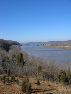
The northern edge of Meade County stretches for 56 miles. This border is along the Ohio River. Across the river is the state of Indiana.
Fun Outdoor Places to Visit
Meade County has many cool places to enjoy nature. You can visit these spots:
- Doe Run Inn
- Otter Creek Outdoor Recreation Area
- Meade Olin Park
- Diana’s Park
- Park Down By The River
Neighboring Counties Around Meade
Meade County shares its borders with several other counties:
- Hardin County to the southeast.
- Breckinridge County to the southwest.
- Harrison County, Indiana to the northeast.
- Perry County, Indiana to the northwest.
- Crawford County, Indiana to the north.
Understanding Meade County's Population
| Historical population | |||
|---|---|---|---|
| Census | Pop. | %± | |
| 1830 | 4,131 | — | |
| 1840 | 5,780 | 39.9% | |
| 1850 | 7,393 | 27.9% | |
| 1860 | 8,898 | 20.4% | |
| 1870 | 9,485 | 6.6% | |
| 1880 | 10,323 | 8.8% | |
| 1890 | 9,484 | −8.1% | |
| 1900 | 10,533 | 11.1% | |
| 1910 | 9,783 | −7.1% | |
| 1920 | 9,442 | −3.5% | |
| 1930 | 8,042 | −14.8% | |
| 1940 | 8,827 | 9.8% | |
| 1950 | 9,422 | 6.7% | |
| 1960 | 18,938 | 101.0% | |
| 1970 | 18,796 | −0.7% | |
| 1980 | 22,854 | 21.6% | |
| 1990 | 24,170 | 5.8% | |
| 2000 | 26,349 | 9.0% | |
| 2010 | 28,602 | 8.6% | |
| 2020 | 30,003 | 4.9% | |
| 2023 (est.) | 30,131 | 5.3% | |
| U.S. Decennial Census 1790–1960 1900–1990 1990–2000 2010–2020 |
|||
In 2000, there were 26,349 people living in Meade County. These people lived in 9,470 homes. About 7,396 of these homes were families. On average, there were about 85 people per square mile.
Most people in the county were White (about 92%). A smaller number were Black or African American (about 4%). Other groups made up the rest of the population. About 2% of the people were Hispanic or Latino.
Many homes (42%) had children under 18 living there. Most families (64%) were married couples. About 18% of homes had just one person living there.
The population of Meade County is made up of people of all ages. About 30% of the people were under 18 years old. About 33% were between 25 and 44 years old. The average age in the county was 32 years old.
Towns and Places in Meade County
Meade County has several towns and communities. Some are cities, and others are smaller places.
Cities in Meade County
- Brandenburg is the main town and county seat.
- Ekron
- Muldraugh (part of this city is also in Hardin County)
Special Census Areas
These are areas that are counted in the census but are not official cities:
- Doe Valley
- Fort Knox is a military base. Part of it is also in Hardin County.
Other Small Communities
Many other smaller, unincorporated places are found in Meade County:
- Battletown
- Big Spring (partly in Breckinridge County and Hardin County)
- Concordia
- Flaherty
- Garrett
- Guston
- Lickskillet
- Midway
- Payneville
- Rhodelia
- Rock Haven
- Wolf Creek
- Garnettsville
- Buck Grove
Learning and Schools in Meade County
Most students in Meade County go to schools run by Meade County Schools. This includes Meade County High School.
However, students who live on the Fort Knox military base go to different schools. These schools are managed by the Department of Defense Education Activity (DoDEA). One of these schools is Fort Knox Middle High School.
See also
 In Spanish: Condado de Meade (Kentucky) para niños
 | Jackie Robinson |
 | Jack Johnson |
 | Althea Gibson |
 | Arthur Ashe |
 | Muhammad Ali |


