De Queen, Arkansas facts for kids
Quick facts for kids
De Queen, Arkansas
|
|
|---|---|
|
City
|
|

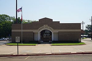
De Queen City Hall
|
|

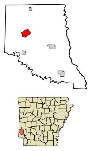
Location of De Queen in Sevier County, Arkansas.
|
|
| Country | United States |
| State | Arkansas |
| County | Sevier |
| Area | |
| • Total | 6.16 sq mi (15.96 km2) |
| • Land | 6.06 sq mi (15.70 km2) |
| • Water | 0.10 sq mi (0.26 km2) |
| Elevation | 430 ft (130 m) |
| Population
(2020)
|
|
| • Total | 6,105 |
| • Density | 1,007.43/sq mi (388.95/km2) |
| Time zone | UTC-6 (CST) |
| • Summer (DST) | UTC-5 (CDT) |
| ZIP code |
71832
|
| Area code(s) | 870 |
| FIPS code | 05-18490 |
| GNIS feature ID | 2404202 |
De Queen is a city in Arkansas, United States. It is the main city, or county seat, of Sevier County. In 2010, about 6,629 people lived there.
The city's name comes from a Dutch businessman named Jan de Goeijen. He helped fund a railway in the area. It is said he was not very happy with how his name was changed for the city.
Contents
Where is De Queen Located?
De Queen is located in southwestern Arkansas. Its exact location is 34°2′24″N 94°20′31″W.
The city covers about 6.16 square miles (15.96 square kilometers). Most of this area is land, with a small part being water.
How Many People Live in De Queen?
The number of people living in De Queen has changed over the years. You can see how the population has grown and shrunk below.
| Historical population | |||
|---|---|---|---|
| Census | Pop. | %± | |
| 1900 | 1,200 | — | |
| 1910 | 2,018 | 68.2% | |
| 1920 | 2,517 | 24.7% | |
| 1930 | 2,938 | 16.7% | |
| 1940 | 3,055 | 4.0% | |
| 1950 | 3,015 | −1.3% | |
| 1960 | 2,859 | −5.2% | |
| 1970 | 3,863 | 35.1% | |
| 1980 | 4,594 | 18.9% | |
| 1990 | 4,633 | 0.8% | |
| 2000 | 5,765 | 24.4% | |
| 2010 | 6,629 | 15.0% | |
| 2020 | 6,105 | −7.9% | |
| U.S. Decennial Census 2014 Estimate |
|||
Population in 2020
In 2020, there were 6,105 people living in De Queen. These people lived in 1,865 households. About 1,380 of these were families.
The city is home to many different groups of people. A large part of the population, about 58%, is of Hispanic or Latino background. Other groups include White (non-Hispanic), Black or African American, Native American, Asian, and Pacific Islander people.
Population in 2010
In 2010, De Queen had 6,629 people. The average age of people living there was 29 years old.
About 53.5% of the people were Hispanic or Latino. Other groups included non-Hispanic white people, non-Hispanic black people, Native Americans, and Asians. Some people reported being of two or more races.
What is the Climate Like?
De Queen has a humid subtropical climate. This means it has hot, humid summers. The winters are usually mild to cool.
| Climate data for De Queen, Arkansas (1991–2020 normals, extremes 1902–present) | |||||||||||||
|---|---|---|---|---|---|---|---|---|---|---|---|---|---|
| Month | Jan | Feb | Mar | Apr | May | Jun | Jul | Aug | Sep | Oct | Nov | Dec | Year |
| Record high °F (°C) | 83 (28) |
88 (31) |
98 (37) |
94 (34) |
96 (36) |
106 (41) |
108 (42) |
114 (46) |
108 (42) |
104 (40) |
88 (31) |
82 (28) |
114 (46) |
| Mean daily maximum °F (°C) | 53.5 (11.9) |
58.0 (14.4) |
65.8 (18.8) |
73.6 (23.1) |
80.5 (26.9) |
87.9 (31.1) |
91.9 (33.3) |
92.8 (33.8) |
86.5 (30.3) |
75.8 (24.3) |
64.1 (17.8) |
55.4 (13.0) |
73.8 (23.2) |
| Daily mean °F (°C) | 41.8 (5.4) |
45.7 (7.6) |
53.3 (11.8) |
60.9 (16.1) |
69.4 (20.8) |
77.4 (25.2) |
81.2 (27.3) |
81.2 (27.3) |
74.6 (23.7) |
63.1 (17.3) |
51.9 (11.1) |
44.1 (6.7) |
62.1 (16.7) |
| Mean daily minimum °F (°C) | 30.1 (−1.1) |
33.4 (0.8) |
40.7 (4.8) |
48.2 (9.0) |
58.4 (14.7) |
66.9 (19.4) |
70.5 (21.4) |
69.6 (20.9) |
62.6 (17.0) |
50.4 (10.2) |
39.7 (4.3) |
32.9 (0.5) |
50.3 (10.2) |
| Record low °F (°C) | −5 (−21) |
−14 (−26) |
8 (−13) |
25 (−4) |
32 (0) |
46 (8) |
52 (11) |
50 (10) |
34 (1) |
20 (−7) |
8 (−13) |
−5 (−21) |
−14 (−26) |
| Average precipitation inches (mm) | 4.12 (105) |
4.15 (105) |
5.03 (128) |
5.85 (149) |
6.25 (159) |
4.37 (111) |
3.44 (87) |
3.34 (85) |
4.05 (103) |
4.66 (118) |
4.44 (113) |
5.25 (133) |
54.95 (1,396) |
| Average snowfall inches (cm) | 1.1 (2.8) |
1.0 (2.5) |
0.1 (0.25) |
0.0 (0.0) |
0.0 (0.0) |
0.0 (0.0) |
0.0 (0.0) |
0.0 (0.0) |
0.0 (0.0) |
0.0 (0.0) |
0.1 (0.25) |
0.2 (0.51) |
2.5 (6.4) |
| Average precipitation days (≥ 0.01 in) | 8.2 | 7.8 | 8.6 | 8.3 | 9.5 | 7.8 | 6.9 | 6.0 | 5.8 | 7.4 | 7.4 | 8.1 | 91.8 |
| Average snowy days (≥ 0.1 in) | 0.4 | 0.5 | 0.1 | 0.0 | 0.0 | 0.0 | 0.0 | 0.0 | 0.0 | 0.0 | 0.1 | 0.2 | 1.3 |
| Source: NOAA | |||||||||||||
Getting Around De Queen
De Queen has several ways to get around. Major roads like US Route 70 and US Route 71 pass through the city. Arkansas State Highway 41 also serves the area.
You can also travel by bus. Jefferson Lines provides bus service to and from De Queen. For moving goods, the De Queen and Eastern Railroad offers freight train service.
The J Lynn Helms Sevier County Airport is located just west of town. It has a paved runway for airplanes.
Schools and Learning
De Queen is home to a campus of the Cossatot Community College of the University of Arkansas. This college offers classes for higher education.
The college also provides special classes for adults. These include GED classes to help people earn their high school equivalency. They also offer ESL (English as a Second Language) training. Other classes help with test preparation and computer skills.
The DeQueen School District manages the public schools in the area.
Historic Places to See
De Queen has several places listed on the National Register of Historic Places. These are important buildings and sites that are protected because of their history. Some of these include:
- Bishop Brookes House
- DeQueen & Eastern Railroad Machine Shop
- DeQueen Commercial Historic District
- First Presbyterian Church
- Hayes Hardware Store
- Otis Theodore and Effiegene Locke Wingo House
Famous People from De Queen
Some well-known people have connections to De Queen:
- J. Oscar Humphrey was an important politician in Arkansas. He served as the State Auditor for many years.
- Collin Raye is a popular country music singer.
- Wes Watkins is a politician from Oklahoma. He lived in De Queen when he was a child.
- Otis Wingo was a member of the United States House of Representatives. He worked as a lawyer in De Queen before he became a congressman.
See also
 In Spanish: De Queen (Arkansas) para niños
 | Misty Copeland |
 | Raven Wilkinson |
 | Debra Austin |
 | Aesha Ash |


