Dead Horse Island facts for kids

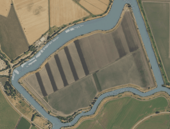
USGS aerial imagery of Dead Horse Island.
|
|
| Geography | |
|---|---|
| Location | Northern California |
| Coordinates | 38°13′45″N 121°30′08″W / 38.2290821°N 121.5021750°W |
| Adjacent bodies of water | Sacramento–San Joaquin River Delta |
| Administration | |
| State | |
| County | Sacramento |
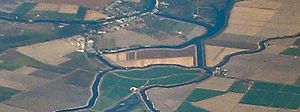
Dead Horse Island is a small, privately owned island in California. It is located in the San Joaquin River delta. This delta is a large area where the Sacramento and San Joaquin rivers meet. They flow together before reaching the San Francisco Bay.
Where is Dead Horse Island?
Dead Horse Island is found in Sacramento County. Its exact location can be pinpointed using coordinates: 38°13′45″N 121°30′08″W / 38.2290821°N 121.5021750°W. This helps people find it on a map.
Who owns and manages the island?
The island is owned by the Wilson Family. It is also managed by something called Reclamation District 2111. A reclamation district is a local group that helps manage land and water in certain areas. They often work to protect land from floods or to help with irrigation for farming.
Black History Month on Kiddle
Outstanding African-American Social Activists
 | Frances Mary Albrier |
 | Whitney Young |
 | Muhammad Ali |

All content from Kiddle encyclopedia articles (including the article images and facts) can be freely used under Attribution-ShareAlike license, unless stated otherwise. Cite this article:
Dead Horse Island Facts for Kids. Kiddle Encyclopedia.


