Deer Pond (Stillwater, New York) facts for kids
Quick facts for kids Deer Pond |
|
|---|---|
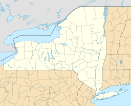
| Location | Herkimer County, New York |
| Coordinates | 43°56′03″N 75°03′28″W / 43.9342075°N 75.0578069°W |
| Surface area | 19 acres (0.030 sq mi) |
| Surface elevation | 1,952 feet (595 m) |
| Settlements | Moshier Falls |
Deer Pond is a small lake located in Herkimer County, New York. It sits northeast of a small community called Moshier Falls. This pond is a natural body of water, meaning it was formed by nature, not by people.
Contents
What is Deer Pond?
Deer Pond is a peaceful, natural body of water. It is often called a pond because of its smaller size. Ponds and lakes are important parts of the natural world. They provide homes for many plants and animals.
Where is Deer Pond Located?
Deer Pond is found in the beautiful region of the Adirondack Mountains in New York. Specifically, it is in Herkimer County, New York. The nearest small community is Moshier Falls. This area is known for its forests and many lakes and streams.
How Big is Deer Pond?
Deer Pond covers an area of about 19 acres. To help you imagine this, one acre is roughly the size of a football field without the end zones. So, Deer Pond is about 19 football fields in size. The pond sits at an elevation of about 1,952 feet above sea level. This means it is quite high up in the mountains.
Water Flow and Surroundings
The water in Deer Pond flows out through a small, unnamed creek. This creek then travels south and empties into Moshier Creek. Moshier Creek is a larger waterway in the area. This system of water flowing from one body to another is part of the natural hydrologic cycle. The areas around Deer Pond are typically forested. These forests provide a habitat for many types of wildlife, including deer, which might be how the pond got its name.


