Demijohn Lake facts for kids
Quick facts for kids Demijohn Lake |
|
|---|---|
| Location | Thunder Bay District, Ontario |
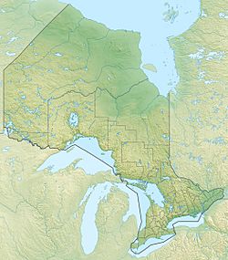
| Coordinates | 48°57′29″N 87°22′18″W / 48.95806°N 87.37167°W |
| Primary inflows | Whitesand River |
| Primary outflows | Whitesand River |
| Basin countries | Canada |
| Max. length | .75 km (0.47 mi) |
| Max. width | .1 km (0.062 mi) |
| Surface elevation | 390 m (1,280 ft) |
Demijohn Lake is a special lake located in the beautiful Thunder Bay District in Ontario, Canada. It has a unique shape, looking a bit like the letter "J" when you see it on a map. This lake is a natural wonder, important to the local environment.
Contents
Discovering Demijohn Lake
Demijohn Lake is a fascinating body of water. It is known for its distinct "J" shape. This makes it stand out from many other lakes. Imagine looking down from an airplane; you would clearly see its curved form.
Where is Demijohn Lake?
This interesting lake is found in the Thunder Bay District. This area is part of the large province of Ontario in Canada. Ontario is one of Canada's biggest provinces. It is home to many lakes, forests, and natural areas. The Thunder Bay District is in the northwestern part of Ontario. It is a place known for its vast wilderness and many freshwater lakes.
How Big is Demijohn Lake?
Demijohn Lake might not be the biggest lake you've ever heard of, but it's still a good size! It stretches for about 750 metres (2,461 ft) long. That's like walking the length of more than seven football fields! At its widest point, the lake is about 100 metres (328 ft) across. This means it's not very wide, but it has a good length.
The lake sits at an elevation of 390 metres (1,280 ft) above sea level. This means it is quite high up. Being at this elevation affects the surrounding landscape. It also influences how water flows into and out of the lake.
The Whitesand River's Role
The Whitesand River is very important to Demijohn Lake. It is the main source of water flowing into the lake. This means the river feeds the lake with fresh water. The Whitesand River also flows out of Demijohn Lake. So, the same river that brings water in also carries it away. This constant flow helps keep the lake healthy and fresh. It also connects Demijohn Lake to other parts of the local water system.


