Des Quinze Lake facts for kids
Quick facts for kids Des Quinze Lake |
|
|---|---|

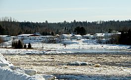
The Ottawa River at the outlet of Lac des Quinze at Angliers.
|
|
| Location | Témiscamingue |
| Coordinates | 47°32′52″N 79°07′26″W / 47.54778°N 79.12389°W |
| Primary inflows | Ottawa River, Little Roger River, Fraser River (Ottawa River), McFadden River |
| Primary outflows | Ottawa River |
| Basin countries | Canada |
| Max. length | 52 km (32 mi) |
| Max. width | 11 km (6.8 mi) |
| Surface area | 145 km2 (56 sq mi) |
| Surface elevation | 258 m (846 ft) |
| Islands | Morris (facing Allard Bay), Du Chenal Blind (near the dam of Angliers), Frigon, Fox, Jumelles, Squelette (facing Sèche Bay) |
Lac des Quinze is a large freshwater lake in Quebec, Canada. It's located in the Abitibi-Témiscamingue region. This beautiful lake stretches across several towns like Moffet and Angliers. It's a key part of the famous Ottawa River system.
Contents
Exploring Lac des Quinze
Lac des Quinze is a big lake, covering about 145 kilometres (90.10 mi) (56 square miles). It looks like a wide crescent shape if you view it from above. This lake is actually a major widening of the Ottawa River.
Size and Shape
The lake is about 52 kilometres (32 mi) (32 miles) long. At its widest point, it measures 11 kilometres (6.8 mi) (7 miles) across. The main source of water for Lac des Quinze comes from the Ottawa River on its east side. The Ottawa River flows into it after passing through other lakes like Lac Simard.
Rivers and Inflows
Many rivers and smaller lakes feed into Lac des Quinze:
- On the south side, the Fraser River (Ottawa River) flows into Gillies Bay.
- From the east, the McFadden River brings water from Rondelet Lake.
- To the north, water comes from lakes like Lébret, Rocher, and Beaumesnil Lake. The Little Roger River also adds water from lakes like Beaudry lake and Gaboury.
The Ottawa River's Journey
After flowing through Lac des Quinze, the Ottawa River continues its journey west. It passes through a series of rapids, including Cypress and Kakake. Eventually, the river reaches the "First Fall" near the village of Notre-Dame-du-Nord, Quebec. From there, the water flows into Paulson Bay, which is north of Lake Timiskaming.
Surrounding Areas
The lake is managed by several municipalities. These include Guérin in the north and Angliers in the southwest. A special protected area, the Lac des Quinze Biodiversity Reserve, is located southwest of the lake. A long bay of Lac des Quinze stretches into the middle of this reserve.
What's in a Name?
The name "Lac des Quinze" (which means "Lake of the Fifteen" in French) has an interesting history.
Origin of the Name
In the 1870s, a surveyor named Walter McOuat explained the name. He wrote that to travel up the Ottawa River by canoe to reach this lake, people had to make about fifteen "portages." A portage is when you carry your canoe and gear around a waterfall or rapids because you can't paddle through them. So, "Les Quinze" referred to these fifteen difficult spots.
Early History and Development
Logging began in the Lac des Quinze area in the mid-1800s. Between 1884 and 1910, more and more settlers started to live on the south shore of the lake. In 1883, John Morrison, who used to work for the Hudson's Bay Company, set up a trading post. This post was at Gillies Bay, where he traded furs with Indigenous peoples.
Around 1912, a hydroelectric dam was built on the Ottawa River at the lake's outlet. This dam, called "Des Quinze," was made even taller in 1947. Later, three more dams with power stations were built downstream to generate electricity.
The name "Lac des Quinze" was officially recognized on December 5, 1968, by the Commission de toponymie du Québec, which is Quebec's place-names commission.


