Lake Timiskaming facts for kids
Quick facts for kids Lake Timiskaming |
|
|---|---|
 |
|
| Location | Timiskaming District / Nipissing District, Ontario and Témiscamingue Regional County Municipality, Quebec |
| Coordinates | 47°20′N 79°30′W / 47.333°N 79.500°W |
| Type | Rift lake |
| Native name | (or Lake Temiskaming) Lac Témiscamingue Error {{native name checker}}: parameter value is malformed (help) |
| Primary inflows | Blanche River, Ottawa River, Montreal River, Matabitchuan River |
| Primary outflows | Ottawa River |
| Basin countries | Canada |
| Max. length | 110 km (68 mi) |
| Surface area | 295 km2 (114 sq mi) |
| Max. depth | 216 m (709 ft) |
| Surface elevation | 178.40 m (585.3 ft) |
| Islands | du Collège, Mann Farr Island |
| Settlements | Temiskaming Shores
Ville-Marie, Quebec Ville-Marie, Quebec Notre dam Du Nord |
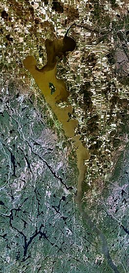
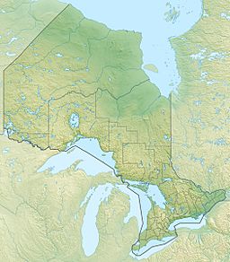
Lake Timiskaming (also called Lake Temiskaming or Lac Témiscamingue in French) is a big freshwater lake in Canada. It sits right on the border between the provinces of Ontario and Quebec. This lake is part of the Ottawa River system.
Lake Timiskaming is about 110 kilometres (68 mi) long and covers an area of almost 295 km2 (114 sq mi). Its water level usually stays between 175 m (574 ft) and 179 m (587 ft) above sea level. The lake can be very deep, reaching up to 216 m (709 ft) in some spots. You can find several islands on the lake, like Mann Island and du Collège Island.
What's in a Name?
The name Timiskaming comes from the Algonquin language. The original words, Temikami or Temikaming, mean "deep body of water with rapid winds."
Fish in the Lake
Lake Timiskaming is home to 30 different kinds of fish! Some of the most well-known types include:
How the Lake Was Formed
Lake Timiskaming was shaped a very long time ago during the last ice age. Giant glaciers moved across the land, carving out the rock and creating the lake's basin. It's also what's left of a huge ancient lake called Lake Ojibway, which existed about 9,500 years ago.

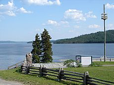
Looking south over Lake Timiskaming from Fort Témiscamingue near Ville-Marie, Quebec.
|
The Timiskaming Graben
Lake Timiskaming is located in a very old and large rift valley called the Timiskaming Graben. A rift valley is a long, narrow valley formed when the Earth's crust pulls apart. This particular rift extends for hundreds of kilometers to the north-east. It is connected to a larger system called the Saint Lawrence rift system.
There have been earthquakes along this rift valley, even recently. The area has many faults, which are cracks in the Earth's crust. These faults have created tall cliffs, like Devil's Rock. This impressive cliff is just 5 km (3 mi) south of Haileybury and is incredibly old, about 2.2 billion years old! Scientists have also found special rock formations called kimberlite pipes in this rift valley, which can sometimes contain diamonds.
 | Sharif Bey |
 | Hale Woodruff |
 | Richmond Barthé |
 | Purvis Young |


