Montreal River (Timiskaming District) facts for kids
Quick facts for kids Montreal River |
|
|---|---|

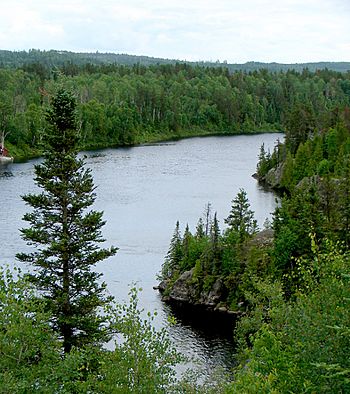
Montreal River at Matachewan
|
|
|
Location of the mouth of the Montreal River in Ontario
|
|
| Country | Canada |
| Province | Ontario |
| District | Timiskaming |
| Physical characteristics | |
| Main source | Smoothwater Lake Timiskaming, Unorganized, West Part 378 m (1,240 ft) 47°25′30″N 80°41′25″W / 47.42500°N 80.69028°W |
| River mouth | Lake Timiskaming Timiskaming, Unorganized, West Part 178.4 m (585 ft) 47°08′20″N 79°27′15″W / 47.13889°N 79.45417°W |
| Length | 220 km (140 mi) |
| Basin features | |
| Progression | Lake Timiskaming→ Ottawa River→ Saint Lawrence River→ Gulf of Saint Lawrence |
| River system | Ottawa River drainage basin |
| Tributaries |
|
The Montreal River is a long and important river in Ontario, Canada. It flows for about 220 kilometers (137 miles). The river starts at Smoothwater Lake and ends at Lake Timiskaming. This lake is part of the larger Ottawa River system. The Montreal River is very important because it helps make hydroelectricity. This is a way to create electricity using the power of flowing water.
Contents
River's Journey
The Montreal River has a unique shape, like a backwards check mark. It first flows about 70 kilometers (43 miles) to the northeast. Then, it turns and flows about 150 kilometers (93 miles) to the southeast.
Where the River Starts
The river begins in Lady Evelyn-Smoothwater Provincial Park. This park is a beautiful natural area. Near the start of the river is Ishpatina Ridge. This is the highest point in all of Ontario! The ridge separates the beginning of the Montreal River from another river, the Lady Evelyn River. The Lady Evelyn River joins the Montreal River much further downstream.
Flowing North and East
As the Montreal River heads north, it collects water from many smaller streams. It reaches a place called Inlet Bay on Gowganda Lake. The small town of Gowganda is also located here. The river then leaves the lake and flows under Ontario Highway 560. It continues its journey northeast.
Turning Southeast
The river then reaches a spot called The Forks near Matachewan. Here, a big stream called the West Montreal River joins it. After a short distance, the river turns southeast. It flows under Ontario Highway 65. It also picks up more water from Sydney Creek and Council Creek.
Power Stations and Towns
The river then reaches the Indian Chute Generating Station. This is a dam and power plant run by Ontario Power Generation (OPG). The river continues southeast to the community of Elk Lake. Here, another important stream, the Makobe River, joins it. The river passes under Highway 65 and Highway 560 again.
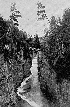
Further southeast, the river flows through a rocky area called the Mountain Chutes. The large Lady Evelyn River joins the Montreal River at Mowat Landing. Finally, the river flows into Bay Lake and reaches the town of Latchford. Highway 65 runs alongside the river for much of the way from Matachewan to Latchford.
Reaching Lake Timiskaming
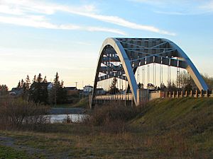
Near Latchford, the river flows over the Latchford Dam. It also passes under the Sgt. Aubrey Cosens VC Memorial Bridge. This bridge carries Ontario Highway 11. The river then goes past two more OPG power stations: Hound Chute Generating Station and Ragged Chute Generating Station.
The river flows over Fountain Falls and the Paugan Rapids. It then enters a reservoir, which is a large artificial lake. This reservoir is created by the OPG Lower Notch Generating Station and dam. After passing through this last power station, the Montreal River finally reaches its end at Lake Timiskaming.
River Life
The area around the Montreal River is home to many different birds. Scientists study these birds at two special stations. One station is at Mountain Chutes, and the other is at Gillies Lake. These stations help us learn more about the birds that live along the river.
Smaller Streams and Rivers
Many smaller streams and rivers flow into the Montreal River. These are called tributaries. They add water to the main river as it flows. Here are some of the important ones:
- Lady Evelyn River
- Makobe River
- West Montreal River
- Council Creek
- Sydney Creek
- Smoothwater Lake (where the river starts)
- Gowganda Lake (which the river flows through)
- Sandstone Creek
- Giroux Creek
- Hound Chute Creek
- Gillies Creek
- Loon Creek
- Sucker Gut Creek
- Gilchrist Creek
- McLaren's Creek
- Kitt Creek
- Wadi's Creek
- Moccasin Creek
- Spray Creek
- Barber Creek
- Etwill Creek
- Wabun Creek
- Moosehorn Creek
- Explorer Creek
- Whiskeyjack Creek
- Miller Creek
- Haines Creek
- Okinada Creek
- Smith Creek (flows into Smoothwater Lake)
 | James Van Der Zee |
 | Alma Thomas |
 | Ellis Wilson |
 | Margaret Taylor-Burroughs |


