Description de l'Égypte facts for kids
 |
|
| Author | Commission des sciences et arts d'Egypte |
|---|---|
| Original title | Description de l'Égypte |
| Country | France |
| Language | French |
| Publisher | French government |
|
Publication date
|
1809–22 |
The Description de l'Égypte (which means "Description of Egypt" in English) was a huge collection of books. It started coming out in 1809 and the last book was published in 1829. Its main goal was to record everything known about ancient and modern Egypt. It also covered Egypt's plants and animals.
This amazing work was created by about 160 civilian experts and scientists. They were often called "savants." These savants went with Napoleon Bonaparte's army when he explored Egypt from 1798 to 1801. Around 2000 artists and technicians, including 400 engravers, helped put the whole work together. When it was first published, it was the biggest book project ever known in the world!
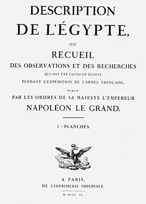
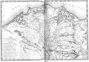
The full name of the work was very long. It meant "Description of Egypt, or the collection of observations and researches which were made in Egypt during the expedition of the French Army, published by the order of His Majesty the Emperor, Napoleon the Great." One part of the book, called Carte de l'Égypte, had about 50 maps. These were the first maps of Egypt, Syria, and Palestine made using a special measuring method called triangulation. They were used as the main maps for the region for most of the 1800s.
Contents
Creating the Great Book
About 160 civilian experts, known as the savants, worked together on the Description. Many of them were from a famous French group called the Institut de France. Together, they formed the Commission des Sciences et Arts d'Égypte.
In August 1798, Napoleon ordered the creation of the Institut d'Égypte. It was set up in a palace near Cairo. Gaspard Monge was its first president. This institute was like a big research center. It had a library, labs, and workshops. The savants also kept their Egyptian collections there. The workshop was very important. It made tools for both the army and the scientists. They even built new instruments. This was needed because many tools were lost when the French ships sank in August 1798. This happened during the Battle of the Nile at Aboukir Bay.
Sharing Knowledge
One main goal of the institute was to share knowledge. To do this, the savants published a journal called La Décade égyptienne. They also had a newspaper, the Courrier de l'Égypte. These publications shared news about the French army's activities. They also reported on the work of the Commission des Sciences et Arts d'Égypte and the Institute itself.
The idea for one huge book that would combine all the French discoveries in Egypt came about in November 1798. Joseph Fourier was given the job of bringing together all the reports. When the French army left Egypt in 1801, the savants took many notes and drawings with them. They also took small artifacts that the British didn't notice.
In 1802, a special group was formed to prepare all this information. This was ordered by Napoleon. The final book used information from the journal La Décade and the newspaper Courier de l'Égypte. It also used a four-volume work called Mémoires sur l'Égypte. Plus, there were many notes and drawings from the scholars. Because there was so much information, they published it as it was ready. Even so, it took over 20 years for the first edition to be fully published.
The first test copies of the engravings were shown to Napoleon in 1808. The first books were published by order of the emperor. Later ones were published by order of the king. The very last ones were simply published by order of the government.
A second edition, known as the Panckoucke edition, was also published. This edition had more text volumes. They were printed in a smaller size. New copies were made from the original plates. Many of the large pictures were folded to fit into the smaller books.
What the Book Looks Like
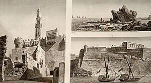
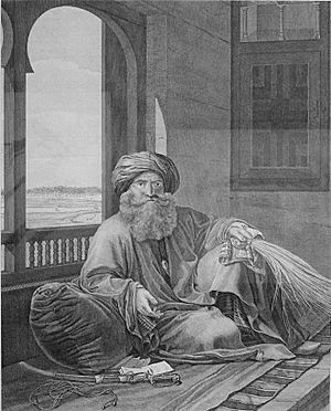
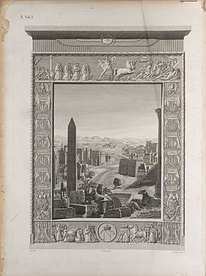
The Description de l'Égypte is an amazing work. The text is printed beautifully. The engravings (pictures) are very artistic. Some of the books are unusually large. The "Mammutfolio" size is about 1 meter by 0.81 meters!
The first edition usually has nine text volumes. It also has one volume describing the plates. Then there are ten volumes of plates (pictures). Two extra-large "Mammutfolio" volumes contain plates of ancient things and modern Egypt. Finally, there is one volume of maps. This makes a total of twenty-three volumes. Sometimes, the number of volumes can be slightly different.
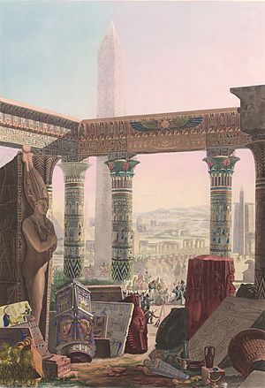
The second edition usually has thirty-seven volumes. Twenty-four of these are text volumes, sometimes split into more physical books. Volume ten describes the plates. There are ten volumes of plates, plus one map volume. This second edition was cheaper to make. It was printed in black and white. However, the very first page of the book was in full color.
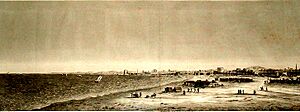
There are 894 plates (pictures) in the ten volumes of plates. These were made from over 3000 original drawings. Many of these plates are in the "Natural History" volumes. Some plates have more than 100 small pictures of plants or animals on them. 38 of the plates were colored by hand. Some versions of the book might have a few more plates.
Exploring the Plates
The amazing illustrations from the 10 volumes of plates have been republished in different books. You can also see all the illustrations from the first edition online. They are available as galleries on Wikimedia Commons. This lets you explore the detailed drawings and maps from the original work.
- Antiquités, planches, Tome I
- Antiquités, planches, Tome II
- Antiquités, planches, Tome III
- Antiquités, planches, Tome IV
- Antiquités, planches, Tome V
- État moderne. planches, Tome I
- État moderne. planches, Tome II
- Histoire naturelle, planches, Tome I
- Histoire naturelle, planches, Tome II et II bis
- Carte topographique de l’Égypte
How it Changed History
The Description de l'Égypte is often given credit for starting the study of Egyptology. This is the scientific study of ancient Egypt. Some historians say that while it was very important, it wasn't the only work of its kind.
Reports About Damage
There were some incorrect reports that the original manuscript of the Description de l'Égypte was destroyed. This was said to have happened in a fire at the Institut d'Égypte (Egyptian Scientific Institute) in December 2011. This fire occurred during clashes between protestors and the military.
However, the building's collection actually contained a set of the 23-volume first edition. This set was saved and did not suffer lasting damage. Also, Egypt's minister of culture stated that at least two more complete sets of the same original edition were still in Egypt. Most of the original notes and drawings for the Description are kept in Paris, France. They are in the National Archives and National Library there.
Different Editions
There are a few different versions of these editions. This is especially true for the first edition, which sometimes has extra volumes. For example, one copy of the first edition had 29 volumes. A "standard" first edition usually has 23 volumes.
It's also interesting that the dates printed on the title pages are often much earlier than when the books were actually published. For instance, a book from the first edition might say 1809 on its title page. But it was actually published much later, in 1826. The volume with maps was not printed until 1828, even though its title page might say 1818 or 1826.
First Edition (Imperial Edition)
The first edition was published in many volumes. These included books on "Antiquities" (ancient things), "Modern Egypt," and "Natural History" (plants and animals). There were also many volumes of plates (pictures) for each section. Some of these plate volumes were the very large "Mammutfolio" size. The map volume was also in this huge format.
Second Edition (Panckoucke Edition)
The second edition, known as the Panckoucke edition, also had many volumes. It expanded on the text and included new prints of the plates. This edition was generally smaller in size and less expensive to produce. It also covered "Antiquities," "Modern Egypt," and "Natural History," along with an atlas of maps.
See also
- List of most expensive books and manuscripts
- Orientalism
 | Isaac Myers |
 | D. Hamilton Jackson |
 | A. Philip Randolph |


