Deweyville, Texas facts for kids
Quick facts for kids
Deweyville, Texas
|
|
|---|---|

Location of Deweyville, Texas
|
|
 |
|
| Country | United States |
| State | Texas |
| County | Newton |
| Area | |
| • Total | 11.3 sq mi (29.3 km2) |
| • Land | 11.2 sq mi (29.1 km2) |
| • Water | 0.1 sq mi (0.2 km2) |
| Elevation | 16 ft (5 m) |
| Population
(2020)
|
|
| • Total | 571 |
| • Density | 50.53/sq mi (19.49/km2) |
| Time zone | UTC-6 (Central (CST)) |
| • Summer (DST) | UTC-5 (CDT) |
| ZIP code |
77614
|
| Area code(s) | 409 |
| FIPS code | 48-20212 |
| GNIS feature ID | 2408667 |
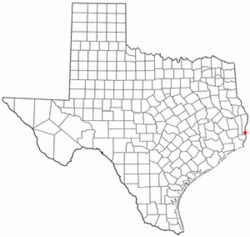
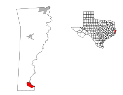
Deweyville is a small community in Newton County, Texas. It's located near the eastern border of Texas. In 2020, about 571 people lived there. This number was lower than in 2010, when 1,023 people called Deweyville home. It is called a census-designated place (CDP), which means it's an area identified by the U.S. Census Bureau for statistics, but it's not an officially incorporated town or city.
Contents
History of Deweyville
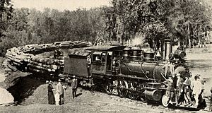
Deweyville started in 1898 as a place where a company called Sabine Tram Company cut down trees and processed them into wood. This kind of place is called a sawmill. The town was named after George Dewey. He was a famous admiral in the United States Navy. Admiral Dewey won an important battle called the Battle of Manila Bay during the Spanish–American War in 1898.
Just two years after it was founded, Deweyville got its own post office. For a short time, it was the biggest town in Newton County. In the 1920s, electricity was brought to the homes in Deweyville.
Before it was called Deweyville, the area was known as "Possum Bluff." A man named Pierre Lavine bought it in 1886. There's a special sign, called a Texas Historical Marker, that tells this story. It was first put up on Highway 12 in 1967. Later, it was moved to the front of the Deweyville Public Library.
Geography and Climate
Deweyville covers an area of about 11.3 square miles (29.3 square kilometers). Most of this area is land, with a small part being water. The community is located right next to the Sabine River. This river forms part of the border between Texas and Louisiana.
Weather in Deweyville
The weather in Deweyville is usually hot and humid during the summer. Winters are generally mild, meaning they are not too cold. This type of weather is known as a humid subtropical climate. On climate maps, you might see it labeled as "Cfa."
Population Information
| Historical population | |||
|---|---|---|---|
| Census | Pop. | %± | |
| 2020 | 571 | — | |
| U.S. Decennial Census 1850–1900 1910 1920 1930 1940 1950 1960 1970 1980 1990 2000 2010 |
|||
Deweyville was first counted as a census-designated place (CDP) in the 1980 U.S. Census. This means the U.S. government started collecting specific population data for it then.
2020 Census Details
In 2020, the population of Deweyville was 571 people. Most of the people living there were White, making up about 91.59% of the population. There were also smaller groups of Black or African American people, Native American people, Asian people, and people of mixed races. About 2.63% of the population was Hispanic or Latino.
2016 Flooding Event
In March 2016, Deweyville and the areas around it experienced severe flooding. Over 5,000 homes were flooded. This also affected parts of Louisiana along the Sabine River. The flooding happened because of very heavy rainfall. Also, water was released from the Toledo Bend Reservoir, which is a large lake upstream.
See also
 In Spanish: Deweyville (Texas) para niños
 | Ernest Everett Just |
 | Mary Jackson |
 | Emmett Chappelle |
 | Marie Maynard Daly |


