Toledo Bend Reservoir facts for kids
Quick facts for kids Toledo Bend Reservoir |
|
|---|---|
| Location | Texas / Louisiana |
| Coordinates | 31°11′47″N 93°34′20″W / 31.1965°N 93.5721°W |
| Lake type | reservoir |
| Primary inflows | Sabine River |
| Primary outflows | Sabine River |
| Basin countries | United States |
| Max. length | 65 mi (105 km) |
| Max. width | 10 mi (16 km) |
| Surface area | 186,000 acres (75,000 ha) |
| Average depth | 24 ft (7 m) |
| Max. depth | 110 ft (34 m) |
| Water volume | 4,477,000 acre⋅ft (5.52 km3) |
| Shore length1 | 1,264 mi (2,030 km) |
| Surface elevation | 170 ft (52 m) |
| 1 Shore length is not a well-defined measure. | |
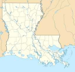
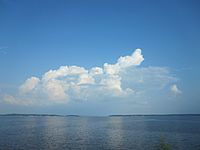
The Toledo Bend Reservoir is a huge man-made lake. It sits on the Sabine River, right between the states of Texas and Louisiana. This lake is truly massive! It covers about 185,000 acres (750 km2) of land. This makes it the largest man-made lake partly in both Louisiana and Texas. It is also the biggest in the southern United States. In fact, it's the fifth largest lake by surface area in the whole country.
The dam at Toledo Bend is very powerful. It can create 92 megawatts of electricity. This is enough to power many homes! Most of the lake stretches north into several counties and parishes. These include Sabine, Shelby, and Panola counties in Texas. In Louisiana, it reaches into Sabine and DeSoto parishes.
Contents
Building the Lake: A Big Project
The area around the Sabine River used to flood often. This caused a lot of damage. People also needed water for cities, farms, and fun activities. So, in 1949, Texas created the Sabine River Authority of Texas (SRA-T). Louisiana then formed its own Sabine River Authority (SRA-L) in 1950.
Working Together for Water
These two groups, one from Texas and one from Louisiana, decided to work together. They signed an agreement called the Sabine River Compact. Both states and the U.S. government approved this plan. The main goal was to create a fresh water supply. They also wanted to make electricity and provide places for recreation.
In 1955, they started studying how to build the lake. By 1959, both states agreed to spend 30 million dollars on the project. They bought the land in 1963. Construction began the very next year. The Massman-Johnson Construction Company was the main builder. The project was finished in 1969. Texas spent about $70 million on its part. It's important to know that the states built this dam all by themselves. They did not get any money from the federal government.
Timeline of Construction
Work on the Toledo Bend Reservoir began in May 1963. This is when they started buying the land. The actual building of the dam, spillway, and power plant started on May 11, 1964. The dam began holding water in October 1966. The power plant was ready and started making electricity in early 1969. The main reasons for building Toledo Bend were to supply water, make electricity, and offer fun activities.
Toledo Bend Reservoir acts as a border between Texas and Louisiana. From the dam, the lake goes up the river for about 65 miles (105 km). It reaches all the way to Logansport, Louisiana. The lake covers land in several areas. These include Sabine, Shelby, Panola, and Newton Counties in Texas. It also covers parts of Sabine and DeSoto Parishes in Louisiana.
Communities Affected by the Lake
When the lake was built, some communities were covered by water. These included homes, schools, and churches. For example, in Sabine Parish, communities like Pine Flat, Barlake, Richard Neck, and Kites Landing were flooded. The lake normally covers about 186,000 acres (750 km2). It can hold a huge amount of water, about 4,477,000 acre-feet (5.52 km3).
Fun Activities at Toledo Bend
Toledo Bend is a great place for outdoor fun! It has over 1,200 miles (1,900 km) of shoreline. This means there's lots of space for activities. You can go swimming, boating, and picnicking. Fishing, camping, hunting, and sightseeing are also very popular. Many fishing clubs even hold tournaments here.
Boating and Safety Tips
The lake has many trees and stumps under the water. Because of this, it's best for smaller, shallow boats. There are special boat lanes that have been cleared. But even on these lanes, you should be careful. Always watch out for stumps, trees, and floating logs, especially if you go off the marked lanes.
Toledo Bend Army Recreation Park
There's a special park on the south end of the lake. It's called the Toledo Bend Army Recreation Park. This park is only for active and retired military members and government workers. It has a store and rents out different types of boats. You can rent pontoon boats, bass boats, kayaks, and canoes. The park also has a beach, cabins, and yurts. The U.S. Army runs this park.
 | Jewel Prestage |
 | Ella Baker |
 | Fannie Lou Hamer |


