Dixie, Idaho County, Idaho facts for kids
Quick facts for kids
Dixie, Idaho
|
|
|---|---|
| Country | United States |
| State | Idaho |
| County | Idaho |
| Elevation | 5,620 ft (1,710 m) |
| Time zone | UTC-8 (Pacific (PST)) |
| • Summer (DST) | UTC-7 (PDT) |
| Area code(s) | 208, 986 |
| GNIS feature ID | 1802953 |
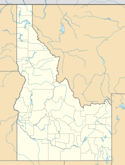
Dixie is a small, unincorporated community in Idaho County, Idaho, United States. It is located about 43 miles (69 km) east-northeast of Riggins.
Long ago, Dixie was an important gateway to the Thunder Mountain Mines in Idaho. It was the northern end of the Three Blaze Trail. This trail was a shortcut to the mines. It passed through places like Campbell's Ferry and what is now the Frank Church-River of No Return Wilderness. The trail then continued south to the mining town of Roosevelt.
Contents
A Look Back at Dixie's Past
Dixie has always been a small community. In 1909, about 292 people lived there. By 1960, the population had become much smaller, with only 25 residents.
Dixie's Weather and Climate
Dixie experiences a type of weather called a dry summer continental subarctic climate. This means it has cold, snowy winters and mild, dry summers. It's a climate often found in areas with high elevations and far from large bodies of water.
| Climate data for Dixie N, Idaho, 1991–2020 normals, 2008-2023 extremes: 5740ft (1750m) | |||||||||||||
|---|---|---|---|---|---|---|---|---|---|---|---|---|---|
| Month | Jan | Feb | Mar | Apr | May | Jun | Jul | Aug | Sep | Oct | Nov | Dec | Year |
| Record high °F (°C) | 47 (8) |
53 (12) |
64 (18) |
70 (21) |
83 (28) |
94 (34) |
93 (34) |
93 (34) |
89 (32) |
88 (31) |
74 (23) |
48 (9) |
94 (34) |
| Mean maximum °F (°C) | 40.5 (4.7) |
46.1 (7.8) |
52.4 (11.3) |
63.2 (17.3) |
73.4 (23.0) |
83.8 (28.8) |
88.0 (31.1) |
87.6 (30.9) |
82.3 (27.9) |
70.9 (21.6) |
55.2 (12.9) |
40.5 (4.7) |
89.4 (31.9) |
| Mean daily maximum °F (°C) | 30.7 (−0.7) |
33.0 (0.6) |
38.4 (3.6) |
45.5 (7.5) |
56.7 (13.7) |
64.5 (18.1) |
75.9 (24.4) |
75.6 (24.2) |
65.3 (18.5) |
52.1 (11.2) |
35.8 (2.1) |
27.7 (−2.4) |
50.1 (10.1) |
| Daily mean °F (°C) | 17.8 (−7.9) |
20.4 (−6.4) |
25.5 (−3.6) |
32.9 (0.5) |
42.6 (5.9) |
49.5 (9.7) |
57.3 (14.1) |
56.0 (13.3) |
48.2 (9.0) |
37.9 (3.3) |
24.8 (−4.0) |
16.6 (−8.6) |
35.8 (2.1) |
| Mean daily minimum °F (°C) | 4.9 (−15.1) |
7.8 (−13.4) |
12.7 (−10.7) |
20.4 (−6.4) |
28.5 (−1.9) |
34.5 (1.4) |
38.6 (3.7) |
36.3 (2.4) |
31.1 (−0.5) |
23.7 (−4.6) |
13.8 (−10.1) |
5.5 (−14.7) |
21.5 (−5.8) |
| Mean minimum °F (°C) | −16.7 (−27.1) |
−16.5 (−26.9) |
−8.3 (−22.4) |
2.1 (−16.6) |
17.9 (−7.8) |
26.4 (−3.1) |
30.0 (−1.1) |
28.8 (−1.8) |
21.8 (−5.7) |
8.8 (−12.9) |
−4.8 (−20.4) |
−17.0 (−27.2) |
−21.3 (−29.6) |
| Record low °F (°C) | −31 (−35) |
−32 (−36) |
−29 (−34) |
−13 (−25) |
8 (−13) |
23 (−5) |
27 (−3) |
24 (−4) |
16 (−9) |
−14 (−26) |
−25 (−32) |
−25 (−32) |
−32 (−36) |
| Average precipitation inches (mm) | 3.80 (97) |
3.58 (91) |
3.05 (77) |
3.25 (83) |
3.10 (79) |
2.79 (71) |
1.15 (29) |
0.88 (22) |
1.40 (36) |
2.27 (58) |
3.57 (91) |
4.79 (122) |
33.63 (856) |
| Average snowfall inches (cm) | 42.6 (108) |
37.1 (94) |
30.6 (78) |
15.0 (38) |
2.4 (6.1) |
0.6 (1.5) |
0.0 (0.0) |
0.0 (0.0) |
0.6 (1.5) |
8.3 (21) |
24.0 (61) |
43.2 (110) |
204.4 (519.1) |
| Average extreme snow depth inches (cm) | 46.7 (119) |
55.1 (140) |
52.8 (134) |
41.3 (105) |
18.8 (48) |
0.8 (2.0) |
0.0 (0.0) |
0.0 (0.0) |
0.3 (0.76) |
5.1 (13) |
12.9 (33) |
31.7 (81) |
59.1 (150) |
| Source 1: NOAA | |||||||||||||
| Source 2: XMACIS2 (records, monthly max/mins, 2009-2023 snowfall/depth) | |||||||||||||
Getting Around Dixie
Local Airports
There are a couple of small public airports located close to Dixie:
- Dixie USFS Airport (A05)
- Wilson Bar USFS Airport (C48)
 | Anna J. Cooper |
 | Mary McLeod Bethune |
 | Lillie Mae Bradford |


