Riggins, Idaho facts for kids
Quick facts for kids
Riggins, Idaho
|
|
|---|---|
| Motto(s):
"Idaho's Whitewater Capital"
|
|

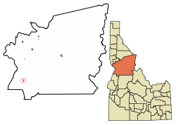
Location of Riggins in Idaho County, Idaho.
|
|
| Country | United States |
| State | Idaho |
| County | Idaho |
| Area | |
| • Total | 0.45 sq mi (1.15 km2) |
| • Land | 0.40 sq mi (1.03 km2) |
| • Water | 0.05 sq mi (0.12 km2) |
| Elevation | 1,837 ft (560 m) |
| Population
(2010)
|
|
| • Total | 419 |
| • Density | 1,045.23/sq mi (403.92/km2) |
| Time zone | UTC-7 (Mountain) |
| • Summer (DST) | UTC-6 (Mountain) |
| ZIP code |
83549
|
| Area code(s) | 208 |
| FIPS code | 16-67870 |
| GNIS feature ID | 2410949 |
Riggins is a small city in the western United States, located in Idaho County, Idaho. It's known as "Idaho's Whitewater Capital" because it sits in a deep canyon. The city is where the Salmon River and Little Salmon River meet.
Riggins is about 150 miles (240 km) north of Boise. It's also about 120 miles (190 km) south-southeast of Lewiston. The city is 1,821 feet (555 meters) above sea level. In 2010, 419 people lived there.
U.S. Route 95 is the main highway that goes through Riggins. It connects the northern part of Idaho (the Idaho Panhandle) to the south. Riggins is the most northwestern town in the Mountain Time Zone. Just north of the city, across the Salmon River, the Pacific Time Zone begins.
Contents
History of Riggins
Riggins got its name from Richard L. Riggins. He was a local businessman and the postmaster (the person in charge of the post office). His father, Fred Riggins, used to deliver mail to the area for many years.
There used to be a sawmill in Riggins. A sawmill is a factory that cuts logs into lumber. This sawmill operated until 1982, when it was destroyed by an explosion and fire.
Geography and Location
Riggins is located in a unique spot in Idaho. The city is surrounded by beautiful natural areas.
Land and Water Area
The United States Census Bureau says that Riggins covers a total area of 0.45 square miles (1.15 square kilometers). Most of this area, about 0.43 square miles (1.11 square kilometers), is land. The rest, about 0.02 square miles (0.05 square kilometers), is water.
Riggins Climate
Riggins has a special kind of weather for its region. It has a humid subtropical climate, which means it usually has hot, humid summers and mild winters. However, because its winters can be quite cold, it's almost like a dry, hot summer humid continental climate.
| Climate data for Riggins (1896-2012) | |||||||||||||
|---|---|---|---|---|---|---|---|---|---|---|---|---|---|
| Month | Jan | Feb | Mar | Apr | May | Jun | Jul | Aug | Sep | Oct | Nov | Dec | Year |
| Record high °F (°C) | 64 (18) |
72 (22) |
83 (28) |
95 (35) |
103 (39) |
108 (42) |
113 (45) |
115 (46) |
110 (43) |
95 (35) |
80 (27) |
69 (21) |
115 (46) |
| Mean daily maximum °F (°C) | 41.8 (5.4) |
48.9 (9.4) |
56.5 (13.6) |
65.3 (18.5) |
73.4 (23.0) |
80.8 (27.1) |
92.2 (33.4) |
91.7 (33.2) |
80.9 (27.2) |
66.9 (19.4) |
51.2 (10.7) |
42.5 (5.8) |
66 (19) |
| Mean daily minimum °F (°C) | 27.8 (−2.3) |
30.6 (−0.8) |
34.2 (1.2) |
39.1 (3.9) |
45.3 (7.4) |
51.5 (10.8) |
57.5 (14.2) |
56.9 (13.8) |
49.6 (9.8) |
41.1 (5.1) |
34.3 (1.3) |
29.1 (−1.6) |
41.4 (5.2) |
| Record low °F (°C) | −10 (−23) |
−12 (−24) |
3 (−16) |
18 (−8) |
25 (−4) |
22 (−6) |
36 (2) |
36 (2) |
20 (−7) |
16 (−9) |
−13 (−25) |
−8 (−22) |
−13 (−25) |
| Average precipitation inches (mm) | 1.12 (28) |
1.13 (29) |
1.61 (41) |
1.68 (43) |
2.12 (54) |
1.83 (46) |
0.72 (18) |
0.74 (19) |
1.07 (27) |
1.29 (33) |
1.39 (35) |
1.33 (34) |
16.04 (407) |
| Average snowfall inches (cm) | 2.8 (7.1) |
1.6 (4.1) |
0.7 (1.8) |
0.1 (0.25) |
0 (0) |
0 (0) |
0 (0) |
0 (0) |
0 (0) |
0 (0) |
0.4 (1.0) |
2.2 (5.6) |
7.9 (20) |
| Average precipitation days | 8 | 8 | 10 | 10 | 10 | 9 | 4 | 4 | 5 | 7 | 9 | 9 | 93 |
| Source: WRCC | |||||||||||||
People of Riggins
This section shares information about the people who live in Riggins.
| Historical population | |||
|---|---|---|---|
| Census | Pop. | %± | |
| 1910 | 60 | — | |
| 1920 | 60 | 0.0% | |
| 1930 | 66 | 10.0% | |
| 1940 | 150 | 127.3% | |
| 1950 | 287 | 91.3% | |
| 1960 | 588 | 104.9% | |
| 1970 | 533 | −9.4% | |
| 1980 | 527 | −1.1% | |
| 1990 | 443 | −15.9% | |
| 2000 | 410 | −7.4% | |
| 2010 | 419 | 2.2% | |
| 2019 (est.) | 416 | −0.7% | |
| U.S. Decennial Census | |||
2010 Census Information
In 2010, a census (a count of the population) was taken. It showed that 419 people lived in Riggins. These people lived in 239 households, and 116 of these were families.
The city had about 974 people per square mile (376 people per square kilometer). Most residents (96.9%) were White. A small number were Native American (0.7%) or from other backgrounds. About 1.7% of the population was Hispanic or Latino.
- About 13.8% of households had children under 18.
- 34.3% were married couples.
- The average household had 1.75 people.
- The average family had 2.33 people.
The average age in Riggins was 53.3 years old.
- 12.6% of people were under 18.
- 29.1% were 65 years or older.
- The population was almost evenly split between males (51.1%) and females (48.9%).
Fun Things to Do in Riggins
Riggins offers many exciting activities and events.
Arts and Culture Events
The Riggins Rodeo is a popular event held in early May. You can watch it from grandstands or from a hillside. Riggins also hosts "Hot Summer Nights," a two-day music festival and talent show.
Outdoor Adventures
Riggins is a great place for outdoor fun in North Central Idaho.
- You can go rafting or kayaking on the rivers.
- Fishing and hunting are also popular activities.
- Many campgrounds are nearby, perfect for enjoying nature and seeing wildlife.
- Visitors can even pan for gold in the river gravel. Guides are available to help with these activities.
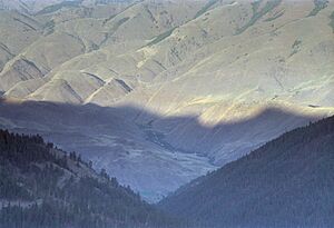
The Seven Devils Mountains and the Hells Canyon National Recreation Area are close to Riggins. The Frank Church–River of No Return Wilderness is also nearby, to the east along the Salmon River. These areas offer amazing scenery and chances to explore the wilderness.
Famous People from Riggins
Some well-known people have connections to Riggins:
- Dan Cummins, a comedian.
- Leighton Vander Esch, an NFL linebacker who plays for the Dallas Cowboys.
- Paul Shepherd, a politician who was a member of the Idaho House of Representatives.
See also
 In Spanish: Riggins (Idaho) para niños
 | William Lucy |
 | Charles Hayes |
 | Cleveland Robinson |


