Little Salmon River facts for kids
Quick facts for kids Little Salmon River |
|
|---|---|

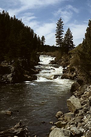
A waterfall on the Little Salmon River
|
|
|
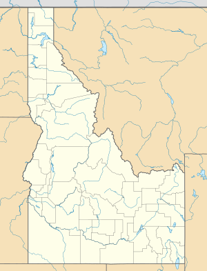
Location of the mouth of the Little Salmon River in Idaho
|
|
| Country | United States |
| State | Idaho |
| Region | Idaho County, Adams County |
| City | New Meadows |
| Physical characteristics | |
| Main source | Blue Bunch Ridge Sawtooth Range, Adams County 6,280 ft (1,910 m) 44°50′28″N 116°15′46″W / 44.84111°N 116.26278°W |
| River mouth | Salmon River Riggins, Idaho County 1,716 ft (523 m) 45°25′00″N 116°18′53″W / 45.41667°N 116.31472°W |
| Length | 51 mi (82 km), South-North |
| Depth |
|
| Basin features | |
| River system | Salmon River |
| Basin size | 576 sq mi (1,490 km2) |
| Tributaries |
|
The Little Salmon River is a river in Idaho, United States. It's a smaller river that flows into the bigger Salmon River. The Little Salmon River is about 51 miles (82 km) long. It drains water from an area of about 576 square miles (1,490 km²).
River's Journey
The Little Salmon River starts high up on Blue Bunch Ridge. This is in the Sawtooth Mountains in south-central Idaho. It begins at an elevation of about 6,280 feet (1,910 m). This is close to Payette Lake.
From its source, the river flows north. It passes through a wide valley called Meadows Valley. Here, it goes by the towns of Meadows and New Meadows. Along the way, it gets water from smaller streams. These include Goose Creek and Mud Creek.
After the valley, the river enters a deep canyon. It cuts through the western part of the Salmon River Mountains. The river forms the border between Idaho County and Adams County. It also runs right next to U.S. Highway 95. More streams join it in the canyon. These are Hazard Creek, Payette Creek, Boulder Creek, the Rapid River, and Squaw Creek. Finally, the Little Salmon River joins the main Salmon River. This happens near the town of Riggins. At this point, the river is about 1,720 feet (520 m) above sea level.
How Much Water Flows?
The amount of water flowing in a river is called its "discharge." The U.S. Geological Survey (USGS) measures this. They have a station at the mouth of the Little Salmon River.
From 1952 until now, the river's average flow has been about 731 cubic feet per second (20.7 m³/s). This is like filling about 20 large bathtubs every second! The highest flow ever recorded was on June 17, 1974. On that day, the river flowed at 12,600 cubic feet per second (357 m³/s). That's a huge amount of water!
Land and How It's Used
The Little Salmon River area was formed by a "rift valley." This is a place where the Earth's crust has pulled apart. The rocks under much of the area are from old volcanoes. These are called basalt. The whole area has many "fault-blocks." These are large blocks of Earth's crust that have moved up or down.
The upper part of the river valley is wide and flat. It has rich soil. People use this area mainly for farming and ranching. Most of the people who live in the river's basin live here. The rest of the river flows through a wild, deep, and narrow canyon. This part is mostly undeveloped. Only the highway runs through it.
In the past, people used to cut down trees here (logging). Today, tourism and fishing are becoming more popular. It's interesting that this river starts in a developed, flat area. Then it flows through mountains further downstream. This is a bit unusual for rivers.
River's Past
Long ago, Native American tribes lived along the Little Salmon River. These included the Nez Perce, Shoshone, and Bannock tribes. They depended on the river for salmon fish. They also used the land for hunting animals and finding natural resources. These resources helped them trade with other tribes.
Europeans brought horses to the Bannock tribe. The Bannock then shared horses with the Shoshones. This allowed them to travel further. They could hunt buffalo and other big animals. Settlers started arriving in the 1850s. They built farms, ranches, and towns. For a long time, it was hard to communicate with the outside world. This changed when roads and railroads were built in the early 1900s. Even so, the area has remained quite isolated.
Parts of the Little Salmon River area are within the Payette National Forest and Nez Perce National Forest. However, the river itself does not flow through these protected federal lands. The river flows freely, meaning there are no dams or dikes on it.
Most of the area gets about 20 to 25 inches (510 to 640 mm) of rain each year. Higher up in the mountains, rainfall can be much more. About half of the river is home to salmon. But at a place called Little Salmon Falls, these "anadromous fish" (fish that swim upriver from the ocean to lay eggs) cannot go any further. This barrier might have been different in the past. Native Americans used to fish much further upriver from the falls.
Besides salmon, other fish live here too. These include steelhead, Pacific lamprey, different kinds of trout, and dace. Along the river banks, you can find trees like cottonwood, willow, dogwood, and alder.
Water Use
Today, the main way people use water from the Little Salmon River is for irrigation. This means using water to help crops grow. There are farms all along the river that use irrigation. Most of these farms are in the Meadows Valley. Also, the area around Round Valley Creek, a major stream that flows into the Little Salmon, uses a lot of water for irrigation.
About 18,500 acres (75 km²) of farmland in the Meadows Valley and Round Valley Creek area are irrigated. Another 700 acres (2.8 km²) are irrigated closer to the river's mouth. The Little Salmon River itself doesn't have any dams. But there are three dams on Goose Creek. Goose Creek is a big stream that feeds into the Little Salmon River. These dams help control the water flow for irrigation. In total, about 74,800 acre-feet (92,300,000 m³) of water are used for irrigation each year.
 | Lonnie Johnson |
 | Granville Woods |
 | Lewis Howard Latimer |
 | James West |


