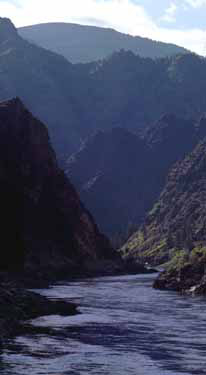
Salmon River Mountains facts for kids
Quick facts for kids Salmon River Mountains |
|
|---|---|
 |
|
| Highest point | |
| Peak | White Mountain (Idaho) |
| Elevation | 10,442 ft (3,183 m) |
| Dimensions | |
| Length | 106 mi (171 km) North-south |
| Width | 122 mi (196 km) East-west |
| Area | 8,900 sq mi (23,000 km2) |
| Geography | |
| Country | United States |
| State | Idaho |
The Salmon River Mountains are a big mountain range located in the middle of Idaho, a state in the United States. These mountains stretch for more than 120 miles (190 km) (about 193 km). Their edges are mostly marked by the Salmon River and its many smaller rivers that flow into it.
These mountains are part of the central Rocky Mountains. All the water from the Salmon River Mountains flows west towards the Snake River. The highest point in this range is White Mountain, which stands at 10,442 feet (3,183 m) (about 3,183 meters) above sea level. There are five peaks that are taller than 10,000 feet (3,000 m) (about 3,048 meters).
Contents
What are the Salmon River Mountains?
The Salmon River Mountains form a large, block-shaped area in central Idaho. The western edge of these mountains follows the Little Salmon River. The main part of the Salmon River marks the northern and eastern edges.
This mountain area is about 102 miles (164 km) (164 km) from north to south. It is also about 122 miles (196 km) (196 km) from east to west. In total, it covers almost 8,900 square miles (23,000 km2) (23,051 square kilometers).
Parts of the Mountain Range
The Salmon River Mountains are divided into three main parts. These parts are named after different branches of the Salmon River:
- The West Salmon River Mountains are found between the Little Salmon River and the South Fork of the Salmon River.
- The Central Salmon River Mountains are located between the South Fork and the Middle Fork of the Salmon River.
- The East Salmon River Mountains are the mountains found east of the Middle Fork of the Salmon River.
Even though the northwestern part of the range is only about 30 miles (48 km) (48 km) southeast of the city of Lewiston, the Salmon River Mountains are known for being one of the most remote places in the contiguous United States. This means they are far away from many people and towns.
Neighboring Mountain Areas
The southeastern part of the Salmon River Mountains borders other mountain ranges. These include the White Knob Mountains, the Pioneer Mountains, and the Bould Mountains. It also borders the areas around Marsh Creek, Valley Creek, and Warm Spring Creek.
The southwestern edges of the Salmon River Mountains are formed by branches of the Payette River. The Payette River also flows into the Snake River.
Mountain Heights
The mountains in the Salmon River range generally get taller as you move from west to east. They slope upwards towards the Continental Divide of the Americas. The highest peak is West White Mountain, which is in the eastern part of the range. It reaches 10,442 feet (3,183 m) (3,183 meters) high.
All ten of the highest peaks in the Salmon River Mountains are located in the eastern section. In the central part of the mountains, the highest peak is Big Baldy, standing at 9,705 feet (2,958 m) (2,958 meters). The tallest mountain in the western part of the range is North Loon Mountain, which is 9,322 feet (2,841 m) (2,841 meters) high.
 | Kyle Baker |
 | Joseph Yoakum |
 | Laura Wheeler Waring |
 | Henry Ossawa Tanner |

