Sawtooth Range (Idaho) facts for kids
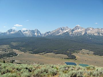
The Sawtooth Range is a group of mountains in central Idaho, United States. It's part of the larger Rocky Mountains. The highest point is Thompson Peak, which stands at 10,751 feet (3,277 m) tall. These mountains cover about 678 square miles (1,756 km2) and stretch across several counties. To the east, you'll find the Sawtooth Valley. A big part of the Sawtooth Range is protected within the Sawtooth Wilderness, which is part of the Sawtooth National Recreation Area and Sawtooth National Forest. The mountains got their name because their peaks look like the teeth of a saw!
Quick facts for kids Sawtooth Range |
|
|---|---|
 |
|
| Highest point | |
| Peak | Thompson Peak |
| Elevation | 10,756 ft (3,278 m) NAVD 88 |
| Dimensions | |
| Length | 43 mi (69 km) N/S |
| Width | 25 mi (40 km) E/W |
| Area | 678 sq mi (1,760 km2) |
| Geography | |
| Country | United States |
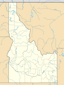
| State | Idaho |
| Counties | Custer, Boise, Blaine and Elmore |
| Range coordinates | 43°57′12″N 114°59′26″W / 43.95333°N 114.99056°W |
| Parent range | Rocky Mountains |
| Borders on | Sawtooth Valley |
Contents
Mountain Peaks
The Sawtooth Range has many tall mountains. There are 57 peaks that are over 10,000 feet (3,000 m) high. The very highest is Thompson Peak, reaching 10,751 feet (3,277 m).
Another 77 peaks in the range are between 9,000 and 10,000 feet (2,700 and 3,000 m) tall. Some climbs are easy, like Observation Peak, which is a simple hike. Others are very difficult rock climbs, like King Spire.
How the Mountains Formed
The northern part of the Sawtooth Range was created from a huge block of rock called the Sawtooth batholith. This happened a very long time ago, during the Eocene period. Further south, the mountains formed from another type of rock called granodiorite.
These mountains were once covered by huge sheets of ice called glaciers. Even though there are no big glaciers left today, you can still find patches of snow that stay all year. There are also "rock glaciers," which are slow-moving rivers of rock and ice. Scientists have found 202 of these permanent snow and ice patches.
The last time glaciers covered a large area here was during the Ice Age. Smaller glaciers probably existed more recently, around the year 1850. You can still see signs of these old glaciers, like beautiful glacial lakes, piles of rock called moraines, sharp peaks, and U-shaped valleys.
Earthquakes in the Area
In 2010, scientists found a large crack in the Earth's crust called the Sawtooth Fault. It runs for about 40 mi (64 km) near the towns of Stanley and Redfish Lake. The last time this fault was very active was thousands of years ago.
However, experts believe it could still cause a strong earthquake, possibly as big as a 7.5 magnitude. An earthquake that strong could be felt far away, even in Boise, which is about 132.7 miles (213.5 km) away.
Lakes and Rivers
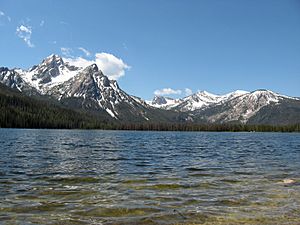
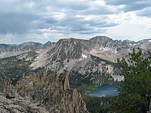
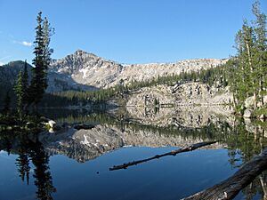
The Sawtooth Range is famous for its many lakes. There are hundreds of them, all created by the ancient glaciers that melted away. Nearly 400 lakes are found just within the protected Sawtooth Wilderness area.
Some of the biggest lakes are just outside the wilderness. These include Redfish, Alturas, Pettit, Yellow Belly, and Stanley. One of the largest, Sawtooth Lake, is inside the wilderness.
Most of the water on the east side of the mountains flows into the Salmon River. On the west side, water flows into the South Fork Payette River. Smaller parts of the range drain into the Middle Fork Salmon River and the Boise River.
Fun Activities
The Sawtooth Wilderness has about 350 miles (560 km) of trails. These trails are great for day hiking, backpacking (camping overnight), and horseback riding. You can reach these trails from 23 different starting points. There are even more trails in the lower parts of the mountains, outside the wilderness.
You can camp almost anywhere in the wilderness. There are also special campgrounds with facilities on the western side of the range. These are located near lakes like Redfish, Little Redfish, Alturas, Pettit, and Stanley, and also at Iron Creek. Remember to check for rules about campfires and pets in certain areas.
See also
- Sawtooth National Recreation Area
- Lakes of the Sawtooth Mountains (Idaho)
- Sawtooth National Forest
- List of mountain ranges in Idaho
- List of mountains of Idaho
- List of mountain peaks of Idaho
 | Jessica Watkins |
 | Robert Henry Lawrence Jr. |
 | Mae Jemison |
 | Sian Proctor |
 | Guion Bluford |


