Douillet facts for kids
Quick facts for kids
Douillet
|
|
|---|---|
 |
|
| Country | France |
| Region | Pays de la Loire |
| Department | Sarthe |
| Arrondissement | Mamers |
| Canton | Sillé-le-Guillaume |
| Intercommunality | Haute Sarthe Alpes Mancelles |
| Area
1
|
18.99 km2 (7.33 sq mi) |
| Population
(Jan. 2019)
|
322 |
| • Density | 16.956/km2 (43.92/sq mi) |
| Time zone | UTC+01:00 (CET) |
| • Summer (DST) | UTC+02:00 (CEST) |
| INSEE/Postal code |
72121 /72590
|
| Elevation | 72–164 m (236–538 ft) (avg. 110 m or 360 ft) |
| 1 French Land Register data, which excludes lakes, ponds, glaciers > 1 km2 (0.386 sq mi or 247 acres) and river estuaries. | |
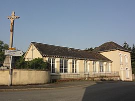
Douillet is a small town, also known as a commune, located in the western part of France. It is found in the Pays de la Loire region, which is like a large state or province. Within this region, Douillet is part of the Sarthe department.
Contents
Where is Douillet Located?
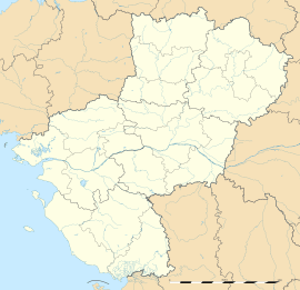
Douillet is in the Sarthe department. This area is known for its green landscapes and quiet villages. The commune is situated in the northwest of France.
What is a Commune?
In France, a commune is the smallest unit of local government. It is similar to a city or a town. Each commune has its own mayor and local council. They manage local services for the people living there.
How Many People Live in Douillet?
As of January 2019, about 322 people lived in Douillet. This makes it a very small and peaceful community. The area of the commune is about 18.99 square kilometers.
Who is the Mayor of Douillet?
The mayor of Douillet is Louis d'Angleville. He was elected to lead the commune from 2008 to 2014. The mayor is responsible for running the local government. They make decisions about things like local roads and public services.
What is the Elevation of Douillet?
The land in Douillet varies in height. The lowest point is 72 meters above sea level. The highest point reaches 164 meters. The average elevation of the commune is around 110 meters.
See also
 In Spanish: Douillet para niños
 | Kyle Baker |
 | Joseph Yoakum |
 | Laura Wheeler Waring |
 | Henry Ossawa Tanner |


