Downey, Iowa facts for kids
Quick facts for kids
Downey, Iowa
|
|
|---|---|

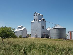
Grain bins along the Iowa Interstate railroad tracks in Downey
|
|
| Country | United States |
| State | Iowa |
| County | Cedar |
| Township | Springdale |
| Area | |
| • Total | 0.68 sq mi (1.75 km2) |
| • Land | 0.68 sq mi (1.75 km2) |
| • Water | 0.00 sq mi (0.00 km2) |
| Elevation | 689 ft (210 m) |
| Population
(2020)
|
|
| • Total | 112 |
| • Density | 165.93/sq mi (64.04/km2) |
| Time zone | UTC-6 (Central (CST)) |
| • Summer (DST) | UTC-5 (CDT) |
| ZIP code |
52358
|
| Area code(s) | 319 |
| GNIS feature ID | 455974 |
Downey is a small, unincorporated community located in Cedar County, Iowa, United States. Being "unincorporated" means it's not an official city or town with its own local government. Instead, it's part of the larger county area.
The Story of Downey
Downey was started a long time ago, in 1856. This was just one spring after a big train track, the Chicago, Rock Island and Pacific Railroad, was built right through the area. People had actually started living here even earlier, in 1836. Downey got its name from the person who founded it, a man named Hugh D. Downey.
Over the years, the number of people living in Downey changed a bit. In 1902, about 100 people lived there. By 1925, the population grew slightly to 105. In 1940, there were 111 residents.
How Many People Live Here?
Knowing the "demographics" of a place means understanding its population. According to the 2020 United States Census, 112 people lived in Downey.
| Historical population | |||
|---|---|---|---|
| Census | Pop. | %± | |
| 2020 | 112 | — | |
| U.S. Decennial Census | |||
 | Janet Taylor Pickett |
 | Synthia Saint James |
 | Howardena Pindell |
 | Faith Ringgold |


