Drinnan, Alberta facts for kids
Quick facts for kids
Drinnan
|
|
|---|---|
|
Former village
|
|
| Country | Canada |
| Province | Alberta |
| Planning region | Upper Athabasca |
| Town | Hinton |
| Incorporated (village) | January 1, 1957 |
| Amalgamated | April 1, 1957 |
| Time zone | UTC−7 (MST) |
| • Summer (DST) | UTC−6 (MDT) |
| Forward sortation area |
T7V
|
| Area code(s) | 780 / 587 |
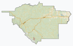
Drinnan was once a small village in western Alberta, Canada. It officially became a village on January 1, 1957. But just three months later, on April 1, 1957, it joined with the nearby town of Hinton.
Today, this area is often called the Hardisty District. You can find it in a valley part of Hinton. It is north of the Canadian National Railway tracks and south of the Athabasca River. The area is about 5 kilometers (3 miles) east of where Hinton first started. The center of the old village was around Athabasca Avenue and Drinnan Way.
How Many People Lived There?
|
|||||||||||||||
Before Drinnan joined Hinton in 1957, a count of people (called a census) was done in 1956. This census showed that 53 people lived in Drinnan. This was more than the 19 people who lived there in 1951.
Black History Month on Kiddle
Famous African-American Athletes:
 | Tommie Smith |
 | Simone Manuel |
 | Shani Davis |
 | Simone Biles |
 | Alice Coachman |

All content from Kiddle encyclopedia articles (including the article images and facts) can be freely used under Attribution-ShareAlike license, unless stated otherwise. Cite this article:
Drinnan, Alberta Facts for Kids. Kiddle Encyclopedia.


