Dry Creek (Haw River tributary) facts for kids
Quick facts for kids Dry Creek |
|
|---|---|
|
Location of Dry Creek mouth
|
|
| Other name(s) | Tributary to Haw River |
| Country | United States |
| State | North Carolina |
| County | Chatham |
| Physical characteristics | |
| Main source | divide between Harlands Creek and Landrum Creek (Rocky River) about 4 miles south-southeast of Silk Hope, North Carolina 630 ft (190 m) 35°44′39″N 079°21′10″W / 35.74417°N 79.35278°W |
| River mouth | Haw River about 2 miles northwest of Bynum, North Carolina 338 ft (103 m) 35°47′44″N 079°10′54″W / 35.79556°N 79.18167°W |
| Length | 12.89 mi (20.74 km) |
| Basin features | |
| Progression | northeast |
| River system | Haw River |
| Basin size | 20.21 square miles (52.3 km2) |
| Tributaries |
|
| Bridges | Harold Hackney Road, Bowers Store Road, Silk Hope Gum Springs Road, Graham Road (NC 87), Old Graham Road |
Dry Creek is a small stream, about 12.89 mi (20.74 km) long, located in Chatham County, North Carolina. It's known as a "tributary," which means it's a smaller stream that flows into a larger river. In this case, Dry Creek flows into the Haw River.
Where Does Dry Creek Start and End?
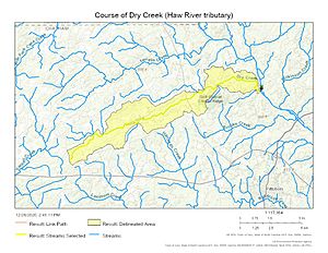
Dry Creek begins its journey about 4 miles (6.4 km) south-southeast of a town called Silk Hope, North Carolina. This is in Chatham County.
From there, the creek flows generally towards the northeast. It continues until it reaches the Haw River. The spot where it joins the Haw River is upstream of Bynum, another town in North Carolina.
What is a Watershed?
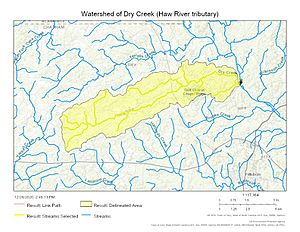
A watershed is like a big bowl or area of land where all the rain and snowmelt drain into a common point, such as a river, lake, or ocean. For Dry Creek, its watershed covers about 20.21 square miles (52.3 km2) (52.3 km²) of land.
This area gets a good amount of rain, about 47.4 inches (120 cm) each year. A large part of the Dry Creek watershed, about 60%, is covered by forests. These forests are important because they help keep the water clean and healthy.
Maps of Dry Creek
Here are some maps that show where Dry Creek is located and the area it drains.
 | Calvin Brent |
 | Walter T. Bailey |
 | Martha Cassell Thompson |
 | Alberta Jeannette Cassell |


