Dryden, Texas facts for kids
Quick facts for kids
Dryden
|
|
|---|---|

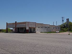
Dryden Post Office
|
|
| Country | United States |
| State | Texas |
| County | Terrell |
| Elevation | 2,110 ft (640 m) |
| Time zone | UTC-6 (Central (CST)) |
| • Summer (DST) | UTC-5 (CDT) |
| ZIP codes |
78851
|
| Area code(s) | 432 |
| GNIS feature ID | 1334709 |
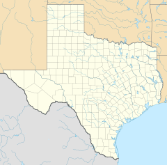
Dryden is a small, quiet place in Terrell County, Texas, in the United States. It's called an unincorporated community, which means it doesn't have its own local government like a city or town.
| Top - 0-9 A B C D E F G H I J K L M N O P Q R S T U V W X Y Z |
History of Dryden
Dryden was started in 1882. It was named after Eugene E. Dryden. He was a main engineer for the Galveston, Harrisburg and San Antonio Railway. This railway built a special house for its workers in Dryden.
Over time, Dryden became a small center for ranching businesses. Ranching means raising animals like cattle or sheep on large farms. The Pecos Land and Cattle Company set up its main office here in 1884. This company dug a well that gave water to the whole area.
By 1912, Dryden had a hotel. It also had a building that was used as a school, a community center, and a church. By 1929, almost 100 people lived in Dryden.
Between 1913 and 1917, during a time of unrest near the Mexican border, two groups of U.S. Army soldiers were stationed in Dryden.
During the Great Depression in the 1930s, things changed for Dryden. The railway closed its station and moved its workers away. The large ranches in the area also started to break up. The number of people living in Dryden began to shrink. By 1970, only about fifty people lived there. The population kept getting smaller, reaching just thirteen people by 1988. However, a general store was still open in 1995.
Dryden used to have a post office that opened in 1888. But now, the United States Postal Service no longer has a post office there.
Recently, a local sheep farmer named Wayne Sutton was chosen as the mayor by the people living in Dryden. He also directs the Dryden Water Supply Company.
The Amtrak train called the Sunset Limited goes through Dryden. It uses the Union Pacific tracks. But the train does not stop in Dryden. The closest stop is about 20 miles west in a town called Sanderson.
Where is Dryden Located?
Dryden is found on U.S. Route 90. This is a major road. It's also where State Highway 349 begins.
Dryden is about 20 miles east of Sanderson. Sanderson is the main town, or county seat, of Terrell County. Dryden is also about 100 miles (162 km) west of Del Rio.
Dryden's Climate
Dryden is about 2,110 feet (643 m) above sea level. The weather in Dryden can be quite warm. Here is some information about the climate:
| Climate data for Dryden, Texas (Jun 1, 1966–Oct 31, 1994) | |||||||||||||
|---|---|---|---|---|---|---|---|---|---|---|---|---|---|
| Month | Jan | Feb | Mar | Apr | May | Jun | Jul | Aug | Sep | Oct | Nov | Dec | Year |
| Record high °F (°C) | 87 (31) |
95 (35) |
98 (37) |
103 (39) |
110 (43) |
112 (44) |
111 (44) |
110 (43) |
106 (41) |
103 (39) |
90 (32) |
87 (31) |
112 (44) |
| Mean daily maximum °F (°C) | 60.2 (15.7) |
65.0 (18.3) |
74.3 (23.5) |
82.7 (28.2) |
88.8 (31.6) |
94.5 (34.7) |
95.5 (35.3) |
94.8 (34.9) |
88.8 (31.6) |
79.9 (26.6) |
69.2 (20.7) |
61.8 (16.6) |
79.6 (26.4) |
| Daily mean °F (°C) | 46.5 (8.1) |
50.5 (10.3) |
59.2 (15.1) |
68.1 (20.1) |
75.2 (24.0) |
81.5 (27.5) |
83.1 (28.4) |
82.1 (27.8) |
76.3 (24.6) |
66.3 (19.1) |
55.3 (12.9) |
47.8 (8.8) |
66.0 (18.9) |
| Mean daily minimum °F (°C) | 32.7 (0.4) |
36.0 (2.2) |
44.0 (6.7) |
53.4 (11.9) |
61.6 (16.4) |
68.6 (20.3) |
70.6 (21.4) |
69.4 (20.8) |
63.8 (17.7) |
52.6 (11.4) |
41.7 (5.4) |
33.8 (1.0) |
52.3 (11.3) |
| Record low °F (°C) | 10 (−12) |
1 (−17) |
12 (−11) |
24 (−4) |
40 (4) |
49 (9) |
60 (16) |
59 (15) |
38 (3) |
27 (−3) |
17 (−8) |
1 (−17) |
1 (−17) |
| Average precipitation inches (mm) | 0.53 (13) |
1.03 (26) |
0.57 (14) |
0.99 (25) |
1.75 (44) |
1.02 (26) |
1.27 (32) |
1.85 (47) |
2.64 (67) |
1.40 (36) |
0.74 (19) |
0.45 (11) |
14.24 (362) |
| Average snowfall inches (cm) | 0.6 (1.5) |
0.2 (0.51) |
0.0 (0.0) |
0.0 (0.0) |
0.0 (0.0) |
0.0 (0.0) |
0.0 (0.0) |
0.0 (0.0) |
0.0 (0.0) |
0.0 (0.0) |
0.1 (0.25) |
0.0 (0.0) |
0.9 (2.3) |
| Average precipitation days (≥ 0.01 in) | 3 | 3 | 2 | 2 | 4 | 3 | 3 | 3 | 5 | 3 | 2 | 2 | 35 |
| Source: Western Regional Climate Center, Desert Research Institute | |||||||||||||
 | George Robert Carruthers |
 | Patricia Bath |
 | Jan Ernst Matzeliger |
 | Alexander Miles |


