Dummy Battery facts for kids
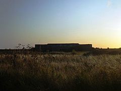
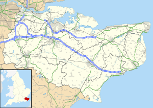
Dummy Battery, first called Grain Battery, is an old military building. It's a fort with big guns, located about 1 kilometer (0.6 miles) south of Grain, Kent. This spot is where the River Thames and River Medway meet.
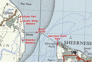
The battery was finished in 1865. It helped protect the area along with two other nearby forts, Grain Fort and Grain Wing Battery. Its guns could shoot across the water, working with Grain Tower and Garrison Point Fort on the Isle of Sheppey. The battery was made of earth and concrete, with places for guns and storage rooms for ammunition underground. It stopped being used for its main purpose around the time of World War I. Later, it was used briefly for anti-aircraft defense. After that, it was left empty and much of it was taken apart. Today, only the strong concrete parts remain.
Why Was Dummy Battery Built?
Dummy Battery was built just before Grain Fort started active duty in 1861–68. Both forts were built because a government group, set up by a leader called Lord Palmerston in 1859, thought France might attack.
The chosen spot for Dummy Battery was about 1 kilometer (0.6 miles) south of Grain Fort. A military road connected it to the fort across marshy land. The battery's job was to help Grain Fort by adding more firepower. Its shooting range overlapped with Garrison Point Fort on the other side of the river.
The battery first looked like a J-shaped earth wall with a concrete center. This center had openings for guns and a storage area for ammunition at the back. It was changed quite a bit after it was first built.
How Dummy Battery Was Used
The battery first had four or five large guns that loaded from the front. These were used to fight big warships. In 1895, these guns were replaced with stronger 6-inch guns that loaded from the back.
In 1905, its name changed from Grain Battery to Dummy Battery. The fort was changed a lot to fit new guns. Two smaller, faster-firing 4.7-inch guns were put on the roof. These were meant to stop smaller, quicker enemy boats like torpedo boats and destroyers. These guns were placed in concrete spots that were low to the ground. They had places nearby to store ammunition for quick use. A covered path connected these gun spots.
A new ammunition storage area was also built inside the battery. It had separate rooms for shells and cartridges. A special spot to control the gun's aim was also added. These changes greatly altered the fort's top area. There was also a shelter for troops behind the main earth walls.
Dummy Battery stopped being used for coastal defense before World War I. Its guns were removed. During the war, it was used for anti-aircraft defense. Two 3-inch anti-aircraft guns were put there to protect the nearby Grain Air Station. After the war, it seems the battery was left empty. Between 1953 and 1955, the old battery was badly damaged. Parts were blown up and dug out for materials, removing the buildings and the original ammunition storage.
What Dummy Battery Looks Like Today
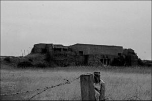
Today, what's left of Dummy Battery is mostly its damaged concrete center from the 1860s. A lake now sits in front of it, created by the digging in the 1950s. The gun spots from 1905 are still partly there, though they are damaged.
A rectangular concrete building to the right of the gun spots once held the fire control equipment and a planning room. Another broken concrete area is further to the right. Nothing is left of the original 1860s ammunition storage or the support buildings. However, you can still see their shapes on the ground.
Dummy Battery is part of a special protected area called a "scheduled monument." This area was set aside in 1976 to protect the old coastal defenses on the Isle of Grain. The battery is on private land, so people cannot visit it freely.
 | Selma Burke |
 | Pauline Powell Burns |
 | Frederick J. Brown |
 | Robert Blackburn |


