Dunfee, Indiana facts for kids
Quick facts for kids
Dunfee, Indiana
|
|
|---|---|
| Country | United States |
| State | Indiana |
| County | Whitley, Allen |
| Township | Jefferson, Aboite |
| Elevation | 856 ft (261 m) |
| Time zone | UTC-5 (Eastern (EST)) |
| • Summer (DST) | UTC-4 (EDT) |
| ZIP code |
46725
|
| Area code(s) | 260 |
| GNIS feature ID | 433778 |
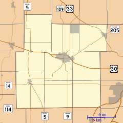
Dunfee is a small, unincorporated community located in the state of Indiana, United States. It is found in both Whitley and Allen counties. An unincorporated community means it's a place with a shared identity but without its own local government.
History of Dunfee
Dunfee got its own post office in 1883. This post office helped people send and receive mail for many years. It stayed open until 1917. It is believed that the community was named after the Dunfee family, who were early settlers in the area.
Geography of Dunfee
Dunfee is located at specific coordinates: 41 degrees, 5 minutes, 8 seconds North latitude and 85 degrees, 20 minutes, 13 seconds West longitude (41°05′08″N 85°20′13″W / 41.08556°N 85.33694°W). This tells us its exact spot on a map. It is part of the landscape of northeastern Indiana.
 | May Edward Chinn |
 | Rebecca Cole |
 | Alexa Canady |
 | Dorothy Lavinia Brown |


