
Dunsandel facts for kids
Quick facts for kids
Dunsandel
|
|
|---|---|

Dunsandel Methodist Church
|
|
| Country | New Zealand |
| Region | Canterbury region |
| District | Selwyn District |
| Ward | Ellesmere |
| Electorates |
|
| Area | |
| • Total | 1.94 km2 (0.75 sq mi) |
| Population
(June 2023)
|
|
| • Total | 480 |
| • Density | 247/km2 (641/sq mi) |
Dunsandel is a small country town in the Canterbury region of New Zealand's South Island. It's located on the flat Canterbury Plains, just south of the Selwyn River / Waikirikiri. The town is about 40 kilometers south of Christchurch.
Dunsandel is an important stop on State Highway 1. It's right in the middle of the journey between Christchurch and Ashburton. Roads from Dunsandel also lead to nearby towns like Leeston, Southbridge, and Hororata. The town offers places for travelers to eat and get coffee. It also supports the farms around it.
The town was created to help the local farming community. Farmers here raise dairy cows, sheep, and grow crops. Dunsandel still provides services like veterinary care, transport, and vehicle repairs for these farms. The town was named after Dunsandle Castle. This castle was the home of Robert Daly, who used to own the land where Dunsandel was built.
Life in Dunsandel
Dunsandel has one primary school for children up to Year 6. About 150 students attend this school. The town is also home to the Dunsandel Cricket Club. Their main team is known as one of the best in the Ellesmere area.
Who Lives in Dunsandel?
Dunsandel is considered a rural settlement by Statistics New Zealand. It covers about 1.94 square kilometers. As of 2018, the town had a population of 438 people. This means there were about 226 people living in each square kilometer.
In 2018, there were 156 homes in Dunsandel. The population was made up of 210 males and 228 females. About 105 people (24%) were under 15 years old. Most people (48.6%) were between 30 and 64 years old.
Most people in Dunsandel (93.8%) are of European or Pākehā background. About 9.6% identify as Māori. A small number of people are from Pacific Islands or Asian backgrounds. People can identify with more than one ethnicity.
When asked about religion, most people (65.1%) said they had no religion. About 23.3% identified as Christian. A small number followed Māori religious beliefs or other religions.
Many adults in Dunsandel have jobs. About 62.2% work full-time, and 13.5% work part-time. Only a small number (2.7%) were unemployed. About 9.9% of people aged 15 or older had a university degree.
Education in Dunsandel
Dunsandel School is a primary school for students in Years 1 to 6. It opened a long time ago, in 1879. Later, in 1936, two other schools, Selwyn and Upper Selwyn schools, joined with Dunsandel School. As of March 2024, the school has about 176 students.
Images for kids
-
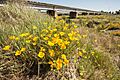
The Selwyn Bridge near Dunsandel.
.jpg)
