Durbuk facts for kids
Quick facts for kids
Durbuk
Rdo-khug, Hdor-khug
Darbuk
|
|
|---|---|
|
Village
|
|
| Country | India |
| Union Territory | Ladakh |
| District | Leh |
| Tehsil | Durbuk |
| Elevation | 3,800 m (12,500 ft) |
| Population | |
| • Total | 852 |
| Time zone | UTC+5:30 (IST) |
| Census code | 873 |
Durbuk (also called Darbuk) is a small village in Ladakh, India. It's the main village for its local area, known as a subdivision and block, within the Leh district. Durbuk is found in the Durbuk tehsil (a type of administrative area).
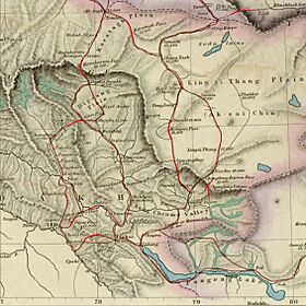
This village is located between the Chang La mountain pass and Tangste village. It's on the road that leads to the famous Pangong Tso Lake. Durbuk is also very important because of a long road, about 255 kilometers (158 miles) long. This road, called the Darbuk–Shyok–DBO Road, connects Durbuk to Shyok village and further north to a military post called Daulat Beg Oldi (DBO) near the China border.
Contents
Exploring Durbuk's Location
Durbuk is in a very important spot. It sits between the Indus Valley to the west and the Shyok Valley to the east. The beautiful Pangong Lake region is to its south.
In the past, important trade routes passed through Durbuk. Traders would travel from here to places like Yarkent (through the Shyok Valley) and Rudok (via Pangong Lake). This made Durbuk a busy and well-known place for travelers.
The Tangtse River Valley
Durbuk is located in the valley of the Tangtse River. People in the past described this valley as "well-cultivated," meaning it was good for farming. The river was also known for having lots of fish.
The Tangtse River starts in the Loi Yogma valley. It flows past Tangtse and Durbuk villages before joining the Shyok River. After Durbuk, the river goes through a deep, narrow valley, like a small canyon, for about 12 kilometers (7.5 miles). A smaller stream from below the Chang La mountain pass also joins the Tangtse River near Durbuk.
Getting Around Durbuk
Today, Durbuk is well-connected by roads to other parts of Ladakh.
- A road goes southwest to Karu. From there, you can reach the Indus river valley, and then Leh and Kargil.
- Another road heads southeast to Pangong Tso Lake and Chushul.
- A road to the northwest follows the Shyok River. This road leads to Diskit and Turtuk.
The 235-kilometer (146-mile) long Darbuk–Shyok–DBO Road goes north from Durbuk. It connects to villages along the eastern part of the Shyok River, including Shyok village (just 16 kilometers or 10 miles north). This road continues further north to the Daulat Beg Oldi (DBO) military post near the China border. The part of the road between Shyok and DBO is called Sub-Sector North (SSN) by the Indian Military. Civilians are not allowed on this part of the road.
Villages in Durbuk Area
The Durbuk subdivision includes several villages:
- Kargyam
- Man Pangong
- Shachukul
- Tangste
- Chushul
- Durbuk
People of Durbuk
According to the 2011 census of India, Durbuk had 160 households (families). The total population was 852 people.
About 66.62% of the people aged 7 and above could read and write. This is called the effective literacy rate.
| Total | Male | Female | |
|---|---|---|---|
| Population | 852 | 416 | 436 |
| Children aged below 6 years | 85 | 40 | 45 |
| Scheduled tribe | 846 | 414 | 432 |
| Literates (can read and write) | 511 | 298 | 213 |
| Workers (people who have jobs) | 502 | 274 | 228 |
| Main workers (work most of the year) | 303 | 200 | 103 |
| Main workers: Farmers | 134 | 96 | 38 |
| Main workers: Farm laborers | 5 | 4 | 1 |
| Main workers: Other jobs | 164 | 100 | 64 |
| Marginal workers (work less than half the year) | 199 | 74 | 125 |
| Marginal workers: Farmers | 165 | 68 | 97 |
| Marginal workers: Farm laborers | 5 | 0 | 5 |
| Marginal workers: Other jobs | 27 | 5 | 22 |
| Non-workers (not working) | 350 | 142 | 208 |


