Early Streets of Brisbane facts for kids
Quick facts for kids Early Streets of Brisbane |
|
|---|---|
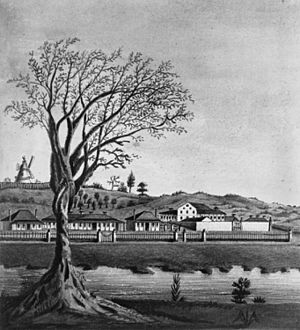
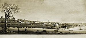
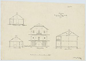
Early drawing of a section of the town of Brisbane, Queensland including the Convict Hospital, 1835
|
|
| Location | Sections of Albert Street, George Street, William Street, North Quay, Queen's Wharf Road, Brisbane City, City of Brisbane, Queensland, Australia |
| Design period | 1824–1841 (convict settlement) |
| Built | 1825– |
| Official name: Early Streets of Brisbane | |
| Type | archaeological |
| Designated | 16 July 2010 |
| Reference no. | 645611 |
| Significant period | 1825–current |
| Significant components | archaeological potential |
| Lua error in Module:Location_map at line 420: attempt to index field 'wikibase' (a nil value). | |
The Early Streets of Brisbane are special heritage-listed areas in the heart of Brisbane City, Queensland, Australia. These streets, including parts of Albert Street, George Street, William Street, North Quay, and Queen's Wharf Road, show us where Brisbane first began. They were built starting in 1825. These historic street areas were added to the Queensland Heritage Register on 16 July 2010 because they hold important clues about Brisbane's past.
Contents
Brisbane's First Streets
The very first streets of Brisbane were laid out when the city was a convict settlement. This means it was a place where prisoners were sent to live and work. In May 1825, Lieutenant Henry Miller moved the settlement from the Redcliffe Peninsula to the northern bank of the Brisbane River. This new spot was chosen because it was high up, had water, and cool breezes.
Building the Early Settlement
The first settlers faced many challenges. There weren't many resources, and the thick sub-tropical plants made building difficult. Between 1826 and 1829, the number of prisoners grew from 200 to 1000. These convicts did most of the hard work to build the settlement.
The location of Brisbane Town was often debated. Commandant Patrick Logan even suggested moving the settlement to Stradbroke Island. But this plan was dropped because it was too hard to cross the bay. Even with this uncertainty, building continued under Commandant Logan. He is known for creating Brisbane's first permanent buildings. Logan was responsible for building the Commissariat Store and Old Windmill. These are Brisbane's only surviving buildings from the convict era.
By 1842, Governor Gipps declared Moreton Bay open for free settlers. This meant people could move there by choice, not just as prisoners.
Life in the Convict Settlement
The Moreton Bay Penal Settlement operated for 15 years. It had many different buildings. These included places for convicts and soldiers to live. There were also homes for officers, the Commandant, and other important people. The settlement had a hospital, the Commissariat Store, and various other storage buildings. There was also a wharf, wells for water, and gardens.
The Commandant's cottage was built in 1825. It was a wooden house with brick chimneys. Other buildings, like the Engineer's cottage, were built nearby. These early buildings helped shape the first layout of the town.
Important Buildings and Places
The first military barracks for soldiers were built in 1825. They were simple huts. The first prisoner homes were also slab huts. Later, in 1829, stone barracks were built for the prisoners. The first Commissariat Store was a long, low building. It was later used as a barn after a new stone store was built.
The main way to enter the settlement was through the wharf on the Brisbane River. This wharf was built by 1827. A crane was used to move goods from ships to the shore. The main road into the settlement went up the steep river bank from the wharf. This road followed the path of today's Queen's Wharf Road.
A hospital was finished in 1827. It was located where Adelaide, George, and Ann Streets are today. The windmill tower on Wickham Terrace was likely finished in late 1828. A treadmill was added to it later.
The Convict Barracks
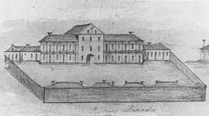
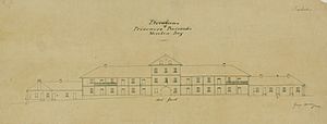
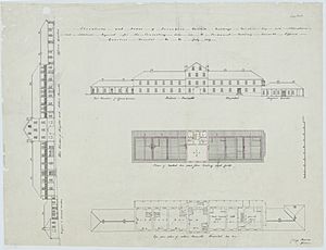
The Prisoners' Barracks were built between 1827 and 1830. They were designed to hold up to 1000 convicts. This was the largest stone building in the settlement at the time. The barracks faced present-day Queen Street. They had a large archway and a walled yard behind them. This yard was used for prisoner activities.
The large archway of the barracks was a main entrance. Inside the archway, there was a special area for punishments. After the convict era, the barracks were used as a courthouse and for Queensland's first Parliament. The building was taken down in 1880 to make way for new shops and businesses. Many of these new buildings along Queen Street are still there today.
Next to the Prisoners' Barracks, along Queen Street, were brick buildings. These buildings had different uses over time. They were homes for officers, a school room, a guard house, and even solitary cells.
The Chaplain's house was built in 1828. It was a nice brick house. It was later divided into two homes.
Government Gardens
The Government Gardens were started in 1828. They were located where the City Botanic Gardens are today, on Alice Street. These gardens grew many vegetables like cabbage, potatoes, and pumpkins. They also grew fruits like bananas and pineapples. There was a Gardener's house in the gardens, which was octagonal (eight-sided) in shape.
The Commissariat Store
The new Commissariat Store, Brisbane was built in 1828 and 1829. It is located between William Street and Queens Wharf Road. This two-story building was made of local stone. Its doors faced the river and the wharf. It was used for storing supplies for the settlement. It is one of only two buildings from the convict period that are still standing today.
One of the main roads of the settlement followed the path of today's Adelaide Street. It went from George Street to Albert Street.
Planning for a Free City
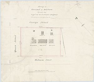
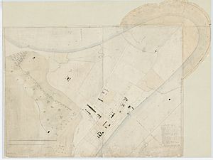
In 1839, surveyors from Sydney came to draw maps of the area. They planned the streets for when Moreton Bay would open for free settlers. These plans showed the proposed street layout for the free town of Brisbane. They also showed other features like a well in George Street and a flagstaff in William Street. There were also many gardens, including military gardens and the Commandant's garden.
A map of Brisbane Town drawn in 1840 is very important. It was part of a special exhibition celebrating Queensland's 150th anniversary.
On 10 February 1842, Governor George Gipps officially closed the Moreton Bay Penal Settlement. He declared the area open for free settlement. New plans for the town were made. The 1843 plan by surveyor Henry Wade was chosen. This plan is the basis for the Brisbane CBD we see today.
Only three other places in the Brisbane CBD from the convict period are listed on the Queensland Heritage Register:
Archaeological digs at these sites have found remains from the convict period. This shows how important these early streets are for understanding Brisbane's beginnings.
What the Early Streets Include Today
The Early Streets of Brisbane include specific parts of many roads. These are:
- Adelaide Street (between George and Albert Street)
- Albert Street (between Margaret and Alice Streets)
- Alice Street (between William and Albert Streets)
- Burnett Lane
- Charlotte Street (between George and Albert Streets)
- Elizabeth Street (between George and Albert Streets)
- George Street (between Adelaide and Queen Streets, and from Charlotte Street to the QUT campus)
- North Quay (between Ann and Queen Streets)
- Margaret Street (between William and George Streets)
- Queen's Wharf Road
- Part of William Street (between Queen and Elizabeth Streets, and between Elizabeth and Alice Streets)
These roads today have modern surfaces like bitumen. They have kerbs and gutters made of concrete or stone. The footpaths are made of brick, concrete, or bitumen.
Burnett Lane
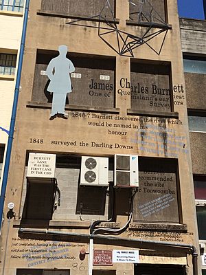
Burnett Lane is a narrow street that runs between George Street and Albert Street. It is Brisbane's oldest laneway. It is named after James Charles Burnett, one of Queensland's first surveyors.
During the convict settlement years, this lane was used as a prison exercise yard. It was also a place where punishments were carried out. Later, it became the entrance for tradespeople to buildings on Queen and Adelaide Streets. In 2008, the Brisbane City Council decided to improve Burnett Lane. Now, it is a popular area with cafes and bars. However, delivery vehicles still use the narrow street, which can be a problem for people walking.
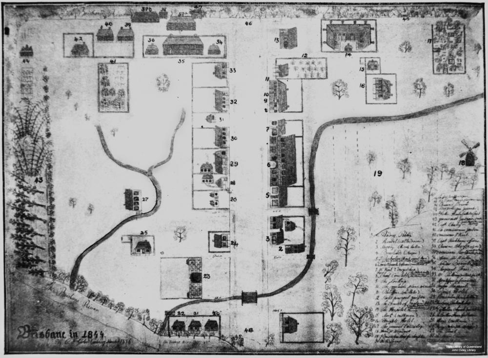
1844 Map of Brisbane
Map Legend
|
|
|
Why These Streets Are Important
The Early Streets of Brisbane were added to the Queensland Heritage Register on 16 July 2010. This is because they are very important for understanding Queensland's history.
These streets likely contain old archaeological items buried underground. These items can tell us how Brisbane was first settled as a convict colony. It's rare to find evidence of this first European settlement because Brisbane has grown into a big, modern city. Finding remains from the Moreton Bay Penal Settlement helps us understand what life was like in these early convict places.
Old maps of the first settlement show where buildings were. These maps can be compared with today's street plans. Even though today's streets look different, they often overlap with the old building sites. This means there's a good chance that parts of old buildings are still buried under the current streets. When Brisbane's streets were built, new layers of material were added on top of the old ones. This helped to preserve the older historical layers underneath. This was seen during construction work in 2003. It showed how layers built up over time in Queen Street. Because of this, the streets are some of the least disturbed areas in the Brisbane CBD. They have the best chance of holding the oldest remains of European settlement in Queensland.
The streets might have buried remains from many parts of the convict settlement. This includes the Prisoners Barracks, the Commandant's House, the Commissariat Store, hospitals, homes, gardens, and barns. Studying these remains can help us learn about buildings that aren't on old maps. It can also tell us about the daily lives of convicts, soldiers, and administrators. This helps us understand the social differences between these groups. It also adds to our knowledge of convict sites across Australia.
Because layers of history have built up over time, there's also a chance to find archaeological remains from later periods. This helps us learn the full story of how Brisbane, Queensland's capital city, developed.
The Early Streets of Brisbane are considered "Exceedingly Rare" because they are linked to Brisbane's convict past. They are also thought to be "Intact" because not much digging has happened deep underground. This combination means they have "Exceptional Archaeological Research Potential." This means they can help answer important questions about Queensland's history. For example, they could help identify unknown buildings or tell us about living conditions for different groups of people.
 | Leon Lynch |
 | Milton P. Webster |
 | Ferdinand Smith |


