East Fork, Pennsylvania facts for kids
Quick facts for kids
East Fork, Pennsylvania
|
|
|---|---|
|
Road district
|
|

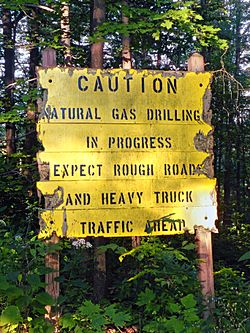
Unpaved McConnell Road passes by many Marcellus Shale natural gas-drilling sites as it traverses the Susquehannock State Forest
|
|

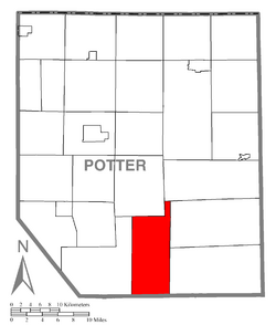
Map of Potter County, Pennsylvania highlighting East Fork
|
|

Map of Potter County, Pennsylvania
|
|
| Country | United States |
| State | Pennsylvania |
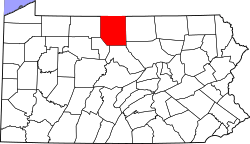
| County | Potter |
| Area | |
| • Total | 51.0 sq mi (132.2 km2) |
| Population
(2000)
|
|
| • Total | 14 |
| • Density | 0.3/sq mi (0.1/km2) |
| Time zone | UTC-5 (EST) |
| • Summer (DST) | UTC-4 (EDT) |
East Fork Road District was a very special kind of local area in Potter County, Pennsylvania, United States. It was unique because it was mostly covered by a large state forest. Only a small part of the land along East Fork Road was privately owned.
In the year 2000, only 14 people lived in East Fork Road District. Because it had so few residents, it couldn't have a full local government like other towns or townships in Pennsylvania. On January 1, 2004, this district officially stopped existing and became part of Wharton Township.
Where Was East Fork Located?
East Fork Road District got its name from a stream called the East Fork of the First Fork Sinnemahoning Creek. A road also ran along this stream.
According to the United States Census Bureau, the district covered a total area of about 132.2 square kilometers (or 51.0 square miles). All of this land was dry land, with no large bodies of water.
Neighboring Areas
East Fork was surrounded by several other townships. To its north and west was Summit Township. West Branch Township was also to the north. To the east, it bordered Abbott Township and Stewardson Township. To the south, it touched Clinton County, and to the west was Wharton Township.
Who Lived in East Fork?
In 2000, when the last official count was done, there were only 14 people living in East Fork Road District. These 14 people lived in 7 households, and 5 of these were families.
The area had a very low population density, meaning there were very few people per square kilometer. There were also many more empty houses than people to live in them. All the residents counted in 2000 were white.
Population Details
The people living in East Fork were mostly adults. There were no children under 18 years old. The population included:
- 1 person aged 18 to 24
- 4 people aged 25 to 44
- 5 people aged 45 to 64
- 4 people who were 65 years old or older
The average age of residents was 59 years. There were 8 men and 6 women living in the district at that time.
 | William L. Dawson |
 | W. E. B. Du Bois |
 | Harry Belafonte |

