Clinton County, Pennsylvania facts for kids
Quick facts for kids
Clinton County
|
|||||
|---|---|---|---|---|---|
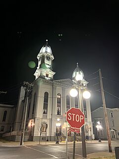
Clinton County Courthouse
|
|||||
|
|||||
| Motto(s):
Where Rivers and Valleys meet Mountains and Sunsets
|
|||||
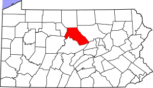
Location within the U.S. state of Pennsylvania
|
|||||
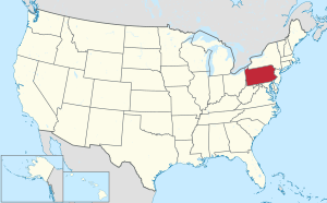 Pennsylvania's location within the U.S. |
|||||
| Country | |||||
| State | |||||
| Founded | June 21, 1839 | ||||
| Named for | DeWitt Clinton | ||||
| Seat | Lock Haven | ||||
| Largest city | Lock Haven | ||||
| Area | |||||
| • Total | 897 sq mi (2,320 km2) | ||||
| • Land | 888 sq mi (2,300 km2) | ||||
| • Water | 8.9 sq mi (23 km2) 1.0%% | ||||
| Population
(2020)
|
|||||
| • Total | 37,450 | ||||
| • Estimate
(2022)
|
37,931 |
||||
| • Density | 41.750/sq mi (16.120/km2) | ||||
| Time zone | UTC−5 (Eastern) | ||||
| • Summer (DST) | UTC−4 (EDT) | ||||
| Congressional district | 15th | ||||
|
Pennsylvania Historical Marker
|
|||||
| Designated: | June 12, 1982 | ||||
Clinton County is a county located in the state of Pennsylvania. In 2020, about 37,450 people lived here. The main town and county seat is Lock Haven.
Clinton County is part of a larger area called the Lock Haven, PA Micropolitan Statistical Area. It's also included in the Williamsport-Lock Haven, PA Combined Statistical Area. This county is found in the Central Pennsylvania region.
Contents
History
Long ago, in 1768, new lands in Pennsylvania were bought from the Haudenosaunee people. This was part of the Treaty of Fort Stanwix. These lands included parts of what is now Clinton County.
Even though the land was officially part of Northumberland County, settlers in the area created their own system. Near what is now Jersey Shore, they elected three leaders each year. These leaders were called the Fairplay Men.
The Fairplay Men made sure everyone was treated fairly. They mostly helped with land problems. But they also handled other legal issues or crimes in their area. They could allow new settlers to come in. They could also take away a settler's land if they were gone for too long. They could even make someone leave the area by sending them away on a canoe!
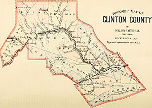
Clinton County was officially created on June 21, 1839. It was formed from parts of Centre and Lycoming Counties.
Etymology
The county was named after DeWitt Clinton. He was the sixth Governor of New York. Some people think it might have been named after Henry Clinton, but DeWitt Clinton is the more common belief.
Geography
Clinton County covers about 897 square miles. Most of this area, about 888 square miles, is land. The rest, about 8.9 square miles, is water.
The county has a climate where summers are warm. In Lock Haven, the average temperature in January is about 26.5°F. In July, it's about 72.2°F. In Renovo, January averages 25.6°F and July averages 71.0°F.
Neighboring Counties
- Potter County (north)
- Lycoming County (east)
- Union County (southeast)
- Centre County (south)
- Clearfield County (southwest)
- Cameron County (west)
Land Features
- Bear Mountain: A mountain peak located in the county.
Main Roads
 I-80
I-80 Future I‑99
 US 220
 PA 64
PA 64 PA 120
 PA 144
 PA 150
 PA 477
 PA 664
 PA 880
Population
| Historical population | |||
|---|---|---|---|
| Census | Pop. | %± | |
| 1840 | 8,323 | — | |
| 1850 | 11,207 | 34.7% | |
| 1860 | 17,723 | 58.1% | |
| 1870 | 23,211 | 31.0% | |
| 1880 | 26,278 | 13.2% | |
| 1890 | 28,685 | 9.2% | |
| 1900 | 29,197 | 1.8% | |
| 1910 | 31,545 | 8.0% | |
| 1920 | 33,555 | 6.4% | |
| 1930 | 32,319 | −3.7% | |
| 1940 | 34,557 | 6.9% | |
| 1950 | 36,532 | 5.7% | |
| 1960 | 37,619 | 3.0% | |
| 1970 | 37,721 | 0.3% | |
| 1980 | 38,971 | 3.3% | |
| 1990 | 37,182 | −4.6% | |
| 2000 | 37,910 | 2.0% | |
| 2010 | 39,238 | 3.5% | |
| 2020 | 37,450 | −4.6% | |
| 2022 (est.) | 37,931 | −3.3% | |
In 2000, there were about 37,914 people living in Clinton County. The population density was about 43 people per square mile. Most people living in the county were White (98.3%).
In 2020, the population was 37,450. The county is mostly White (93.27%). There are also smaller groups of Black or African American, Asian, and Native American residents. About 1.76% of the population is Hispanic or Latino.
Statistical Areas
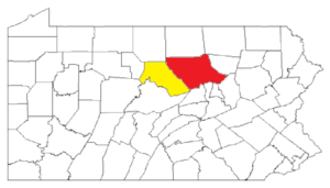
The U.S. government has named Clinton County the Lock Haven, PA Micropolitan Statistical Area (μSA). This means it's a smaller city area with a population center and nearby communities. In 2010, it was the 16th most populated micropolitan area in Pennsylvania.
Clinton County is also part of a larger area called the Williamsport-Lock Haven, PA Combined Statistical Area (CSA). This area includes both Clinton County and Lycoming County. In 2010, this combined area was the 11th most populated in Pennsylvania.
Education
Colleges and Universities
- Lock Haven University of Pennsylvania
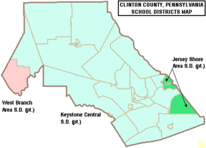
Public School Districts
- Jersey Shore Area School District (also in Lycoming County)
- Keystone Central School District (also in Centre County)
- West Branch Area School District (also in Clearfield County)
Recreation
Clinton County is home to five Pennsylvania state parks. These parks offer many chances to enjoy nature and outdoor activities.
- Bucktail State Park Natural Area: A 75-mile long scenic road along Pennsylvania Route 120. It goes from Lock Haven to Emporium.
- Hyner Run State Park
- Hyner View State Park
- Kettle Creek State Park
- Ravensburg State Park
Communities
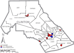
In Pennsylvania, there are different types of towns and cities. These include cities, boroughs, and townships. Here are the communities found in Clinton County:
City
- Lock Haven (This is the county seat, meaning it's the main administrative town.)
Boroughs
Townships
- Allison
- Bald Eagle
- Beech Creek
- Castanea
- Chapman
- Colebrook
- Crawford
- Dunnstable
- Gallagher
- Greene
- Grugan
- Lamar
- Leidy
- Logan
- Noyes
- Pine Creek
- Porter
- Wayne
- West Keating
- Woodward
Census-Designated Places
These are areas that the U.S. Census Bureau names for collecting data. They are not official towns or cities under Pennsylvania law.
Other Communities
These are other small communities in the county that are not officially incorporated.
- Cooks Run
- Farrandsville
- Hyner
- Keating
- Mackeyville
- Westport
Population Ranking
This table shows the population of the main communities in Clinton County, based on the 2020 census.
† county seat
| Rank | City/Town/etc. | Type | Population (2020 Census) |
|---|---|---|---|
| 1 | † Lock Haven | City | 8,108 |
| 2 | Mill Hall | Borough | 1,479 |
| 3 | Avis | Borough | 1,473 |
| 4 | Dunnstown | CDP | 1,464 |
| 5 | Flemington | Borough | 1,271 |
| 6 | McElhattan | CDP | 1,224 |
| 7 | Renovo | Borough | 1,061 |
| 8 | Castanea | CDP | 1,047 |
| 9 | Beech Creek | Borough | 736 |
| 10 | Rauchtown (partially in Lycoming County) | CDP | 722 |
| 11 | Lamar | CDP | 561 |
| 12 | Rote | CDP | 488 |
| 13 | Loganton | Borough | 469 |
| 14 | South Renovo | Borough | 411 |
See also
 In Spanish: Condado de Clinton (Pensilvania) para niños
 | Frances Mary Albrier |
 | Whitney Young |
 | Muhammad Ali |


