Rote, Pennsylvania facts for kids
Quick facts for kids
Rote, Pennsylvania
|
|
|---|---|

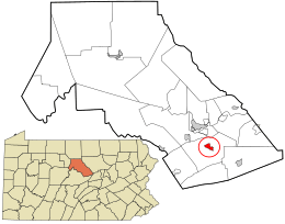
Location in Clinton County and the state of Pennsylvania.
|
|
| Country | United States |
| State | Pennsylvania |
| County | Clinton |
| Township | Lamar |
| Area | |
| • Total | 1.1 sq mi (2.8 km2) |
| • Land | 1.1 sq mi (2.8 km2) |
| • Water | 0 sq mi (0.0 km2) |
| Elevation | 755 ft (230 m) |
| Population
(2010)
|
|
| • Total | 507 |
| • Density | 466/sq mi (179.9/km2) |
| Time zone | UTC-5 (Eastern (EST)) |
| • Summer (DST) | UTC-4 (EDT) |
| ZIP code |
17751
|
| FIPS code | 42-66384 |
| GNIS feature ID | 2630037 |
Rote is a small community located in Lamar Township, which is in the southern part of Clinton County, Pennsylvania, United States. It is known as a census-designated place, or CDP. This means it's an area identified by the U.S. Census Bureau for statistical purposes. It's like a town that doesn't have its own separate local government. In 2010, about 507 people lived in Rote.
Contents
Exploring Rote: Location and Surroundings
Rote is found in the middle of Lamar Township. This area is in the southern part of Clinton County. It sits near the northeast end of a long valley called the Nittany Valley.
How to Get to Rote: Roads and Highways
A road called Pennsylvania Route 477 goes right through Rote. This road helps people travel to and from the community.
- If you go west on PA 477 for about 3 miles (5 kilometers), you will reach U.S. Route 220 in a place called Cedar Springs.
- If you travel east on PA 477 for about 7 miles (11 kilometers), you will find Exit 185 on Interstate 80. This exit is close to Loganton.
- Another way to reach Interstate 80 is by taking Exit 178. This exit is about 2.5 miles (4 kilometers) southwest of Rote. You can get there by using a local road and then U.S. Route 220.
What is a Census-Designated Place?
A census-designated place (CDP) is a special kind of area. It is created by the United States Census Bureau just for counting people. CDPs are like towns or villages that have a name and a community, but they don't have their own city government. They are part of a larger township or county. This helps the government collect accurate information about where people live across the country.
See also
 In Spanish: Rote (Pensilvania) para niños
 | Laphonza Butler |
 | Daisy Bates |
 | Elizabeth Piper Ensley |

