Bucktail State Park Natural Area facts for kids
Quick facts for kids Bucktail State Park Natural Area |
|
|---|---|
|
IUCN Category III (Natural Monument)
|
|

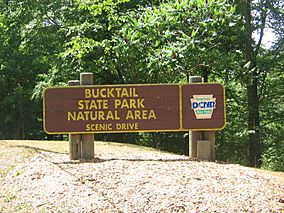
Sign heading west on PA 120, at the eastern end of Bucktail State Park Natural Area in Clinton County
|
|

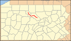
Location of Bucktail State Park Natural Area in Pennsylvania
|
|
| Location | Pennsylvania, United States |
| Area | 16,433 acres (66.50 km2) |
| Elevation | 1,023 ft (312 m) |
| Established | 1933 |
| Named for | The Pennsylvania Bucktail Regiment |
| Governing body | Pennsylvania Department of Conservation and Natural Resources |
| Website | Bucktail State Park Natural Area |
Bucktail State Park Natural Area is a huge park in Pennsylvania. It covers about 16,433 acres (6,650 ha) of land. This special park stretches through Cameron and Clinton Counties.
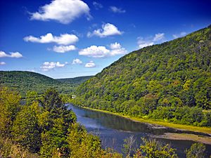
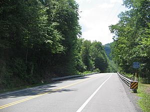
The park follows Pennsylvania Route 120 for about 75 miles (121 km). It runs between the towns of Emporium and Lock Haven. You'll find the park along Sinnemahoning Creek and the West Branch Susquehanna River. It also goes through the town of Renovo.
Bucktail State Park Natural Area is named after the Pennsylvania Bucktails Regiment. This was a famous group of soldiers from the American Civil War. The park is a great place to see wildlife, especially elk!
Contents
Exploring the Park's Path

Bucktail State Park Natural Area follows a long and winding path. It starts near Lock Haven and heads west. You'll travel along Pennsylvania Route 120. This road runs beside the West Branch Susquehanna River.
As you go west, the park passes through several small towns and areas. These include Renovo and South Renovo. After a while, Route 120 leaves the West Branch Susquehanna River. Then it follows Sinnemahoning Creek instead.
The park continues into Cameron County. Here, Route 120 and Sinnemahoning Creek lead to the town of Driftwood. From Driftwood, the road follows the Driftwood Branch of Sinnemahoning Creek north. Finally, the park ends when you reach the town of Emporium.
A Look Back: Park History
The path that Pennsylvania Route 120 follows today is very old. Long ago, it was a trail used by Native American tribes. They called it the Sinnemahoning Path. This trail helped them cross the mountains between two big river systems. One river, the Susquehanna River, flows to the Chesapeake Bay. The other, the Allegheny River, eventually joins the Mississippi River and flows to the Gulf of Mexico.
Early American pioneers also used this trail. They traveled west on it, and it became known as the Bucktail Trail. Over time, as roads improved, this old trail became the highway we know as Route 120.
In 1933, the state of Pennsylvania officially made this area a park. It was named "Bucktail State Park" to honor the Bucktail Regiment. This Civil War regiment was famous for quickly building rafts in Driftwood. They used these rafts to rush to the state capital, Harrisburg, when it was in danger in 1861.
Even though the park covers a lot of land, about 21,039 acres (8,514 ha), some of the land inside its borders is privately owned. The rest of the park land is managed by the state. It's part of the Elk State Forest and Sproul State Forest.
Spotting Wildlife in the Park
Bucktail State Park Natural Area is located in the West Branch and Sinnemahoning Valleys. River valleys are great places for animals to live. They are often warmer and wetter than the mountains around them. This makes them perfect homes for many different creatures.
The valley acts like a natural highway for plants and animals. You can see trees like river birch and sycamore growing here. Many animals call this park home. Keep an eye out for Osprey and different kinds of duck. You might also spot white-tailed deer, bald eagles, otter, merganser, mink, and even black bears!
One of the most exciting animals to see here is the elk. You can often spot them in the early morning or late afternoon. They tend to be in the northern parts of the park. There are even special viewing platforms built nearby, like in Sinnemahoning State Park and near the village of Benezette. These platforms help you get a better look at these amazing animals.
Nearby Parks to Explore
If you love state parks, there are many others close to Bucktail State Park Natural Area. Here are some within about 30 miles (48 km):
- Bald Eagle State Park (Centre County)
- Bendigo State Park (Elk County)
- Black Moshannon State Park (Centre County)
- Cherry Springs State Park (Potter County)
- Colton Point State Park (Tioga County)
- Denton Hill State Park (Potter County)
- Hyner Run State Park (Clinton County)
- Hyner View State Park (Clinton County)
- Kettle Creek State Park (Clinton County)
- Kinzua Bridge State Park (McKean County)
- Leonard Harrison State Park (Tioga County)
- Little Pine State Park (Lycoming County)
- Lyman Run State Park (Potter County)
- McCalls Dam State Park (Centre County)
- Ole Bull State Park (Potter County)
- Parker Dam State Park (Clearfield County)
- Patterson State Park (Potter County)
- Prouty Place State Park (Potter County)
- Poe Paddy State Park (Centre County)
- Poe Valley State Park (Centre County)
- R. B. Winter State Park (Union County)
- Sand Bridge State Park (Union County)
- S. B. Elliott State Park (Clearfield County)
- Sinnemahoning State Park (Cameron and Potter Counties)
- Sizerville State Park (Cameron and Potter Counties)
- Susquehanna State Park (Lycoming County)
- Upper Pine Bottom State Park (Lycoming County)
 | Frances Mary Albrier |
 | Whitney Young |
 | Muhammad Ali |


