Upper Pine Bottom State Park facts for kids
Quick facts for kids Upper Pine Bottom State Park |
|
|---|---|
|
IUCN Category III (Natural Monument)
|
|
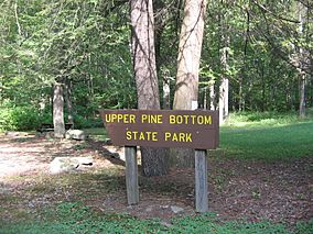
Upper Pine Bottom State Park was a Bureau of Forests picnic area until its 1962 transfer to the Bureau of State Parks.
|
|
| Location | Cummings, Lycoming, Pennsylvania, United States |
| Area | 5 acres (2.0 ha) |
| Elevation | 932 ft (284 m) |
| Established | 1923 |
| Named for | Upper Pine Bottom Run |
| Governing body | Pennsylvania Department of Conservation and Natural Resources |
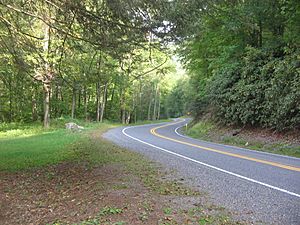
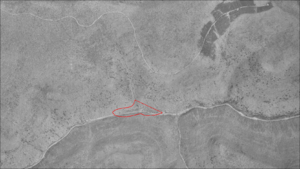
Upper Pine Bottom State Park is a small, 5-acre (2.0 ha) park in Lycoming County, Pennsylvania, United States. It is located in Cummings Township along Pennsylvania Route 44. The park is surrounded by the large Tiadaghton State Forest.
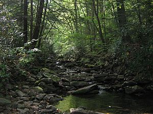
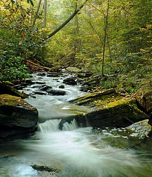
The park gets its name from Upper Pine Bottom Run, a stream that flows through it. This stream eventually joins Pine Creek. Upper Pine Bottom State Park is part of the Pine Creek Gorge, a deep valley carved by streams. This area shows five main rock layers from ancient times, about 300 million years ago.
Long ago, Native American tribes like the Susquehannocks and Iroquois lived here. Later, in the 1800s, people started logging the area. The park began as a public camp in 1923. Today, it is a day-use park, meaning you can visit during the day but not camp overnight. It has picnic tables and a parking area.
Upper Pine Bottom State Park is one of Pennsylvania's smallest state parks. Staff from nearby Little Pine State Park help maintain it. People visit for picnics, but it's also a popular spot for hunters, anglers, hikers, cross-country skiers, snowmobilers, and all-terrain vehicle (ATV) riders. Upper Pine Bottom Run is a great place for trout fishing during the season. The area is now covered by new forests, home to many plants and animals.
Contents
Park History: From Ancient Times to Today
Native American Life in the Valley
People have lived in what is now Pennsylvania for at least 12,000 years. The first people were Paleo-Indian hunters who moved around a lot. Later, during the Archaic period (7000 to 1000 BC), people used more advanced stone tools. The Woodland period (1000 BC to 1500 AD) saw people start to live in villages and grow crops.
The park is in the West Branch Susquehanna River area. The first people recorded here were the Susquehannocks. They lived in villages with large long houses and were a matriarchal society, meaning women held important roles. The mountains around the Pine Creek Gorge were sometimes home to the Susquehannocks. Their population decreased due to sickness and wars with the Iroquois tribes. By 1675, they had mostly disappeared or joined other tribes.
After the Susquehannocks, the Iroquois controlled these lands. The Iroquois lived mostly in what is now New York. They had a strong group of tribes that gave them power. The Iroquois and other tribes used the Pine Creek Path through the gorge. This path connected areas in New York to the Great Shamokin Path in the south. The Seneca tribe, part of the Iroquois, believed the Pine Creek Gorge was sacred. They did not build permanent homes there but used the path and had seasonal hunting camps.
To fill the empty lands, the Iroquois invited other tribes, like the Shawnee and Lenape, to settle here. The valleys of Pine Creek and its smaller streams were important hunting grounds for these tribes. Historians think a Shawnee village might have been just north of Little Pine State Park, close to where Upper Pine Bottom State Park is now.
The French and Indian War (1754–1763) caused many Native Americans to move west. In 1784, the United States bought a large area, including the park's land, from the Iroquois. After this, most Native Americans left Pennsylvania. However, some small groups stayed in the Pine Creek Gorge until the War of 1812.
Lumber, Roads, and Early Industry
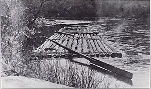
European Americans first settled the land that became Cummings Township in 1784. The area was covered with huge eastern white pine and eastern hemlock trees. Lumbermen began to cut these trees down. To help move the logs, Pine Creek was declared a public highway in 1798.
For a long time, the area around Upper Pine Bottom State Park was a wilderness. In the early 1800s, a path for horses was cut through the woods. This path was later made wider for wagons in 1812.
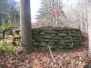
This new road brought industry. In 1814, people found iron ore nearby and built a furnace on Upper Pine Bottom Run to make pig iron. But it was too expensive to bring supplies and ore to the furnace, so it closed in 1817. Its ruins were visible for many years.
The first two sawmills were built on Upper Pine Bottom Run in 1815 and 1817. These sawmills helped create the village of Waterville, which is about 2.5 miles (4.0 km) from the park. Waterville became an important local center.
Between 1825 and 1834, the Jersey Shore and Coudersport Turnpike was built along the old path. This turnpike had toll booths every 5 miles (8.0 km) and charged fees for wagons. Today, Pennsylvania Route 44, which goes through the park, still follows this old turnpike route.
Cummings Township was officially formed in 1832. Early industries included lumber and quarries for building stone. In 1851, the Susquehanna Boom opened on the West Branch Susquehanna River. This helped the lumber industry grow even more, making Williamsport known as the "Lumber Capital of the World."
However, the lumber era did not last. By the early 1900s, almost all the old-growth forests were cut down. The leftover tree tops dried out and caused huge fires. In 1894 and 1908, large fires burned the area around the park. The soil became poor, and the land was called the "Pennsylvania Desert." Floods became common, and much of the wildlife disappeared.
From Forest to Park: A New Beginning
After the forests were destroyed, many companies left the land. People like Joseph Rothrock worried that the forests would not grow back. They wanted the state to buy the land and manage it better. In 1895, Rothrock became the first commissioner of the Pennsylvania Department of Forests and Waters. In 1897, the state began buying land for forest reservations.
On July 13, 1898, the state bought 409-acre (166 ha) in Cummings Township. This was the first purchase for what became Tiadaghton State Forest, which surrounds Upper Pine Bottom State Park. Today, this state forest covers over 146,539 acres (59,302 ha).
Upper Pine Bottom State Park started in the early 1920s. The Pennsylvania Department of Forestry built 31 campsites on state forest land. By 1923, the park was known as "Upper Pine Bottom Class B Public Camp." These camps were for hikers, hunters, and picnickers who wanted to explore the woods. They had shelters, water, picnic tables, and fireplaces.
During the Great Depression, the Civilian Conservation Corps (CCC) helped improve the park in the 1930s. They planted many trees and built a pavilion in 1936. Although a structure was visible in 1959, today there are no buildings in the park. The CCC camps closed by 1942 due to World War II.
In 1950, the park was called "Upper Pine Bottom State Forest Picnic Area." In 1962, it was officially transferred to the Bureau of State Parks. Today, Upper Pine Bottom State Park is a roadside park for day use only. It has a small parking lot and a few picnic tables. It is maintained by staff from nearby Little Pine State Park.
Park Environment: Rocks, Weather, and Wildlife
Geology: How the Land Was Formed
The rocks in Upper Pine Bottom State Park are over 300 million years old. However, the Pine Creek Gorge itself formed about 20,000 years ago during the last ice age. Before then, Pine Creek flowed northeast. But a large glacier blocked the creek, forming a lake. The melting ice caused the creek to overflow and reverse its flow, carving out the deep gorge we see today.
The land where the park sits was once the coast of a shallow sea. This was about 300 million years ago. Mountains to the east slowly wore down, creating layers of clay, sand, and gravel. Over time, huge pressure turned these sediments into the rocks found here: sandstone, shale, conglomerates, limestone, and coal.
The park is at 932 feet (284 m) elevation on the Allegheny Plateau. This plateau formed about 300 million years ago when continents collided. Even though the area looks mountainous, it's actually a dissected plateau. Years of erosion have cut away softer rocks, forming valleys and leaving harder rocks on top of ridges, which look like mountains.
Five main rock layers from the Devonian and Carboniferous periods are found here. The youngest is the Pottsville Formation, a gray rock that can contain coal. Below that is the Mauch Chunk Formation, made of reddish shale and sandstone. Then comes the Burgoon Sandstone, which is buff-colored. Below that is the Huntley Mountain Formation, with softer reddish shale and olive-gray sandstone. The oldest layer is the red shale of the Catskill Formation, about 375 million years old. This soft layer was easily eroded, helping to form the Pine Creek Gorge.
Climate: Weather in the Park
The Allegheny Plateau has a continental climate. This means it has cold winters and warm summers. The temperature can change a lot between day and night. The area gets about 36 to 42 inches (910 to 1,070 mm) of rain and snow each year. January is usually the coldest month, July is the warmest, and June is the wettest. The highest temperature recorded was 104 °F (40 °C) in 1988, and the lowest was −19 °F (−28 °C) in 1982.
| Climate data for Upper Pine Bottom State Park | |||||||||||||
|---|---|---|---|---|---|---|---|---|---|---|---|---|---|
| Month | Jan | Feb | Mar | Apr | May | Jun | Jul | Aug | Sep | Oct | Nov | Dec | Year |
| Mean daily maximum °F (°C) | 35 (2) |
39 (4) |
48 (9) |
62 (17) |
72 (22) |
80 (27) |
84 (29) |
83 (28) |
75 (24) |
63 (17) |
51 (11) |
39 (4) |
61 (16) |
| Mean daily minimum °F (°C) | 18 (−8) |
20 (−7) |
27 (−3) |
36 (2) |
47 (8) |
56 (13) |
60 (16) |
59 (15) |
52 (11) |
40 (4) |
32 (0) |
24 (−4) |
39 (4) |
| Average precipitation inches (mm) | 2.47 (63) |
2.31 (59) |
3.11 (79) |
3.27 (83) |
3.69 (94) |
4.47 (114) |
3.95 (100) |
4.20 (107) |
3.96 (101) |
3.34 (85) |
3.41 (87) |
2.74 (70) |
40.92 (1,042) |
| Source: The Weather Channel | |||||||||||||
Ecology: Plants and Animals of the Park
Before logging, the Pine Creek Gorge was a dense forest. It was mostly hemlock and white pine trees. Large animals like wolves, lynx, wolverines, panthers, and fishers lived here. Today, only bobcats and foxes remain from that list. Herds of American bison and elk also lived here, along with many black bears, river otters, and beavers.
The old forests kept the land and streams cool. Rainwater slowly soaked into the ground, making the creeks flow steadily all year. Pine Creek and its streams had many fish, including trout. However, dams downstream on the Susquehanna River have stopped fish like shad and eels from migrating here. Cutting down the forests destroyed animal habitats, and hunting also reduced wildlife numbers.
The original white pines in Upper Pine Bottom Run were all cut down. But by 1925, new, healthy young trees had grown in their place. In the 1920s, a disease called chestnut blight killed almost all the American chestnut trees. Later, oak trees suffered from insect attacks. Gypsy moths also caused damage to the state forest between 1978 and 1982.
Today, the surrounding state forest has many different kinds of trees. These include mixed oak forests, along with ash, beech, birch, cherry, and maple. You can also find hemlock and pine trees. The Pine Creek Gorge is home to over 225 types of wildflowers, plants, and trees. It also has 40 kinds of mammals, 245 bird species, and 26 types of fish. Common animals you might see include deer, squirrels, bears, eagles, wild turkey, and ravens.
Recreation: Fun Things to Do
Upper Pine Bottom State Park is 5-acre (2.0 ha) and offers limited activities. You can enjoy picnics and fishing here. While the park started as a campground in the 1920s, it no longer has campsites or restrooms.
Upper Pine Bottom Run has been known for good trout and bass fishing since 1885. Today, the entire Upper Pine Bottom Run is approved for trout fishing by the Pennsylvania Fish and Boat Commission. This means it is stocked with trout, and you can fish here during trout season.
The park also serves as a parking area for people wanting to explore the surrounding state forest. In the forest, you can go hiking and hunting. Popular game animals include black bear, ruffed grouse, white-tailed deer, and wild turkey.
The state forest trails are also great for mountain biking and horseback riding. In winter, they are used for cross-country skiing and snowmobiling. Just north of the park is the 19-mile (31 km) Haneyville ATV Trail system for all-terrain vehicles. The parking area for this trail is on PA 44. Some trails are named after the area's history, like Furnace Trail (for the old iron furnace), CCC Trail (for the Civilian Conservation Corps), and Plantation Loop (for the trees planted by the CCC).
Nearby State Parks
The following state parks are within 30 miles (48 km) of Upper Pine Bottom State Park:
- Bald Eagle State Park (Centre County)
- Bucktail State Park Natural Area (Cameron and Clinton Counties)
- Colton Point State Park (Tioga County)
- Hyner Run State Park (Clinton County)
- Hyner View State Park (Clinton County)
- Kettle Creek State Park (Clinton County)
- Leonard Harrison State Park (Tioga County)
- Little Pine State Park (Lycoming County)
- McCalls Dam State Park (Centre County)
- Ole Bull State Park (Potter County)
- Ravensburg State Park (Clinton County)
- R. B. Winter State Park (Union County)
- Sand Bridge State Park (Union County)
- Susquehanna State Park (Lycoming County)
 | Kyle Baker |
 | Joseph Yoakum |
 | Laura Wheeler Waring |
 | Henry Ossawa Tanner |


