East Wallabi Island facts for kids

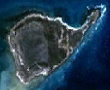
Satellite image
|
|
| Geography | |
|---|---|
| Location | Indian Ocean, off the coast of Western Australia |
| Coordinates | 28°26′23″S 113°43′33″E / 28.43972°S 113.72583°E |
| Archipelago | Houtman Abrolhos |
| Area | 3.21 km2 (1.24 sq mi) |
| Length | 3.3 km (2.05 mi) |
| Width | 1.8 km (1.12 mi) |
| Highest elevation | 15 m (49 ft) |
| Highest point | Flag Hill |
| Administration | |
|
Australia
|
|
| State | Western Australia |
| Demographics | |
| Population | Uninhabited |
East Wallabi Island is a cool island found in the Wallabi Group. This group is part of the Houtman Abrolhos islands. You can find it in the Indian Ocean, off the west coast of Australia.
Contents
Island History: A Story of Survival
East Wallabi Island has an exciting and important history. It played a big part in the story of the Batavia shipwreck. This happened way back in 1629!
After the ship crashed, a group of soldiers landed on West Wallabi Island. They were led by a brave man named Wiebbe Hayes. They were looking for fresh water. The bad guys who took over the ship left them there. They hoped the soldiers would get hungry or thirsty.
But the soldiers were smart! They found out they could walk through the shallow water to East Wallabi Island. And guess what? They found a fresh water spring there! Plus, East and West Wallabi Islands are the only places in this group where the tammar wallaby lives. This meant the soldiers had both food and water. The bad guys didn't have these things. This helped the soldiers survive!
In old stories about the Batavia mutiny, East Wallabi Island was often called "High island". This was its name a long time ago.
Island Geography: Exploring East Wallabi
East Wallabi Island is located at about 28°26′23″S 113°43′33″E. It's the second-largest island in the Houtman Abrolhos islands. Only West Wallabi Island is bigger.
The island is mostly round. But it has a pointy part called Fish Point in the north-east. It's about 3.3 kilometers (2.1 miles) long and 1.8 kilometers (1.1 miles) wide. This gives it an area of about 3.21 square kilometers (1.24 square miles).
There are two hills on the island. Flag Hill is in the north-east, near Fish Point. It's 15 meters (49 feet) tall, making it the highest spot in the Houtman Abrolhos. In the south-east, you'll find another hill called Eagle Hill. Other cool spots include Fish Point and Turtle Bay. There's even a small airstrip near Flag Hill.
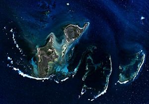
The island is surrounded by underwater coral reefs. These reefs are narrow on the west, north, and east sides. To the east, past the reef, is Pigeon Island Anchorage. This is a main path and parking spot for boats going to Pigeon Island. Pigeon Island is used by people who fish for Western Rock Lobster.
To the south, the reef is very wide. You can even walk from East Wallabi Island to other islands when the water is low! These islands include Barge Rock, Turnstone Island, Seagull Island, Oystercatcher Island, and West Wallabi Island.
Island Plants: A Green Paradise
East Wallabi Island is one of the few islands in the Houtman Abrolhos that has sand dunes. Because of this, it has many different kinds of plants. The dunes and rocky areas are home to lots of different shrubs. These plant areas are very important for nature. They are special because they have so many different species.
A study in 2001 found 124 different plant species on East Wallabi Island. That's more than any other island in the whole group!
Island Birds: A Birdwatcher's Dream
East Wallabi Island is part of a special place called the Houtman Abrolhos Important Bird Area. This area is recognized by BirdLife International. It's important because many seabirds come here to breed and raise their young.
 | Lonnie Johnson |
 | Granville Woods |
 | Lewis Howard Latimer |
 | James West |


