Eastover, North Carolina facts for kids
Quick facts for kids
Eastover, North Carolina
|
||
|---|---|---|

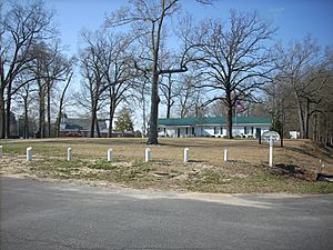
Eastover Community Center
|
||
|
||
| Motto(s):
"Remembering Our Heritage, Creating Our Future"
|
||

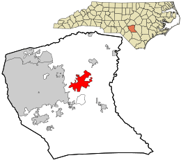
Location in Cumberland County and the state of North Carolina.
|
||
| Country | United States | |
| State | North Carolina | |
| County | Cumberland | |
| Incorporated | 2007 | |
| Area | ||
| • Total | 11.34 sq mi (29.36 km2) | |
| • Land | 11.33 sq mi (29.34 km2) | |
| • Water | 0.01 sq mi (0.02 km2) | |
| Elevation | 141 ft (43 m) | |
| Population
(2020)
|
||
| • Total | 3,656 | |
| • Density | 322.74/sq mi (124.61/km2) | |
| Time zone | UTC-5 (Eastern (EST)) | |
| • Summer (DST) | UTC-4 (EDT) | |
| ZIP code |
28312
|
|
| Area codes | 910, 472 | |
| FIPS code | 37-19740 | |
| GNIS feature ID | 2402438 | |
Eastover is a small town in Cumberland County, North Carolina, United States. It's a great place to learn about local history and geography.
The town was officially created on July 25, 2007. According to the 2020 census, about 3,656 people live there.
Contents
History of Eastover
Eastover has a rich history, even though it was only recently incorporated as a town.
Historic Buildings in Eastover
One important historical site in Eastover is the Robert Williams House. This house was added to the National Register of Historic Places in 1983. This means it's recognized as a special place worth preserving for future generations.
Geography and Location
Eastover is located in the northeastern part of Cumberland County. It is about 7 miles (11 km) northeast of downtown Fayetteville.
Major Roads and Highways
Several important roads pass through or near Eastover:
- U.S. Route 301 goes right through the town. It is known as Dunn Road.
- Interstate 95 runs next to US 301 on the east side of town. You can get on or off I-95 using Exits 55, 56, and 58.
- I-95 can take you northeast to the Rocky Mount area (about 82 miles or 132 km away). It can also take you southwest to Florence, South Carolina (about 91 miles or 146 km away).
- Interstate 295 starts at I-95 (Exit 58). It goes west around Fayetteville.
- U.S. Route 13 also starts at Exit 58. This highway leads northeast to Goldsboro, which is about 50 miles (80 km) away.
Size of Eastover
The United States Census Bureau says that Eastover covers a total area of about 11.3 square miles (29.4 square kilometers). Most of this area is land, with only a very small part (about 0.01 square miles or 0.02 square kilometers) being water.
Population and People
Eastover has seen its population grow over the years.
| Historical population | |||
|---|---|---|---|
| Census | Pop. | %± | |
| 1980 | 1,075 | — | |
| 1990 | 1,243 | 15.6% | |
| 2000 | 1,376 | 10.7% | |
| 2010 | 3,628 | 163.7% | |
| 2020 | 3,656 | 0.8% | |
| U.S. Decennial Census | |||
Eastover in 2020
In 2020, there were 3,656 people living in Eastover. There were 1,346 households and 926 families.
The town is home to people from many different backgrounds:
| Group | Percentage |
|---|---|
| White (not Hispanic or Latino) | 69.69% |
| Black or African American (not Hispanic or Latino) | 18.76% |
| Native American | 1.48% |
| Asian | 0.9% |
| Pacific Islander | 0.11% |
| Other/Mixed | 4.81% |
| Hispanic or Latino | 4.24% |
Eastover in 2010
Back in 2010, Eastover had a population of 3,628 people. There were 1,476 households. About 29.9% of these households had children under 18 living there.
The average household had about 2.40 people. The average family had about 2.86 people.
The median age of people in Eastover was about 44.9 years old. This means half the people were younger than 44.9 and half were older.
See also
 In Spanish: Eastover (Carolina del Norte) para niños


