El Indio, Texas facts for kids
Quick facts for kids
El Indio, Texas
|
|
|---|---|

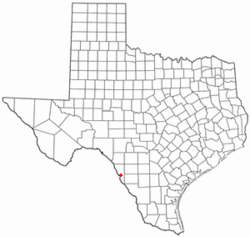
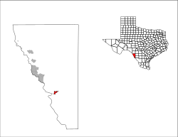
Location of El Indio, Texas
|
|
 |
|
| Country | United States |
| State | Texas |
| County | Maverick |
| Area | |
| • Total | 1.8 sq mi (4.6 km2) |
| • Land | 1.8 sq mi (4.6 km2) |
| • Water | 0.0 sq mi (0.0 km2) |
| Elevation | 735 ft (224 m) |
| Population
(2020)
|
|
| • Total | 182 |
| • Density | 101.1/sq mi (39.6/km2) |
| Time zone | UTC-6 (Central (CST)) |
| • Summer (DST) | UTC-5 (CDT) |
| ZIP code |
78860
|
| Area code(s) | 830 |
| FIPS code | 48-23080 |
| GNIS feature ID | 1356868 |
El Indio is a small community located in Maverick County, Texas, in the United States. It is known as a census-designated place (CDP). This means it's an area identified by the United States Census Bureau for gathering population data, even though it's not officially a city or town with its own local government.
In the year 2000, about 263 people lived in El Indio.
Where is El Indio?
El Indio is found at specific coordinates on a map: 28.514900 degrees North and -100.311537 degrees West. This location helps people find it precisely.
The United States Census Bureau says that El Indio covers a total area of about 1.8 square miles (which is about 4.6 square kilometers). All of this area is land, with no water.
People of El Indio
The population of El Indio has changed over the years. Here's how many people have lived there during different census counts:
| Historical population | |||
|---|---|---|---|
| Census | Pop. | %± | |
| 2020 | 182 | — | |
| U.S. Decennial Census 1850–1900 1910 1920 1930 1940 1950 1960 1970 1980 1990 2000 2010 |
|||
El Indio's Population in 2020
The most recent 2020 United States census counted 182 people living in El Indio. Most of the people living in El Indio are of Hispanic or Latino background, making up about 95% of the population. There are also smaller numbers of White and Native American residents.
See also
 In Spanish: El Indio (Texas) para niños
 | Anna J. Cooper |
 | Mary McLeod Bethune |
 | Lillie Mae Bradford |

