
Maverick County, Texas facts for kids
Quick facts for kids
Maverick County
|
|
|---|---|

Historic Maverick County Courthouse in Eagle Pass
|
|

Location within the U.S. state of Texas
|
|
 Texas's location within the U.S. |
|
| Country | |
| State | |
| Founded | 1871 |
| Named for | Samuel Maverick |
| Seat | Eagle Pass |
| Largest city | Eagle Pass |
| Area | |
| • Total | 1,292 sq mi (3,350 km2) |
| • Land | 1,279 sq mi (3,310 km2) |
| • Water | 13 sq mi (30 km2) 1.0%% |
| Population
(2020)
|
|
| • Total | 57,887 |
| • Density | 42/sq mi (16/km2) |
| Time zone | UTC−6 (Central) |
| • Summer (DST) | UTC−5 (CDT) |
| Congressional district | 23rd |


Maverick County is a county in the state of Texas. It's located in the southwestern part of Texas, right next to the border with Mexico. In 2020, about 57,887 people lived there. The main city and county seat (where the county government is) is Eagle Pass.
Maverick County was officially created in 1856 and started operating in 1871. It was named after Samuel Maverick, who was a famous cattleman and a state lawmaker. The entire county is part of the Eagle Pass, TX Micropolitan Statistical Area.
Contents
History of Maverick County

Early Inhabitants: Native American Tribes
Long, long ago, the first people to live in this area were prehistoric hunter-gatherer groups. We know this because their tools and other items have been found in the county. Later, tribes like the Lipan Apache, Shawnee, and Coahuiltecan lived here.
During the American Civil War, a military post called Fort Duncan was left empty for a few years. This allowed Native American groups to control the area, and both American and Mexican settlers faced many challenges. The fort was reopened in 1868. In 1871, a group of Black Seminole Indians became scouts for the fort. The last known Native American raid in the county happened in 1877, when three traders were killed by Lipan Apaches. This spot is now called Deadman's Hill.
Spanish Explorers and Early Trails
The famous El Camino Real, also known as the Old San Antonio Road, crosses southern Maverick County. This historic trail starts in East Texas and crosses the Rio Grande river. It was first mapped out by Alonso De León in 1690. Many early Spanish explorers and settlers used this path more than any other in Texas.
In 1665, Fernando de Azcué from Saltillo chased Native Americans into the county. Later, in 1675, Fernando del Bosque explored near Quemado. It's believed that Franciscan priests with his group held the first Catholic Mass on Texas soil during this trip. Many other important Spanish leaders, like Domingo Terán de los Ríos (the first Governor of Spanish Texas) and Martín de Alarcón (who helped found San Antonio), also traveled through Maverick County.
In 1720, Marqués de San Miguel de Aguayo brought a huge number of goats, horses, and sheep through the county. This was the beginning of Spanish ranching in Texas.
First Settlers and Fort Duncan

Antonio Rivas was the first known rancher in the area, starting in 1765. Even today, ranching is a big part of Maverick County.
On March 27, 1849, Captain Sidney Burbank set up Fort Duncan, which was first called Camp Eagle Pass. It was located about two miles north of a river crossing point.
Around 1850, General William Leslie Cazneau started ranching here. He worked with John Twohig, a banker from San Antonio, to plan out the city of Eagle Pass in 1850. At the same time, a Mexican military base was set up across the border, which became Piedras Negras.
Many early settlers of Eagle Pass came from Mexican villages along the river. Some were even people who got stuck while traveling to California for the Gold Rush, or soldiers who had finished their service at Fort Duncan. One of these soldiers, Jesse Sumpter, later became the sheriff of Maverick County.
County Established and Growth
Maverick County was officially created in 1856 from Kinney County. It was named after Samuel Maverick, a famous Texas figure. The county government was fully organized on September 4, 1871. In 1860, about 726 people lived in the county. When Texans voted on whether to leave the Union before the Civil War, Eagle Pass voted strongly against it.
During the Civil War, Confederate troops took over Fort Duncan. Eagle Pass became a very important place for trade, especially for cotton, which was sent into Mexico. After the war, General Joseph Orville Shelby's Confederate brigade famously refused to surrender. On July 4, 1865, he buried his Confederate flag in the middle of the Rio Grande river. His unit became known as "The Undefeated."
After the Civil War, during a time called Reconstruction, Eagle Pass saw a lot of saloons, gambling houses, and smuggling. The famous outlaw J. King Fisher and his group were very powerful in the area during this time.
New technologies arrived in Eagle Pass in the late 1800s. Telegraph lines reached the city in 1875, allowing faster communication. In 1880, a major railway line connected San Antonio to Piedras Negras, making transportation much easier.
Water for farming has always been important. In 1885, rancher Patrick W. Thomson started a project to build a large irrigation system using water from the Rio Grande. This system, called the Maverick County Irrigation Canal, began operating in 1932 and helped farmers grow more crops.
Maverick County also played a role in early aviation. On March 3, 1911, Lt. Benjamin D. Foulois and Philip O. Parmalee made the first official military flight to scout for Army troops between Laredo and Eagle Pass. Later, in 1942, the Army Air Force built a flying school north of Eagle Pass.
Oil and gas were discovered in the county in the 1950s. Coal mining was also important around the turn of the 20th century, with large mines near Eagle Pass.
By 1977, industries in the county included cotton gins, cattle feedlots, and a spinach-packing plant. Later, companies making work clothing, mining fluorspar, and raising catfish also came to the area. In 1982, most of the land in the county was used for farming and ranching, with hay, oats, and wheat as the main crops.
Geography of Maverick County
Maverick County covers a total area of about 1,292 square miles. Most of this (1,279 square miles) is land, and only a small part (13 square miles) is water.
Major Roads and Highways
These are the main roads that go through Maverick County:
 U.S. Highway 57
 U.S. Highway 277
 State Highway 131
 Loop 480
Neighboring Areas
Maverick County shares borders with several other counties in Texas and municipalities in Mexico:
- Kinney County (to the north)
- Zavala County (to the east)
- Dimmit County (to the east)
- Uvalde County (to the northeast)
- Webb County (to the southeast)
- Guerrero, Coahuila, Mexico (to the southwest)
- Jiménez, Coahuila, Mexico (to the west)
- Piedras Negras, Coahuila, Mexico (to the southwest)
Population and People
| Historical population | |||
|---|---|---|---|
| Census | Pop. | %± | |
| 1860 | 726 | — | |
| 1870 | 1,951 | 168.7% | |
| 1880 | 2,967 | 52.1% | |
| 1890 | 3,698 | 24.6% | |
| 1900 | 4,066 | 10.0% | |
| 1910 | 5,151 | 26.7% | |
| 1920 | 7,418 | 44.0% | |
| 1930 | 6,120 | −17.5% | |
| 1940 | 10,071 | 64.6% | |
| 1950 | 12,292 | 22.1% | |
| 1960 | 14,508 | 18.0% | |
| 1970 | 18,093 | 24.7% | |
| 1980 | 31,398 | 73.5% | |
| 1990 | 36,378 | 15.9% | |
| 2000 | 47,297 | 30.0% | |
| 2010 | 54,258 | 14.7% | |
| 2020 | 57,887 | 6.7% | |
| U.S. Decennial Census 1850–2010 2010–2014 |
|||
| Race / Ethnicity (NH = Non-Hispanic) | Pop 2000 | Pop 2010 | Pop 2020 | % 2000 | % 2010 | % 2020 |
|---|---|---|---|---|---|---|
| White (NH) | 1,610 | 1,552 | 1,574 | 3.40% | 2.86% | 2.72% |
| Black or African American (NH) | 53 | 75 | 129 | 0.11% | 0.14% | 0.22% |
| Native American or Alaska Native (NH) | 444 | 506 | 835 | 0.94% | 0.93% | 1.44% |
| Asian (NH) | 164 | 140 | 182 | 0.35% | 0.26% | 0.31% |
| Pacific Islander (NH) | 0 | 2 | 4 | 0.00% | 0.00% | 0.01% |
| Other race alone (NH) | 6 | 15 | 110 | 0.01% | 0.03% | 0.19% |
| Mixed race or Multiracial (NH) | 82 | 54 | 117 | 0.17% | 0.10% | 0.20% |
| Hispanic or Latino | 44,938 | 51,914 | 54,936 | 95.01% | 95.68% | 94.90% |
| Total | 47,297 | 54,258 | 57,887 | 100% | 100% | 100% |
In 2020, there were 57,887 people living in Maverick County. This included 16,647 households and 13,402 families.
Back in 2000, the county had 47,297 people. About 95% of the population identified as Hispanic or Latino. Many households (51.60%) had children under 18 living with them. The average household had about 3.6 people.
The median age in the county in 2000 was 28 years old. This means half the people were younger than 28 and half were older. About 36.90% of the population was under 18.
Maverick County has a lower average income compared to many other places in the United States. In 2000, about 34.80% of the population lived below the poverty line. It is known for having one of the highest percentages of people who speak Spanish at home, with 91% of residents speaking it in 2000.
Education in Maverick County
All schools in Maverick County are part of the Eagle Pass Independent School District.
For higher education, Southwest Texas Junior College is the community college for the county. Sul Ross State University also has a campus in Eagle Pass, offering more college options.
Communities in Maverick County
Cities
- Eagle Pass (This is the county seat)
Census-designated places (CDPs)
These are areas that are like towns but are not officially incorporated as cities.
Images for kids
-
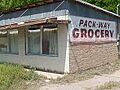
The former Pack-Way Grocery between Eagle Pass and Quemado has long since closed.

See also
 In Spanish: Condado de Maverick para niños
