Old San Antonio Road facts for kids
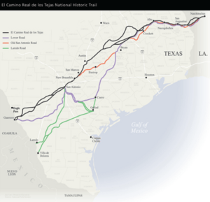
The Old San Antonio Road was a very old and important pathway that stretched across parts of Texas and Louisiana in the United States. It was also known as a section of the larger El Camino Real de los Tejas National Historic Trail. This historic road wasn't just one path; it was a network of trails. It started near Eagle Pass in Texas, close to the Rio Grande river, and went all the way to Natchitoches, Louisiana in Louisiana. From Texas, it even continued south into Mexico to Mexico City. Many parts of this road were originally trails used by Native American people.
Contents
Where Did the Road Go?
The Old San Antonio Road stretched for many miles! In Louisiana, much of it followed what is now Louisiana Highway 6. In Texas, parts of the old road are now Texas State Highway 21 and a special road called Texas State Highway OSR (which stands for Old San Antonio Road).
The road passed through many important cities and towns. Some of these included:
- Natchitoches, Louisiana
- Many, Louisiana
- Nacogdoches, Texas
- Crockett, Texas
- Bryan and College Station, Texas
- San Marcos, Texas
- New Braunfels, Texas
- San Antonio, Texas
- Cotulla, Texas
- Catarina, Texas
The Road's Long History
The Old San Antonio Road has a rich history that goes back hundreds of years.
Early Explorers and Missions
In 1690, a Spanish explorer named Alonso de León traveled across the Rio Grande river into East Texas. He was following trails already used by Native American people and even buffalo. His journey helped create the path for what became the Old San Antonio Road. He was going to East Texas to set up missions, which were religious settlements.
The next year, in 1691, another explorer named Domingo Terán de los Ríos brought more missionaries along a similar path. In 1693, Gregorio de Salinas Varona helped map out the road even more clearly while bringing supplies from Monclova, Mexico.
It's important to remember that the Old San Antonio Road wasn't just one single, perfectly straight road. It was a network of trails that changed over time. Things like the weather or threats from Native American groups could cause travelers to use different routes.
A Busy Pathway
For many years, when Texas was part of Spain and then Mexico, this road was a main route between Mexico City and East Texas. People used it for travel, trade, and moving goods.
After Texas became independent, trade with Mexico slowed down. However, the old road, sometimes called the Camino Arriba, was still very important for Texans to connect with the United States.
During the American Civil War in the 1860s, the road became important again. It was used to bring supplies to the Confederacy. It also helped move cotton to Mexico, which was a way to get around the Union blockade that stopped ships from entering or leaving Southern ports.
After the Civil War, the name Camino Arriba was used less often, and people started calling it the Old San Antonio Road. By the 1870s, with the arrival of railroads, the part of the road connecting San Antonio to Mexico was hardly used. It was then called the Lower Presidio Road.
Protecting This Historic Road
People have worked hard to remember and protect the Old San Antonio Road.
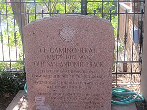
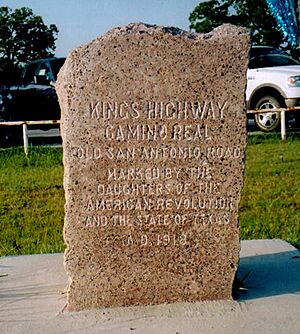
In 1915, the State of Texas and a group called the Daughters of the American Revolution (DAR) started a project. They put pink granite markers every 5 miles (8 km) along the road. A surveyor named V.N. Zively mapped the route. These markers were officially given to the State of Texas in 1918.
The State of Texas used Zively's map to mark some county roads as State Highway OSR. While this highway once covered a long part of the route, it's now a shorter bypass around Bryan.
Even today, most of these markers are still standing, though some have been moved because new highways changed the original path of the road. In some parts of South Texas, many markers are now on private ranches.
In 1929, the Texas government officially recognized Zively's version of the Old San Antonio Road as a historic trail. Later research showed that Zively's route was just one of at least five main routes used over time.
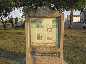
In 1989, the Texas Legislature created a special group to celebrate the road's 300th anniversary in 1991. This group helped promote the road and put up information panels along the route.
Finally, in 2004, President Bush signed a bill. This bill made the El Camino Real de Los Tejas, which includes the Old San Antonio Road, a National Historic Trail. This means it's now a special protected pathway that tells an important part of American history.
How Long Was It?
U.S. Cities Along the Route
 | Tommie Smith |
 | Simone Manuel |
 | Shani Davis |
 | Simone Biles |
 | Alice Coachman |


