Dimmit County, Texas facts for kids
Quick facts for kids
Dimmit County
|
|
|---|---|
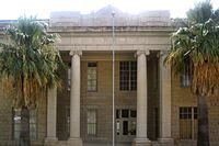
Dimmit County Courthouse in Carrizo Springs located off U.S. Highway 277
|
|
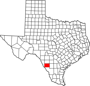
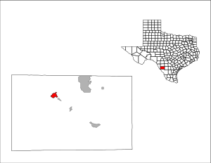
Location within the U.S. state of Texas
|
|
 Texas's location within the U.S. |
|
| Country | |
| State | |
| Founded | 1858 |
| Named for | Philip Dimmitt |
| Seat | Carrizo Springs |
| Largest city | Carrizo Springs |
| Area | |
| • Total | 1,335 sq mi (3,460 km2) |
| • Land | 1,329 sq mi (3,440 km2) |
| • Water | 5.6 sq mi (15 km2) 0.4%% |
| Population
(2020)
|
|
| • Total | 8,615 |
| • Density | 6.5/sq mi (2.5/km2) |
| Time zone | UTC−6 (Central) |
| • Summer (DST) | UTC−5 (CDT) |
| Congressional district | 23rd |
Dimmit County (/ˈdɪmɪt/ DIM-it) is a county in Texas. In 2020, about 8,615 people lived there. The main town and county seat is Carrizo Springs. The county was started in 1858 and officially organized in 1880. It is named after Philip Dimmitt, an important person in the Texas Revolution. The county's name is spelled differently from his name because of a mistake when the county was created.
Contents
History
Early People
Very old tools and items show that people called Paleo-Indians lived in Dimmit County as far back as 9200 BC. Later, during the archaic period (from 6000 BC to AD 1000), more hunter-gatherers lived in the area. These groups mostly ate wild game, fruits, seeds, and roots.
They made tools from wood and stone. They also wove baskets and made clothes from rabbit skins. They used bows and arrows for hunting. A special throwing stick called an atlatl made their spears even more powerful. Over time, Apache and Comanche tribes pushed out the native Coahuiltecan Indians. By 1877, Texas Rangers and local helpers, along with diseases, caused the Native Americans to leave the county.
The Wild Horse Desert
The land between the Rio Grande and the Nueces River was once a disputed area. This meant that neither Texas nor Mexico fully controlled it. This area was known as the Wild Horse Desert. It was a place where many outlaws lived, which made it hard for new settlers to move in. The land ownership was finally settled after the Mexican–American War.
How the County Started
Dimmit County was officially created in 1858. It was formed from parts of other counties like Bexar and Webb. The county was fully organized in 1880, and Carrizo Springs became its main town.
Early settlers found Dimmit County to be a rich grassland. It had many trees and wildlife like buffalo, deer, and wild horses. There were also natural springs that provided water. These springs fed into streams with fish and other water creatures. Explorers thought it was a great place to hunt wild horses and feed cattle.
A cattle rancher named Levi English started the town of Carrizo Springs in 1865. He came with 15 families. Two years later, more settlers joined them. Their first homes were simple adobe buildings or dugouts (homes built into the ground). In 1880, Levi English gave land for a courthouse, schools, and churches in the town.
For a while, there was a lot of crime, especially cattle rustling (stealing cattle) from both sides of the Mexican border. This continued until the 1880s. A lawman named J. King Fisher helped make the area safer. He also made sure that a "dry county" law was followed, which meant alcohol could not be sold.
Dimmit County found its first oil in 1943. By 1980, the county made about $20 million from crops. But it made even more, about $60 million, from oil and gas.
In 1914, a group tried to stop Mexican Americans from taking part in local politics. However, in 1944, the United States Supreme Court ruled that this practice was against the law.
Water Use
In 1884, D.C. Frazier drilled the first artesian well near Carrizo Springs. This well brought up many gallons of water every minute. By 1900, about 25 artesian wells were flowing in the area. But most of the water was not used and went to waste.
Colonel J.S. Taylor was the first to use a lot of water for farming in Dimmit County. He grew Bermuda onions and strawberries. In 1899, Taylor built a dam across the Nueces River to water about 2,000 acres of farmland. He also drilled a deep artesian well. By 1910, many other farmers started using his methods. This use of irrigation helped Dimmit County become part of the Texas Winter Garden region.
However, by the 1920s, the artesian water started to dry up. Farmers had to buy expensive pumps, which caused many to stop farming. By 1934, the government said there wasn't enough water for much more growth. By 1965, only about 15,000 acres were being watered. Much of the land went back to being used for grazing animals.
Oil and Gas
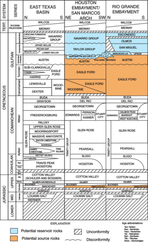
The Big Wells oil field was found in 1969, east of Big Wells. This field gets oil from a rock layer called the San Miguel Formation. This oil field also goes north into Zavala County.
In 2011, the Eagle Ford oil field began to be developed. Plans were made to drill 3,000 wells to get oil using a method called hydraulic fracturing (often called "fracking"). Fracking involves injecting large amounts of water and other liquids into wells to break up rock and release oil. This oil production has helped businesses in the county. However, it has also caused worries about having enough water, since fracking uses a lot of it.
Geography
Dimmit County covers about 1,335 square miles. Only a small part, about 5.6 square miles (0.4%), is covered by water.
Main Roads
Neighboring Counties
- Zavala County (north)
- Frio County (northeast)
- La Salle County (east)
- Webb County (south)
- Maverick County (west)
People and Population
| Historical population | |||
|---|---|---|---|
| Census | Pop. | %± | |
| 1870 | 109 | — | |
| 1880 | 665 | 510.1% | |
| 1890 | 1,049 | 57.7% | |
| 1900 | 1,106 | 5.4% | |
| 1910 | 3,460 | 212.8% | |
| 1920 | 5,296 | 53.1% | |
| 1930 | 8,828 | 66.7% | |
| 1940 | 8,542 | −3.2% | |
| 1950 | 10,654 | 24.7% | |
| 1960 | 10,095 | −5.2% | |
| 1970 | 9,039 | −10.5% | |
| 1980 | 11,367 | 25.8% | |
| 1990 | 10,433 | −8.2% | |
| 2000 | 10,248 | −1.8% | |
| 2010 | 9,996 | −2.5% | |
| 2020 | 8,615 | −13.8% | |
| U.S. Decennial Census 1850–2010 2010–2020 |
|||
2020 Census Information
| Race / Ethnicity (NH = Non-Hispanic) | Pop 2000 | Pop 2010 | Pop 2020 | % 2000 | % 2010 | % 2020 |
|---|---|---|---|---|---|---|
| White alone (NH) | 1,350 | 1,217 | 898 | 13.17% | 12.17% | 10.42% |
| Black or African American alone (NH) | 67 | 81 | 72 | 0.65% | 0.81% | 0.84% |
| Native American or Alaska Native alone (NH) | 23 | 7 | 8 | 0.22% | 0.07% | 0.09% |
| Asian alone (NH) | 68 | 51 | 68 | 0.66% | 0.51% | 0.79% |
| Pacific Islander alone (NH) | 0 | 0 | 10 | 0.00% | 0.00% | 0.12% |
| Other race alone (NH) | 0 | 10 | 12 | 0.00% | 0.10% | 0.14% |
| Mixed race or Multiracial (NH) | 32 | 14 | 60 | 0.31% | 0.14% | 0.70% |
| Hispanic or Latino (any race) | 8,708 | 8,616 | 7,487 | 84.97% | 86.19% | 86.91% |
| Total | 10,248 | 9,996 | 8,615 | 100.00% | 100.00% | 100.00% |
In 2020, there were 8,615 people living in Dimmit County. There were 3,178 households and 2,427 families.
In 2000, there were 10,248 people. About 85% of the people were Hispanic or Latino. About 42% of households had children under 18. About 57% were married couples living together.
The average age in the county was 32 years old. About 33% of the people were under 18. The average income for a family was about $24,579. About 33% of the people lived below the poverty line. This means Dimmit County is one of the poorest counties in the United States.
Education
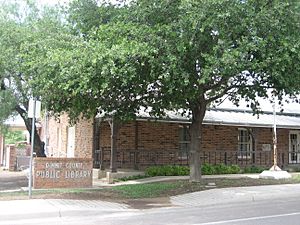
All schools in Dimmit County are part of the Carrizo Springs Independent School District. The Asherton Independent School District closed in 1999 and joined Carrizo Springs ISD. Students can attend Southwest Texas Junior College for higher education.
Communities
Cities
- Asherton
- Big Wells
- Carrizo Springs (county seat)
Other Places
See also
 In Spanish: Condado de Dimmit para niños
 | Aurelia Browder |
 | Nannie Helen Burroughs |
 | Michelle Alexander |


