
Bexar County, Texas facts for kids
Quick facts for kids
Bexar County
|
||
|---|---|---|

The Bexar County Courthouse in San Antonio
|
||
|
||

Location within the U.S. state of Texas
|
||
 Texas's location within the U.S. |
||
| Country | ||
| State | ||
| Founded | December 20, 1836 | |
| Named for | Presidio San Antonio de Béxar | |
| Seat | San Antonio | |
| Largest city | San Antonio | |
| Area | ||
| • Total | 1,256 sq mi (3,250 km2) | |
| • Land | 1,240 sq mi (3,200 km2) | |
| • Water | 16 sq mi (40 km2) 1.3%% | |
| Population
(2020)
|
||
| • Total | 2,009,324 | |
| • Estimate
(2023)
|
2,087,679 |
|
| • Density | 1,599.8/sq mi (617.68/km2) | |
| Time zone | UTC−6 (Central) | |
| • Summer (DST) | UTC−5 (CDT) | |
| Congressional districts | 20th, 21st, 23rd, 28th, 35th | |

Bexar County (pronounced "BAIR" or "BAY-er") is a county in the state of Texas. It is located in South Texas, and its main city, called the county seat, is San Antonio.
In 2020, the county had a population of over 2 million people. This makes it the fourth-largest county in Texas. Bexar County is part of the larger San Antonio–New Braunfels area. It is also one of the most populated counties in the entire United States. Many people from Hispanic backgrounds live here, and the African American population is also growing.
Contents
History of Bexar County
Bexar County was created on December 20, 1836. When it was first formed, it covered a huge area. It included almost the entire western part of the Republic of Texas. This even stretched into parts of what are now New Mexico and Wyoming. Later, after Texas became a state, 128 other counties were made from its original land.
The county got its name from San Antonio de Béxar. This was one of the 23 Mexican areas in Texas when it became independent. San Antonio de Béxar was the first local government set up by the Spanish in Texas. It was created in 1731 when 55 people from the Canary Islands settled near the missions that were already there. These missions were built around the source of the San Antonio River.
The new settlement was named after the Presidio San Antonio de Béjar. A presidio was a Spanish military fort that protected the missions. This fort was founded in 1718. It was named after Viceroy Balthasar Manuel de Zúñiga y Guzmán Sotomayor y Sarmiento, whose family came from a town in Spain called Béjar. The modern city of San Antonio also got its name from San Antonio de Béjar.
Native American History
Many different Native American groups lived in Bexar County. These included the Lipan Apache, Payaya, Tonkawa, and Comanche tribes.
Geography of Bexar County
Bexar County covers about 1,256 square miles. Most of this is land, with a small amount of water. It is located in south-central Texas. It is about 190 miles west of Houston. It is also about 140 miles from both the US-Mexican border and the Gulf of Mexico.
The Balcones Escarpment cuts across the county. North of this line, you'll find the rocky hills, springs, and canyons of the Texas Hill Country. South of it, the land changes to Blackland Prairie and the South Texas plains. The San Antonio River starts from springs north of Downtown San Antonio. It then flows south and southeast through the county.
Major Highways
Bexar County has a large system of highways. These roads connect like a "wagon wheel" around Downtown San Antonio. This makes it easy to travel across the county. Unlike some other big cities, these highways do not have tolls.
 Interstate 10
 Interstate 35
 Interstate 37
 Interstate 410
 U.S. Route 87
 U.S. Route 90
 U.S. Route 181
 U.S. Route 281
 State Highway 16
 State Highway Loop 1604
Neighboring Counties
- Kendall County (north)
- Comal County (north)
- Guadalupe County (northeast)
- Wilson County (southeast)
- Atascosa County (south)
- Medina County (west)
- Bandera County (northwest)
National Protected Area
Communities in Bexar County
Bexar County is home to many different cities and towns. Some cities are so large they spread into other counties. Others are completely surrounded by San Antonio.
Cities in Multiple Counties
- Elmendorf (partly in Wilson County)
- Fair Oaks Ranch (partly in Kendall and Comal counties)
- Lytle (mostly in Atascosa County and a small part in Medina County)
- San Antonio (county seat) (small parts in Medina and Comal counties)
- Schertz (partly in Guadalupe and Comal counties)
- Selma (partly in Guadalupe and Comal counties)
- Universal City (small part in Guadalupe County)
Cities Inside San Antonio
These cities are completely surrounded by the city of San Antonio.
Other Cities in Bexar County
Towns in Bexar County
- China Grove
- Hollywood Park
- St. Hedwig
Census-Designated Places
These are areas that are not officially cities or towns but are recognized for census purposes.
- Cross Mountain
- Lackland AFB
- Macdona
- Randolph AFB
- Scenic Oaks
- Timberwood Park
Other Unincorporated Communities
These are smaller communities that are not part of any city or town.
Population and People
| Historical population | |||
|---|---|---|---|
| Census | Pop. | %± | |
| 1850 | 6,052 | — | |
| 1860 | 14,454 | 138.8% | |
| 1870 | 16,043 | 11.0% | |
| 1880 | 30,470 | 89.9% | |
| 1890 | 49,266 | 61.7% | |
| 1900 | 69,422 | 40.9% | |
| 1910 | 119,676 | 72.4% | |
| 1920 | 202,096 | 68.9% | |
| 1930 | 292,533 | 44.7% | |
| 1940 | 338,176 | 15.6% | |
| 1950 | 500,460 | 48.0% | |
| 1960 | 687,151 | 37.3% | |
| 1970 | 830,460 | 20.9% | |
| 1980 | 988,800 | 19.1% | |
| 1990 | 1,185,394 | 19.9% | |
| 2000 | 1,392,931 | 17.5% | |
| 2010 | 1,714,773 | 23.1% | |
| 2020 | 2,009,316 | 17.2% | |
| 2023 (est.) | 2,087,679 | 21.7% | |
| U.S. Decennial Census 1850–2010 2010–2020 |
|||
| Race / Ethnicity (NH = Non-Hispanic) | Pop 1990 | Pop 2000 | Pop 2010 | Pop 2020 | % 1990 | % 2000 | % 2010 | % 2020 |
|---|---|---|---|---|---|---|---|---|
| White alone (NH) | 496,149 | 496,245 | 519,123 | 535,732 | 41.86% | 35.63% | 30.27% | 26.66% |
| Black or African American alone (NH) | 81,356 | 95,984 | 118,460 | 147,875 | 6.86% | 6.89% | 6.91% | 7.36% |
| Native American or Alaska Native alone (NH) | 2,506 | 3,499 | 3,809 | 4,554 | 0.21% | 0.25% | 0.22% | 0.23% |
| Asian alone (NH) | 13,832 | 21,369 | 39,561 | 65,127 | 1.17% | 1.53% | 2.31% | 3.25% |
| Pacific Islander alone (NH) | N/A | 947 | 1,806 | 2,726 | N/A | 0.07% | 0.05% | 0.14% |
| Other race alone (NH) | 2,371 | 1,500 | 2,881 | 8,218 | 0.20% | 0.11% | 0.17% | 0.41% |
| Mixed race or Multiracial (NH) | N/A | 16,354 | 22,175 | 54,044 | N/A | 1.17% | 1.29% | 2.69% |
| Hispanic or Latino (any race) | 589,180 | 757,033 | 1,006,958 | 1,190,958 | 49.70% | 54.35% | 58.72% | 59.27% |
| Total | 1,185,394 | 1,392,931 | 1,714,773 | 2,009,324 | 100.00% | 100.00% | 100.00% | 100.00% |

As of the 2010 census, there were over 1.7 million people in the county. The population is very diverse. About 58.7% of the people were Hispanic or Latino. Other groups included White, Black or African American, Asian, Native American, and Pacific Islander people. Many people also identify with two or more races.

County Facilities
The Bexar County Sheriff's Office manages the county jail facilities. These are located in downtown San Antonio. The Texas Department of Criminal Justice also runs a state jail for men, called the Dominguez Unit, in Bexar County.
Education in Bexar County
Bexar County has many different school districts. These districts serve the students living in various parts of the county.
School Districts
- Alamo Heights Independent School District
- Boerne Independent School District
- Comal Independent School District
- East Central Independent School District
- Edgewood Independent School District
- Floresville Independent School District
- Fort Sam Houston Independent School District
- Harlandale Independent School District
- Judson Independent School District
- Lackland Independent School District
- Medina Valley Independent School District
- North East Independent School District
- Northside Independent School District
- Randolph Field Independent School District
- San Antonio Independent School District
- Schertz-Cibolo-Universal City Independent School District
- Somerset Independent School District
- South San Antonio Independent School District
- Southside Independent School District
- Southwest Independent School District
All of Bexar County is also served by Alamo Community College.
Libraries
Bexar County is home to a special library called BiblioTech. Opened in 2013, it was the first library in the United States that had no physical books! Instead, it offers digital books and other resources.
Military Bases
Bexar County has several important military installations.
- Brooks City-Base (no longer active)
- Camp Bullis
- Fort Sam Houston
- Kelly Air Force Base (no longer active)
- Lackland Air Force Base
- Randolph Air Force Base
- San Antonio Military Medical Center
Famous People from Bexar County
Many well-known people have connections to Bexar County.
- Carol Burnett, a famous comedian and actress, was born and grew up in San Antonio.
- Joan Crawford, an actress, was born in San Antonio.
- Christopher Cross, a Grammy and Oscar-winning pop music artist.
- Dwight D. Eisenhower, who later became the 34th President of the United States, was stationed at Fort Sam Houston in 1916.
- Al Freeman, Jr., an actor known for TV shows and movies like Malcolm X.
- Rick Galindo, a politician who served in the Texas House of Representatives.
- Mina Myoui, a singer in the South Korean group Twice.
- Cyndi Taylor Krier, the first woman and first Republican elected to the Texas Senate from Bexar County.
- James Robertson Nowlin, a United States District Judge.
- Ciro D. Rodriguez, a member of Congress.
- Michelle Rodriguez, an actress known for movies like Avatar.
- Robert Rodríguez, a director known for films like Spy Kids and Desperado.
- Joe Sage, a politician who served in the Texas House of Representatives.
- Alan Schoolcraft, a former politician in the Texas House of Representatives.
- Percy Sutton, a civil rights attorney and businessman.
- Carlos I. Uresti, a member of the Texas Senate.
- Kevin Patrick Yeary, a judge of the Texas Court of Criminal Appeals.
Climate
|
||||||||||||||||||||||||||||||||||||||||||||||||||||||||||||||||||||||||||||||||||||||||||||||||
Images for kids
-
The official seal of Bexar County.
-
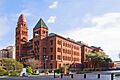
The Bexar County Courthouse in San Antonio.
See also
 In Spanish: Condado de Béxar para niños
